Day 19 – Mt. Whitney

8/8/2015
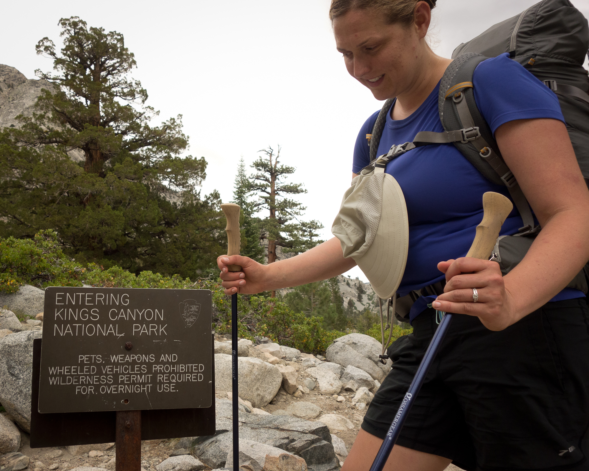
Guitar Lake to Mt. Whitney and then Whitney Portal
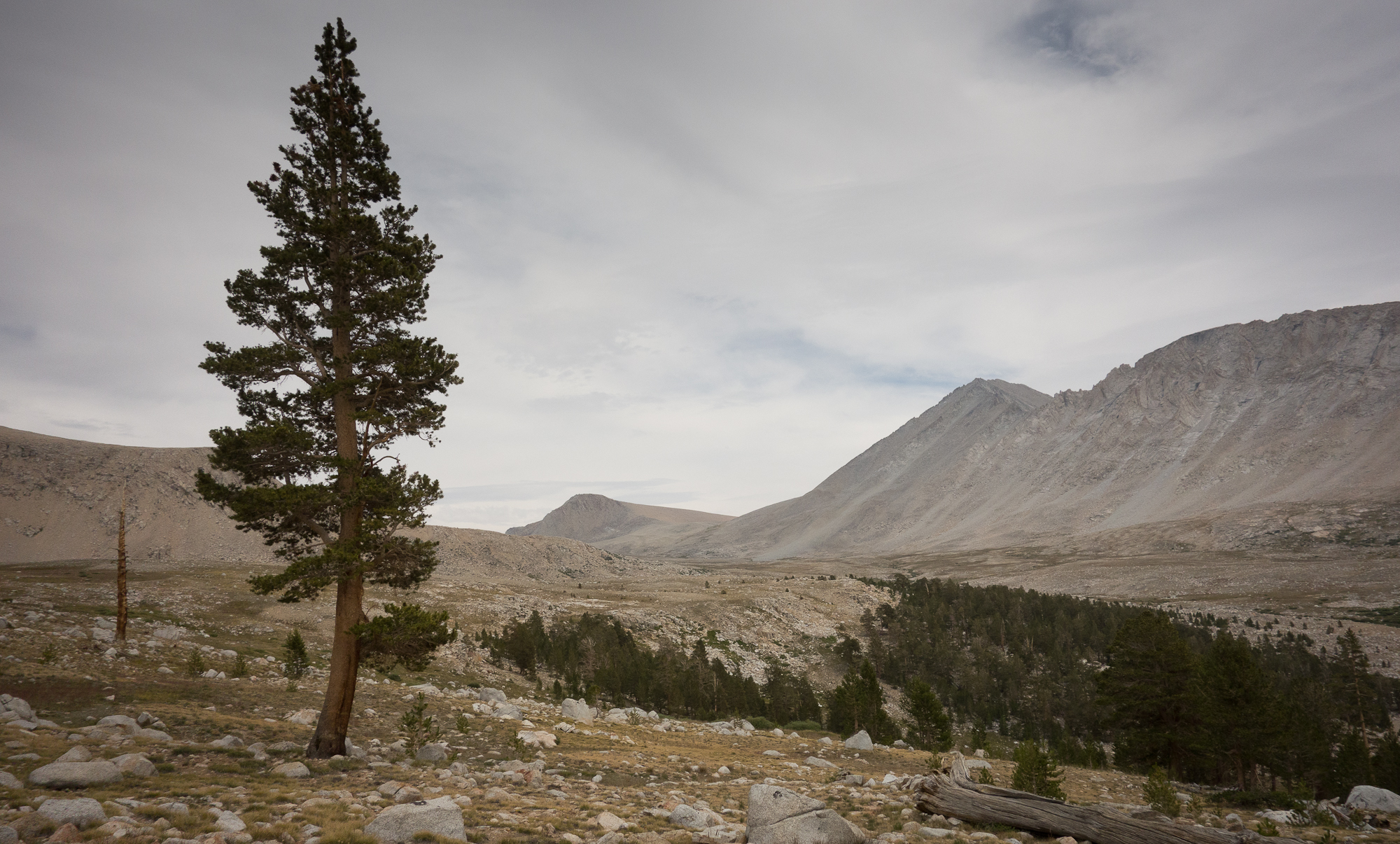
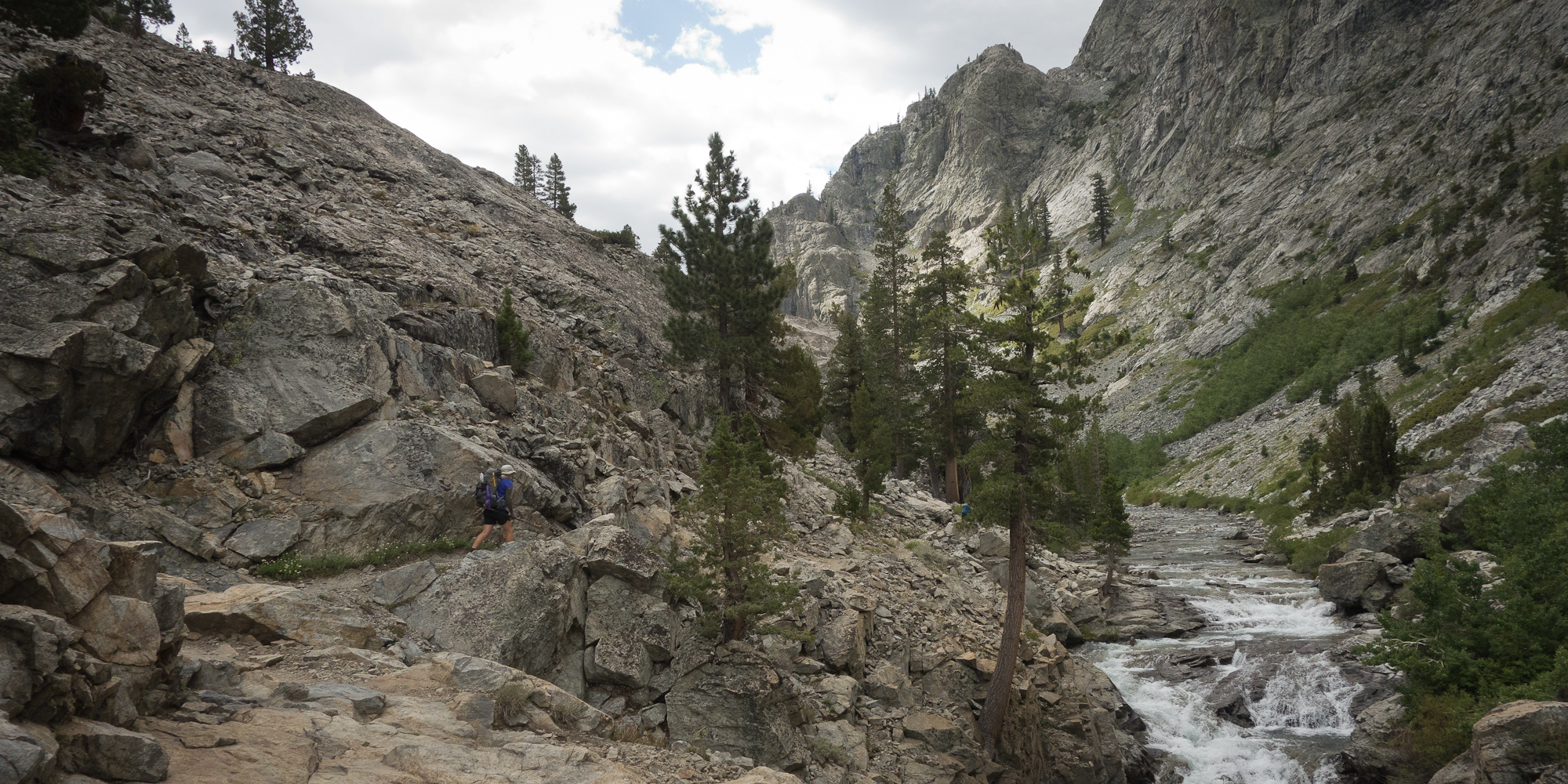
17 miles 3,500′ of up 6,000’+ feet of down
and 250 miles of driving

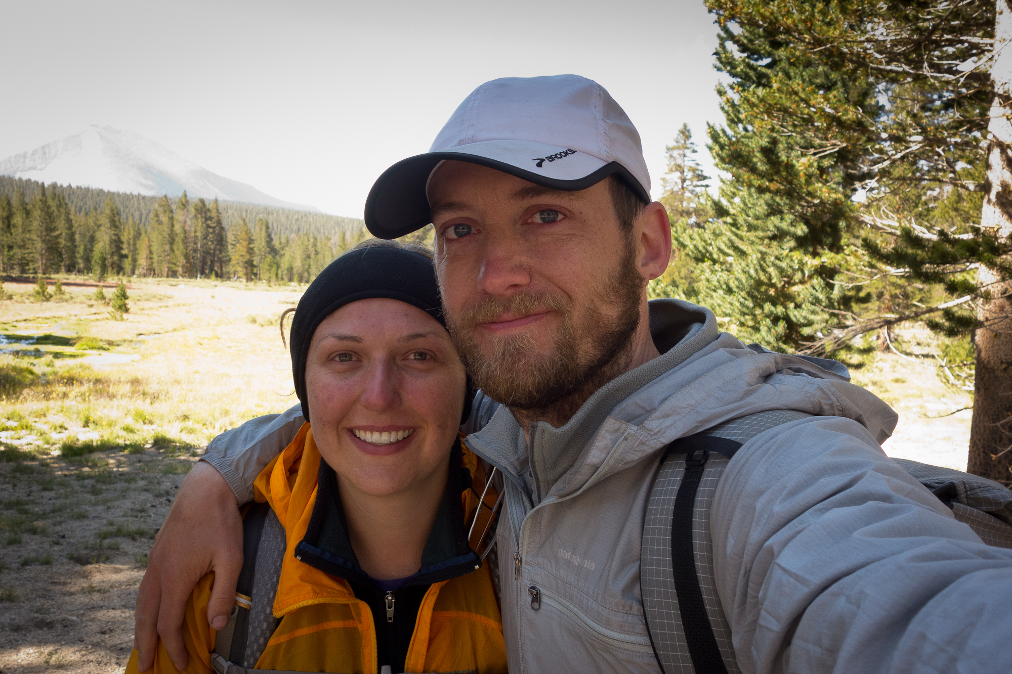
Kevin and I are in a private shuttle now driving up the 395 towards Reno with Dick, Manuela, their kid, and Dave.

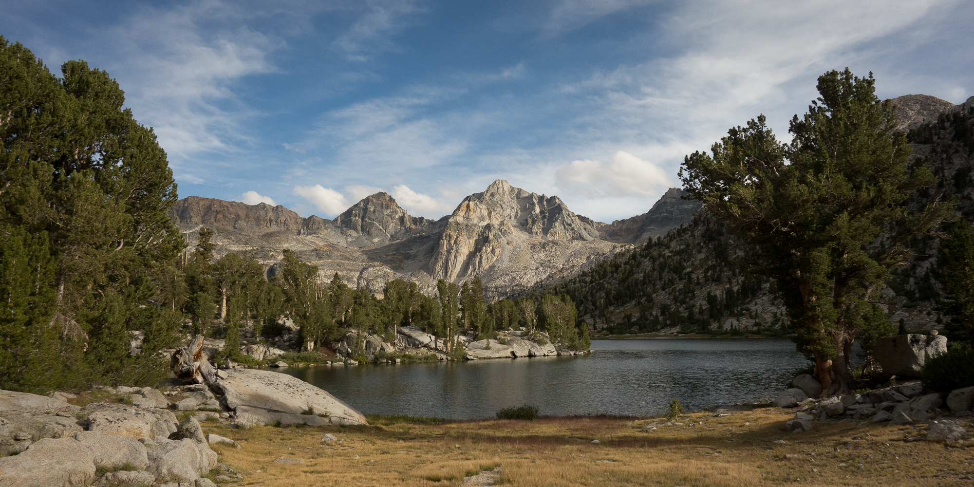
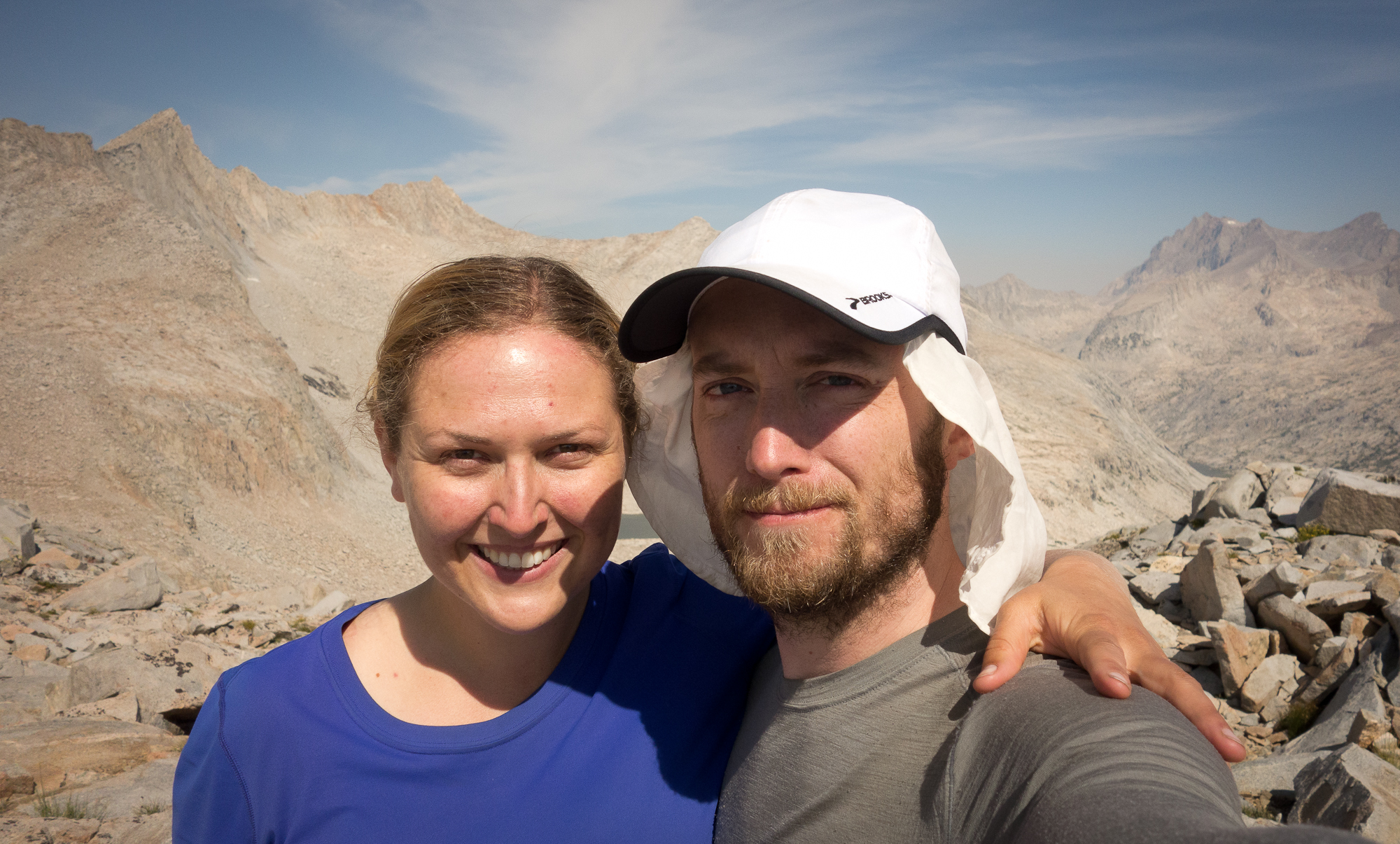
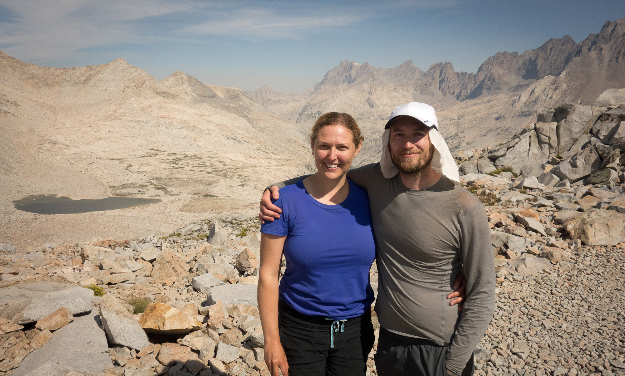
Looks like we completed the John Muir Trail and our adventure is over. Feels really surreal. Especially to be in a car watching the mountains we just took weeks to hike pass by in a matter of minutes.

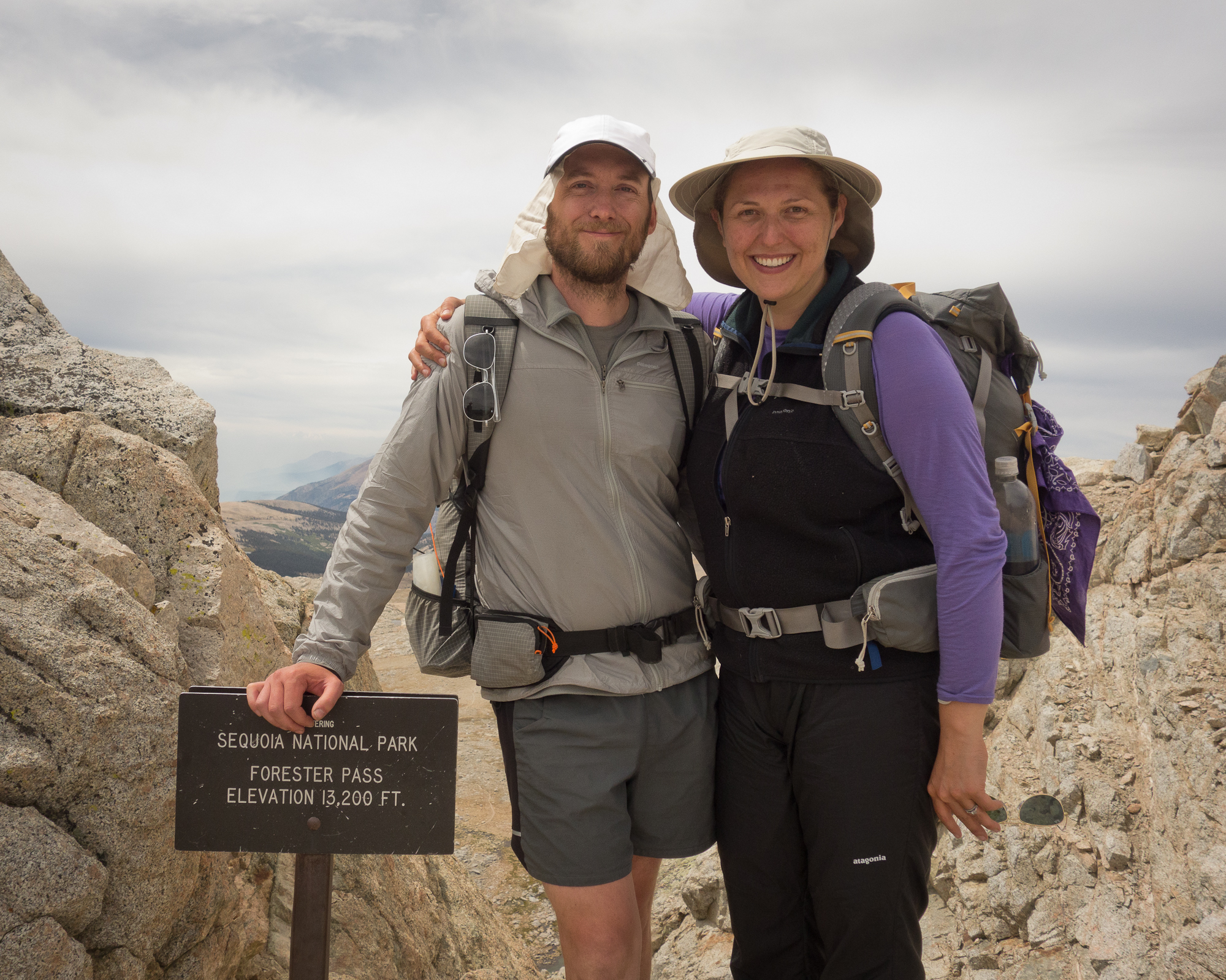
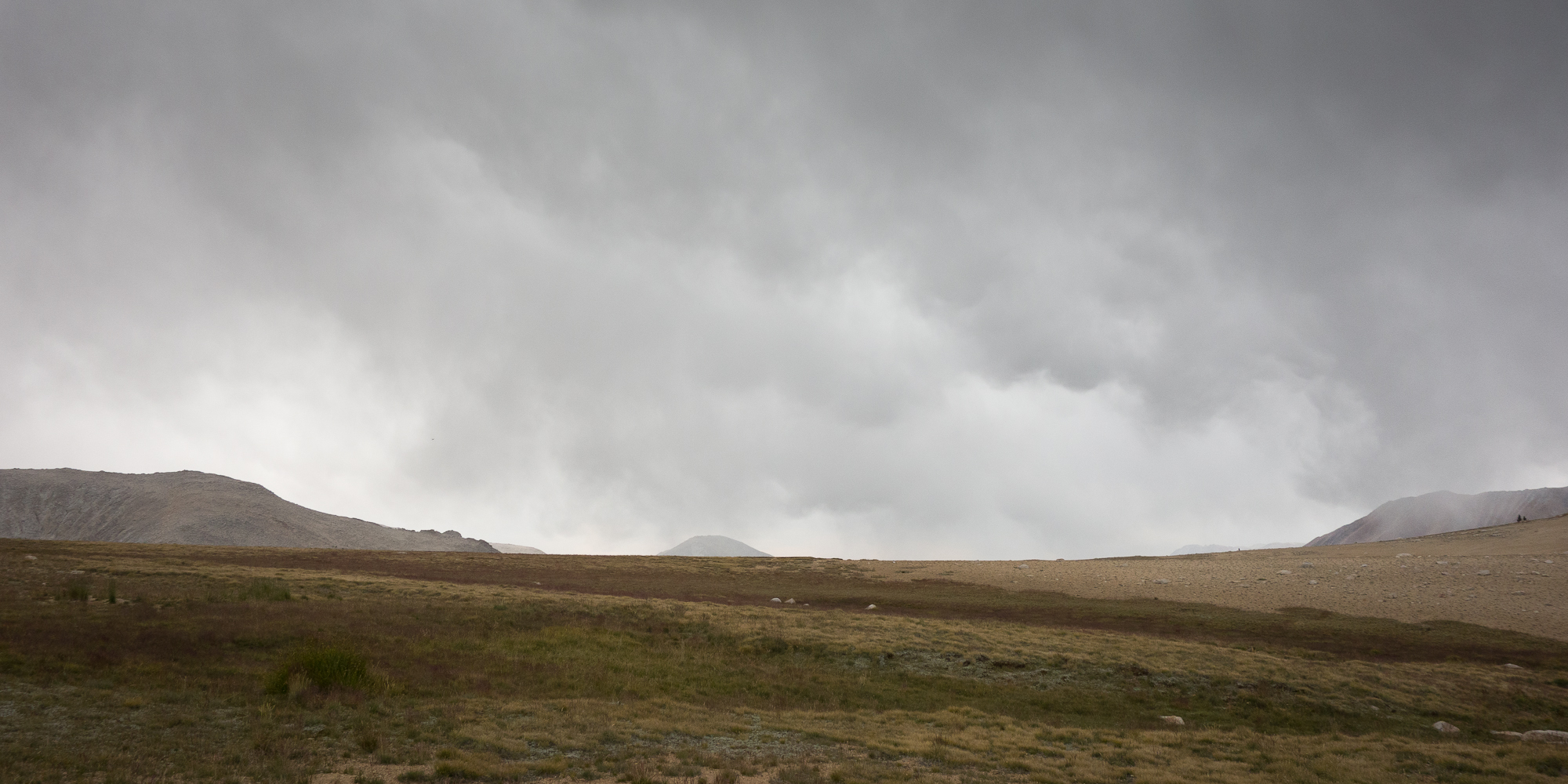
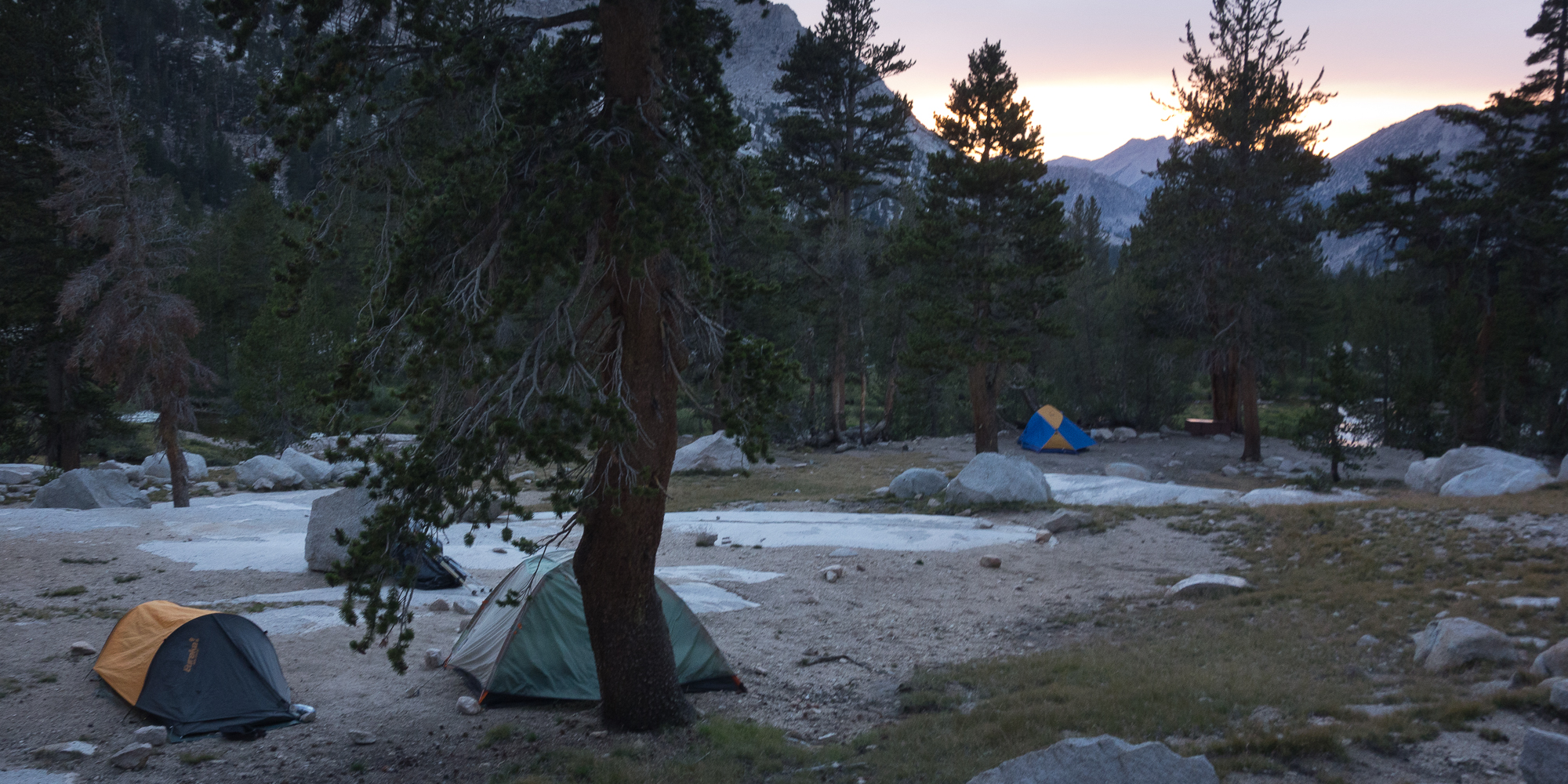
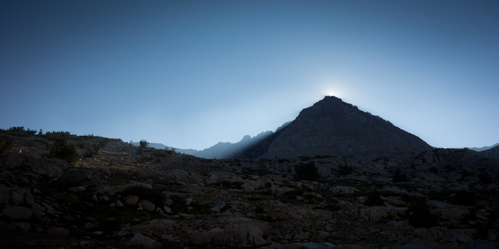
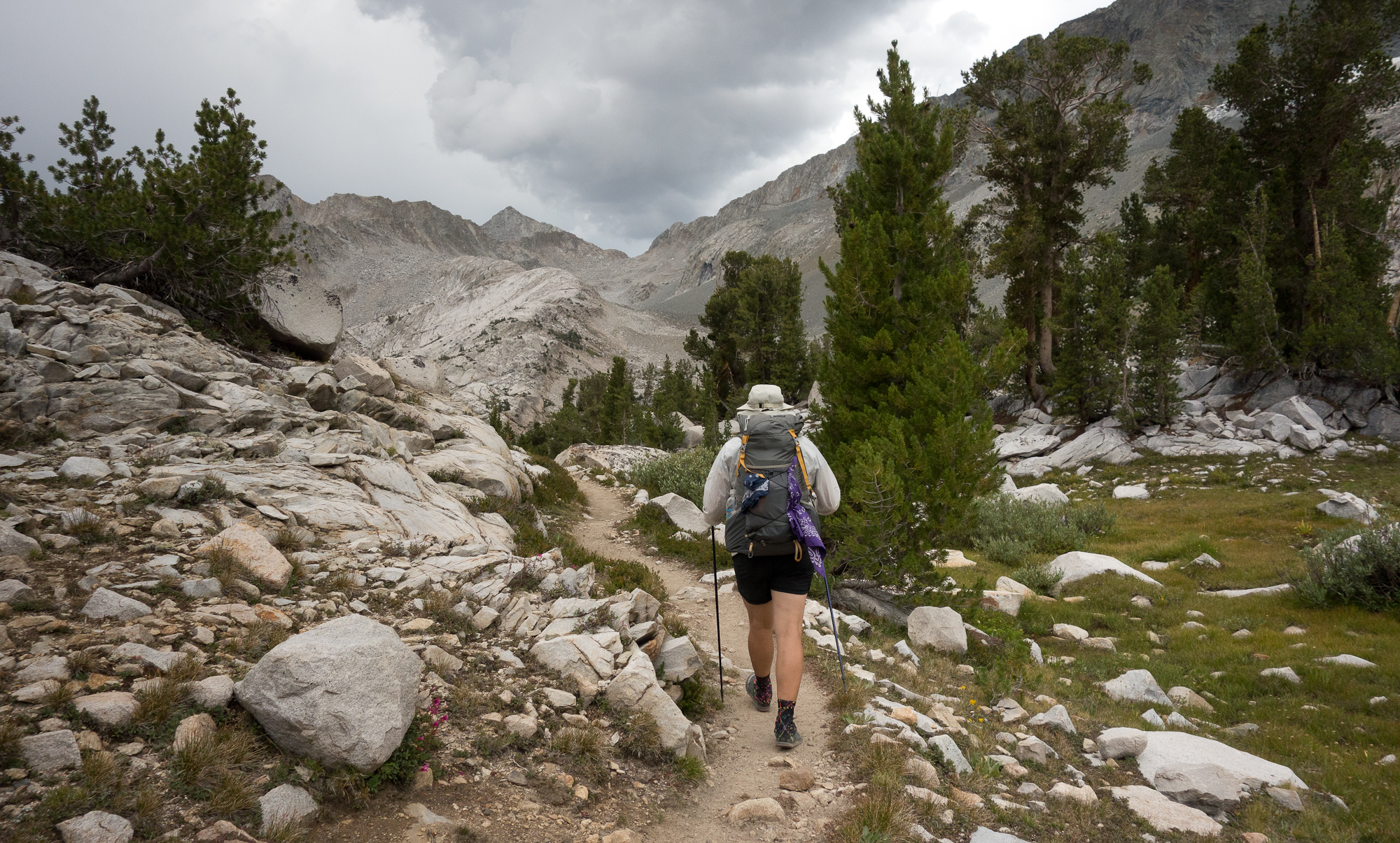
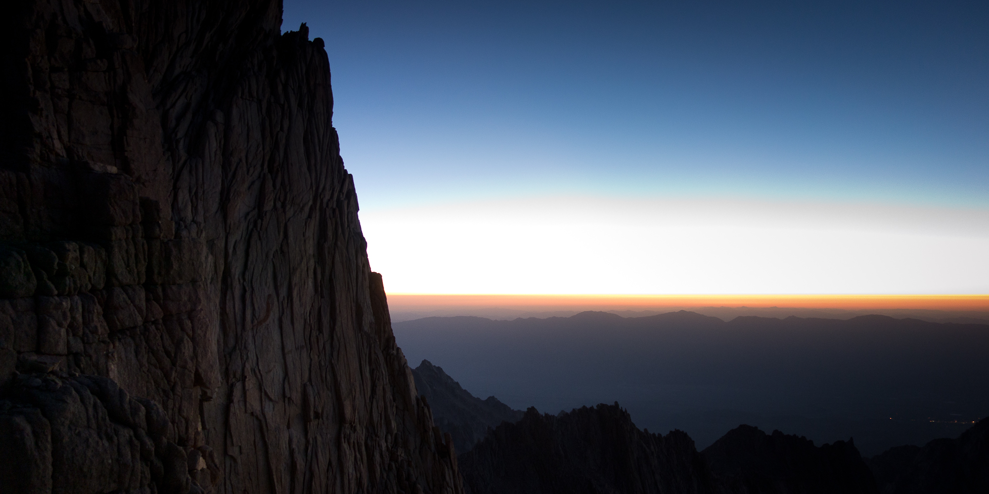
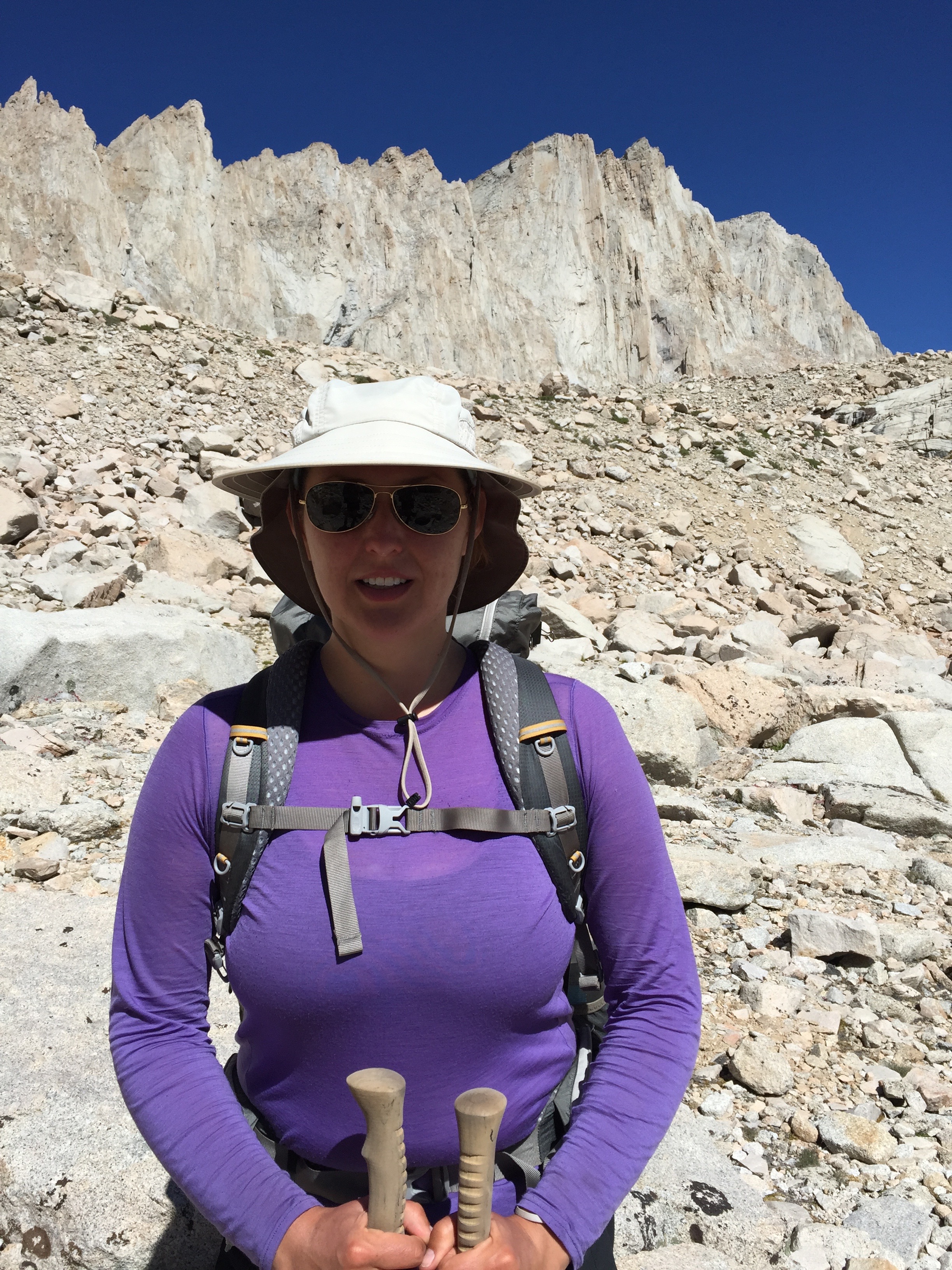
We rose at 1:15 am, put on every piece of clothing we brought with us, two shirts, fleece vest, puffer, wind breaker, fleece ear warmer, as it was freezing cold, tried to eat a super hard Clif bar, packed up camp, and got to walking by 2:15 am. Dick led the way up the mountain. We walked for about an hour (I think) up granite steps. They path was very wet with moisture though thankfully not icy. We paused to change the batteries in our head lamps as they were significantly dimmer than Manuela’s and Dick’s.  I heard Dick greeting a hiker coming down the other direction, which is odd for someone to be coming down Mt. Whitney at this hour. The hiker responded back “Happy Birthday Dad”.

It was their son.

He had surprised them on the side of the mountain. Managed to find his parents on the side of the mountain.  He flew, took a bus, hitchhiked, took a train, more buses, got the last wilderness permit available at Whitney Portal, then climbed up Mt. Whitney from the eastern side to find his parents to surprise his dad on his birthday.  It was absolutely amazing and honestly a bit of wild luck that he found his parents on the trail.  They hadn’t communicated for over a week so he was guessing that they would try to summit today. The parents were flabbergasted that their kid was suddenly on the trail. They thought he was still up in Juneau, Alaska. He was only wearing van sneakers, shorts, a sweater with a puffer over, and had no food should he had not found his parents. But it all worked out!

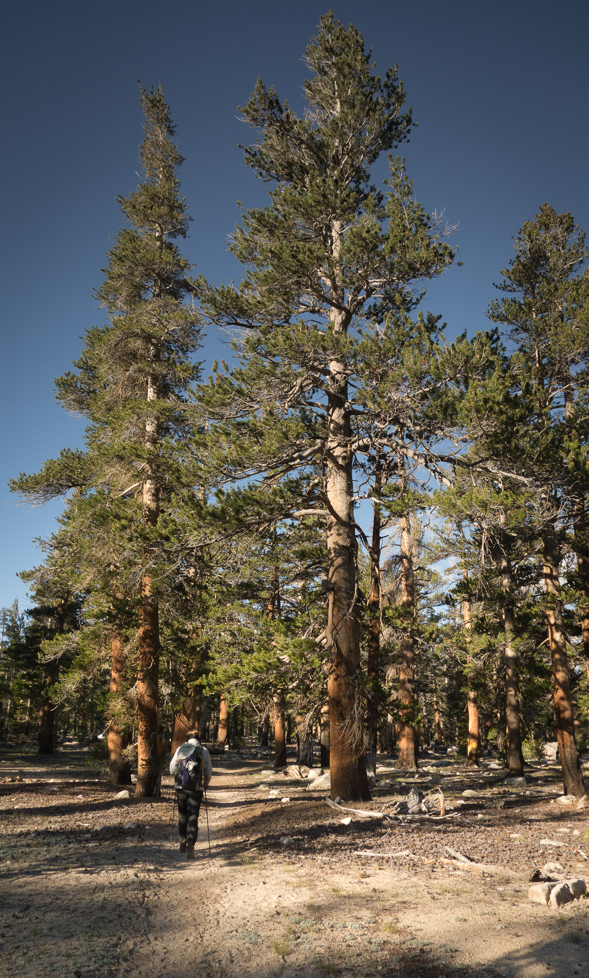
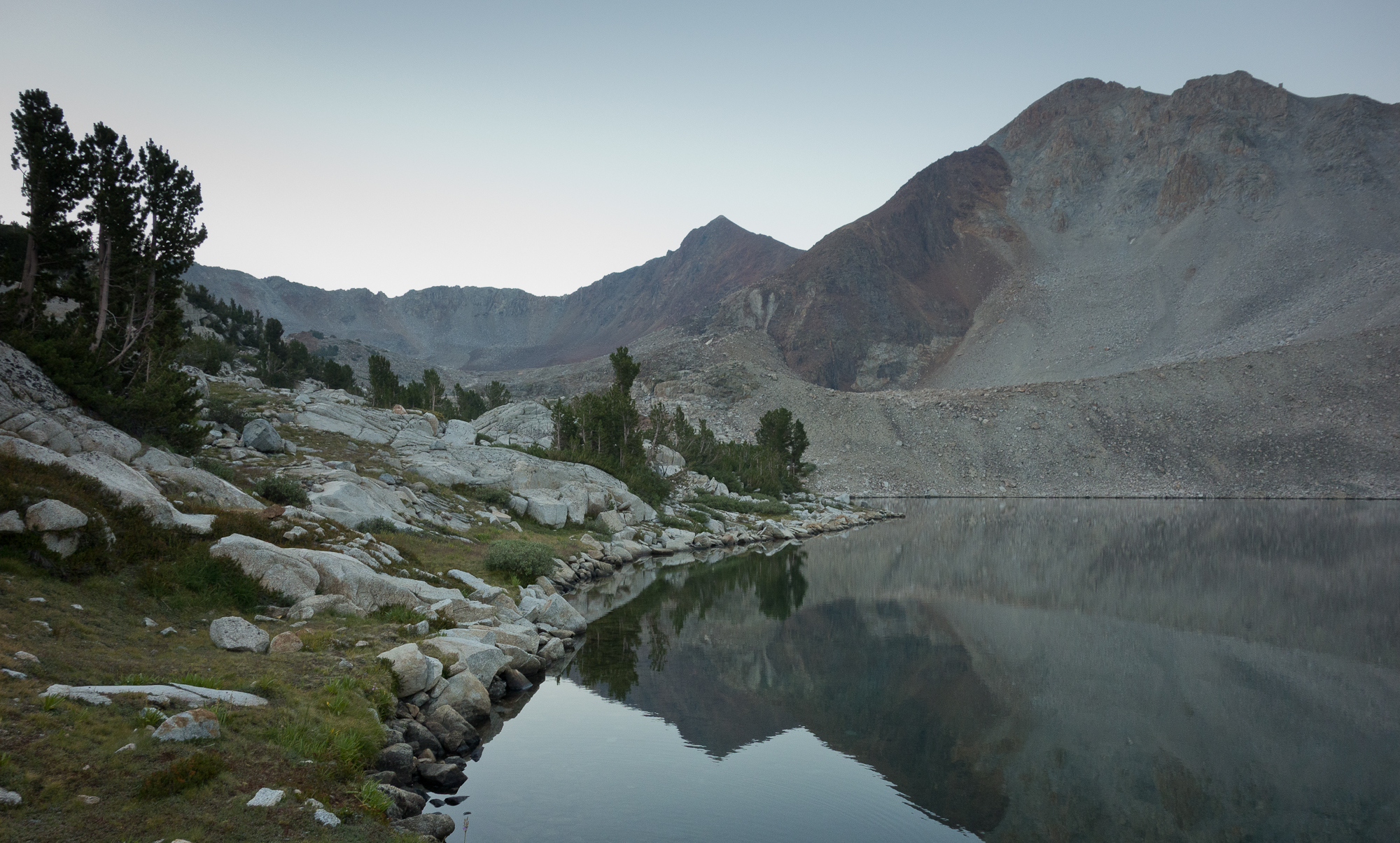
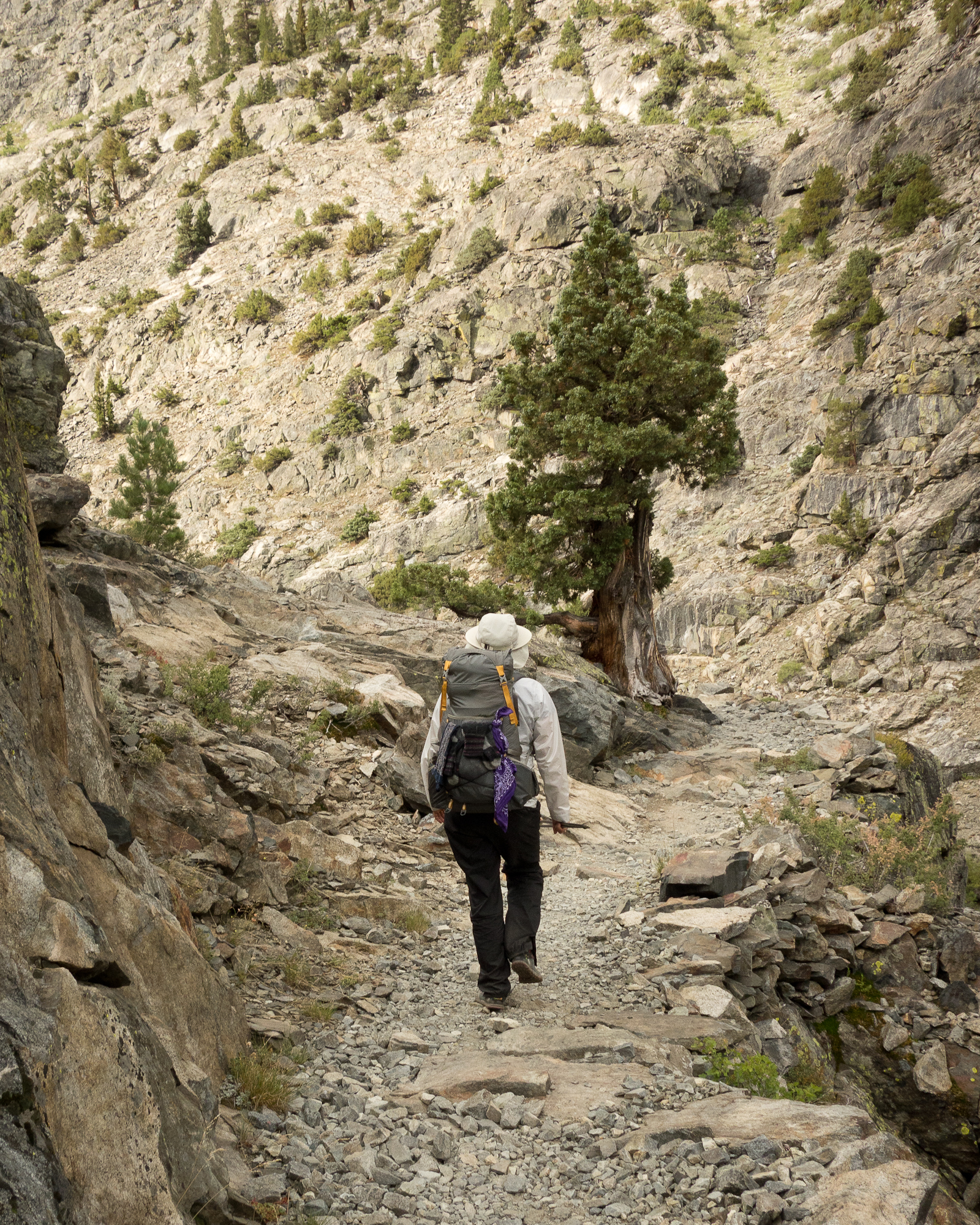
We let the group move on past us as their pace was a bit quicker than mine. Kevin really encouraged me to get up that mountain. We were hiking under the stars and every now and then we paused for water and a nibble to eat and looked out at the night sky. Too bad I have no photos of the night sky as it was incredible.

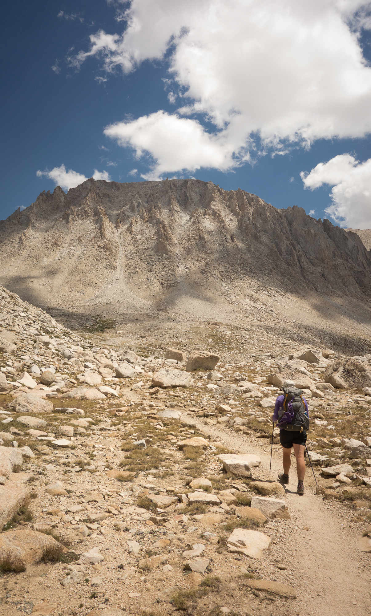
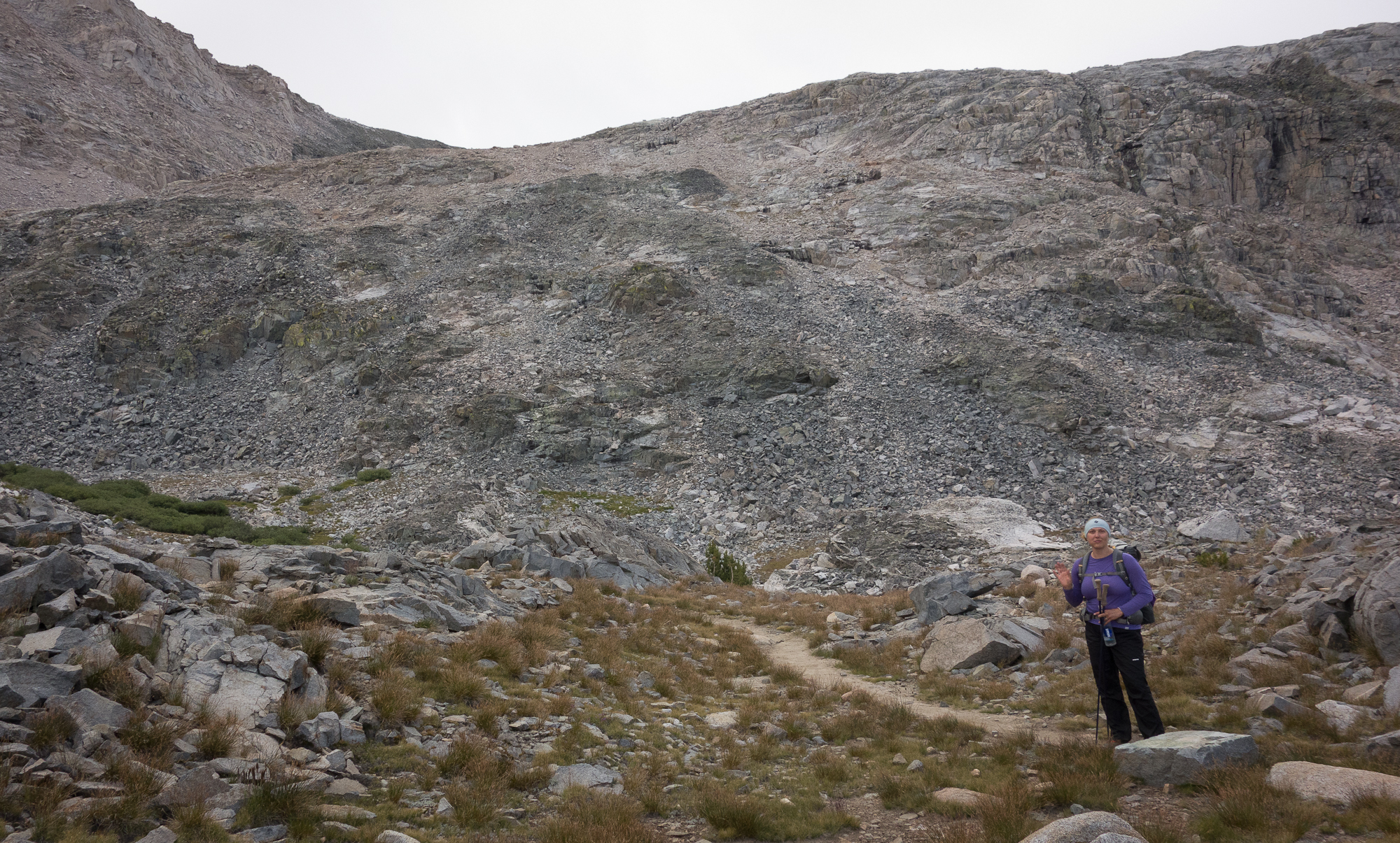
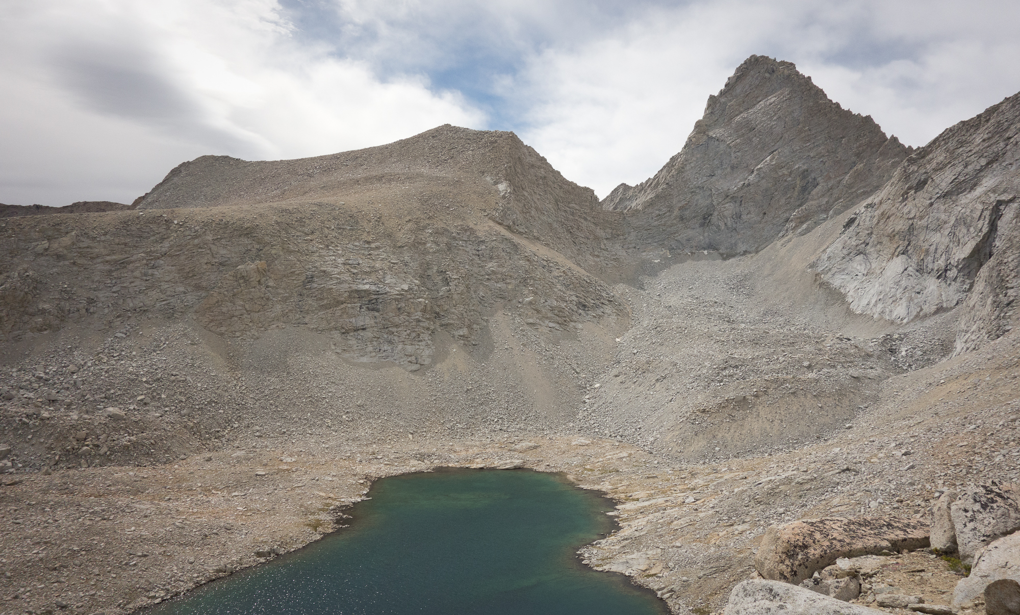
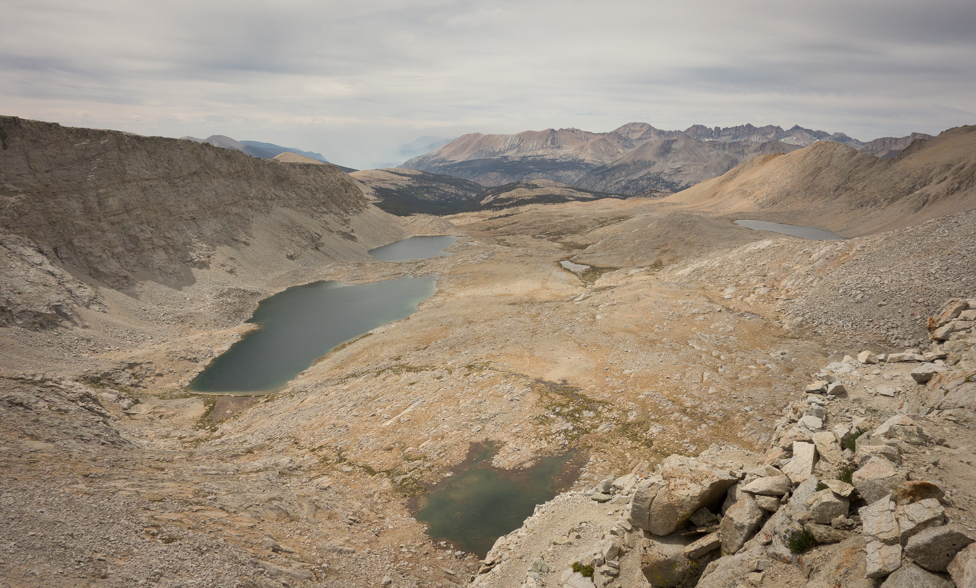
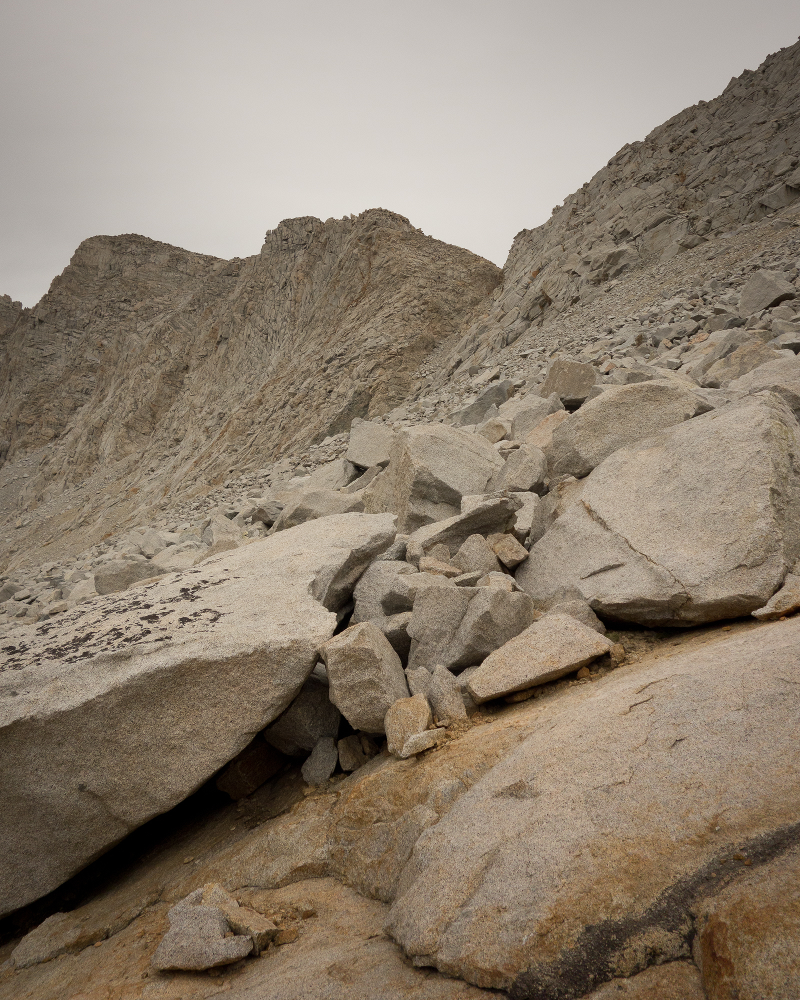
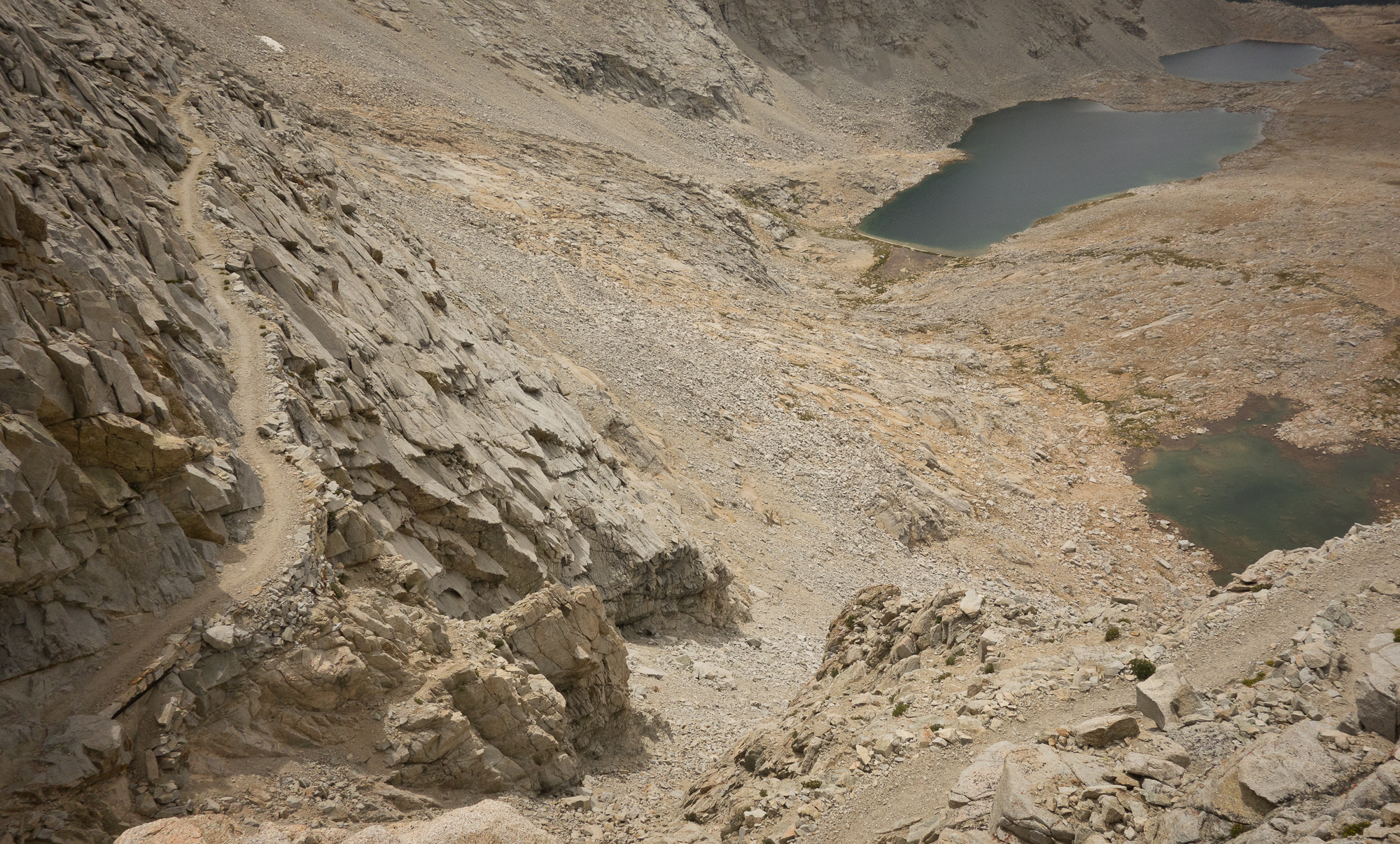
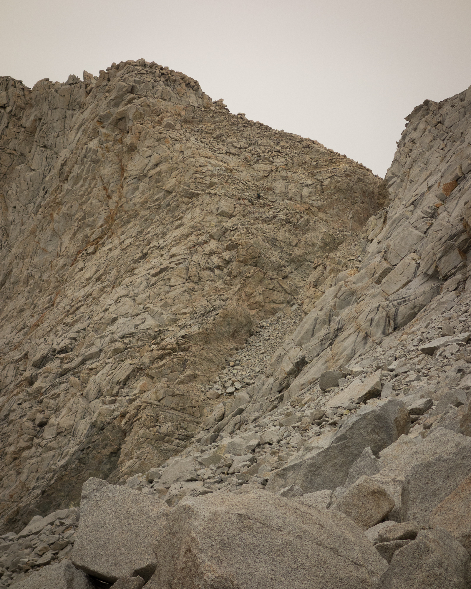
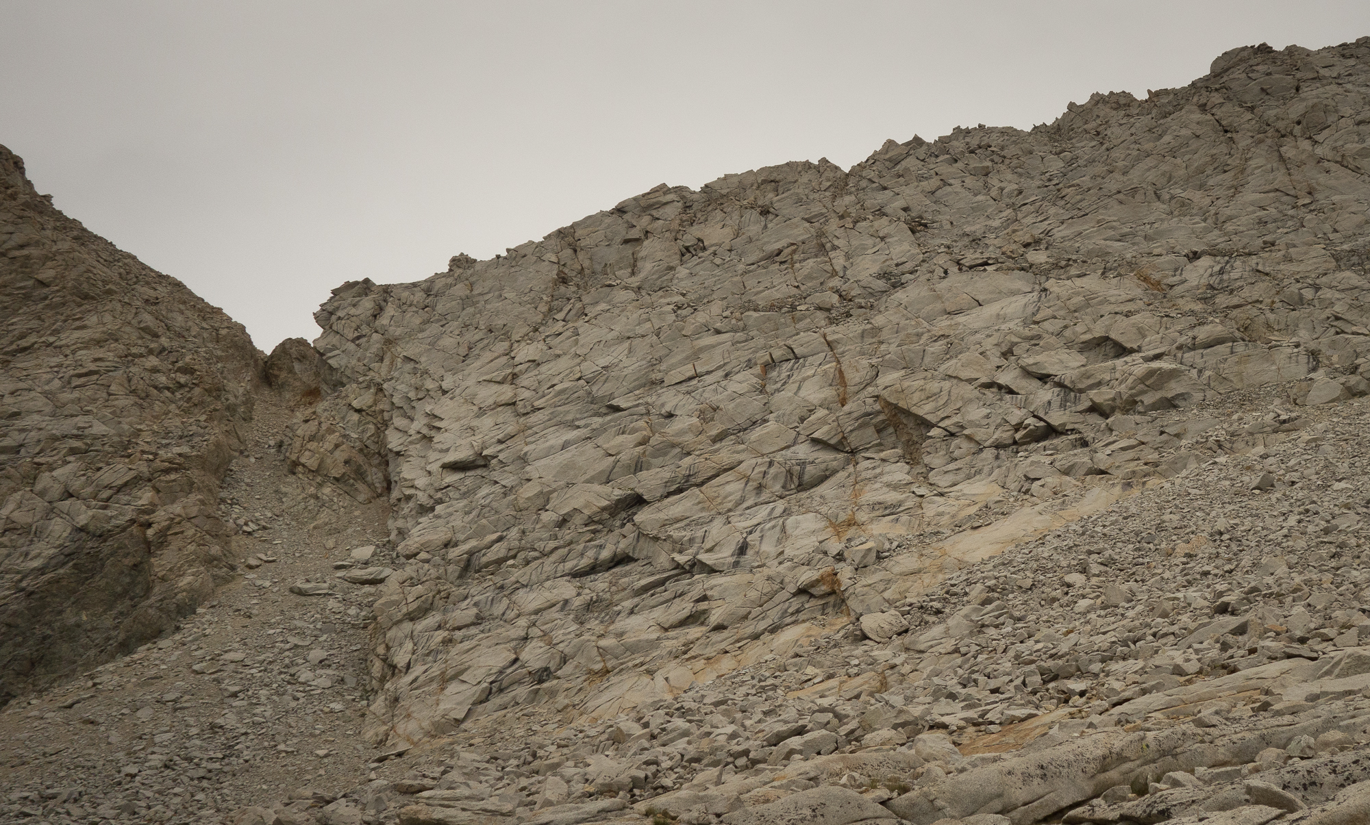
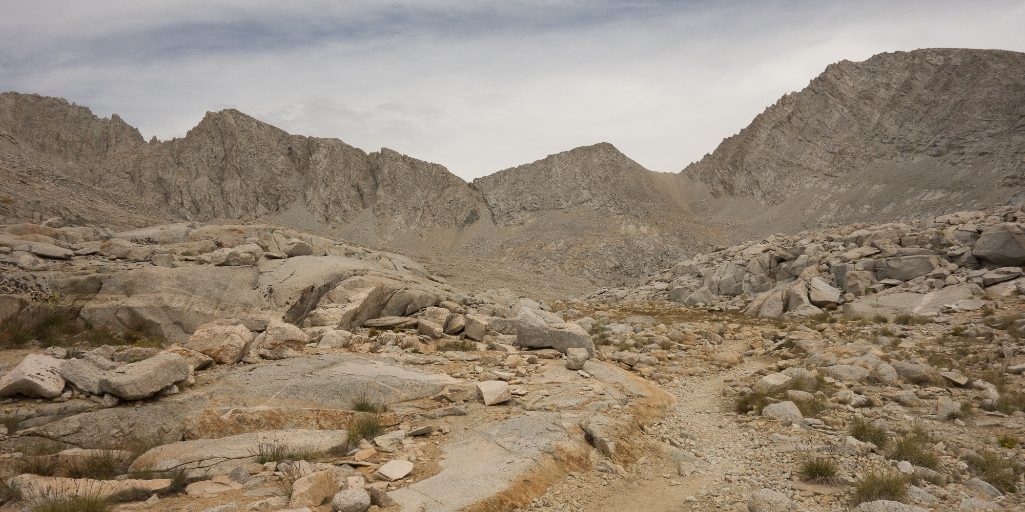
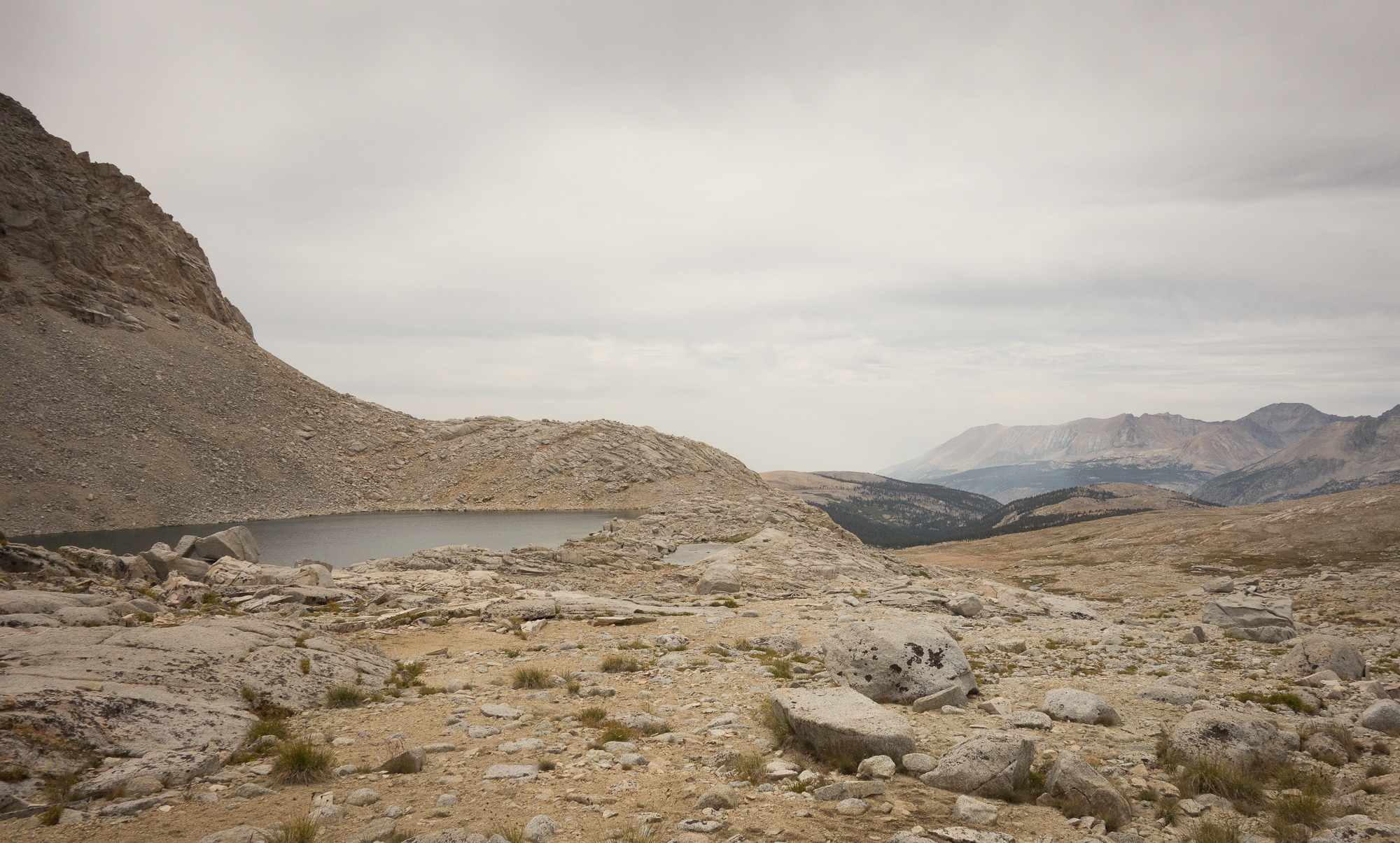
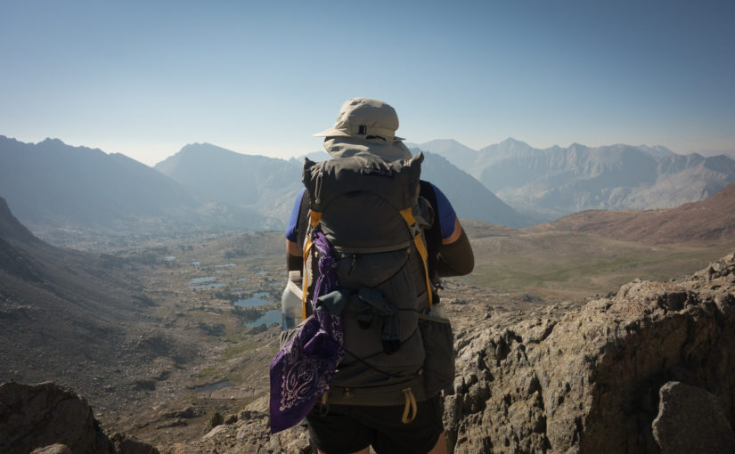
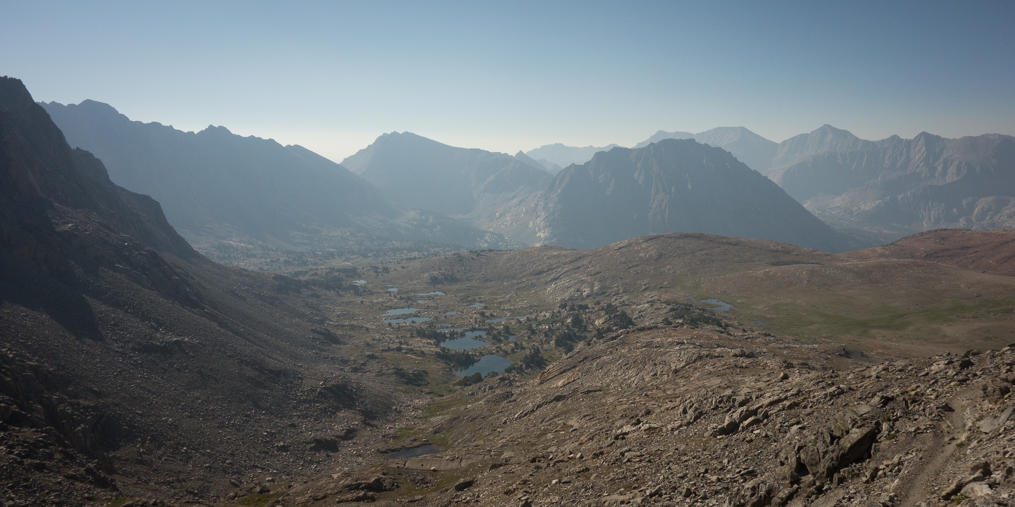
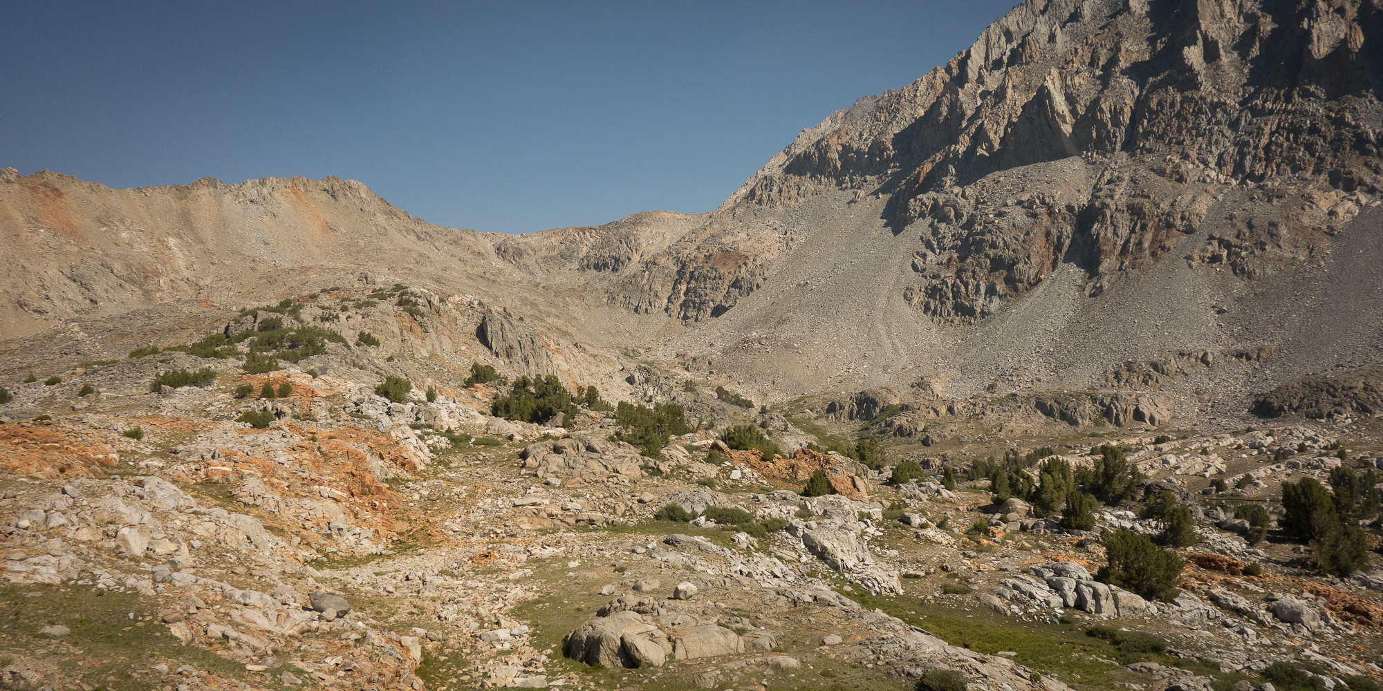
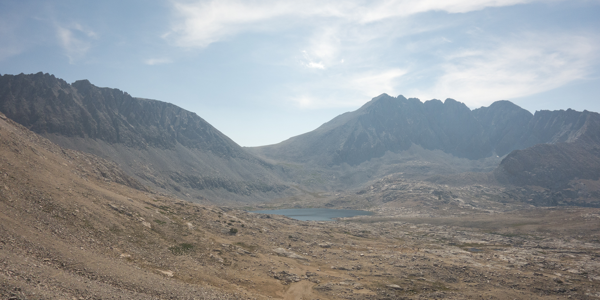
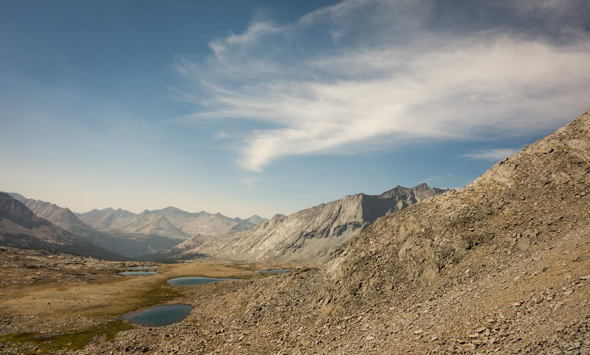
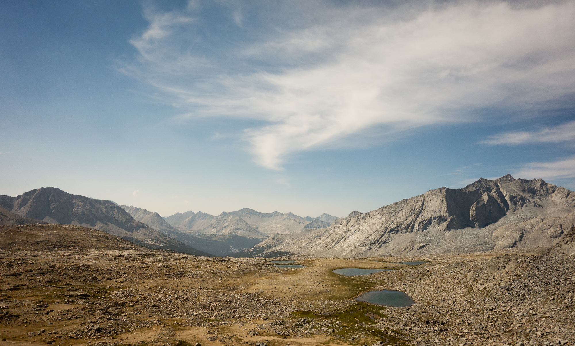
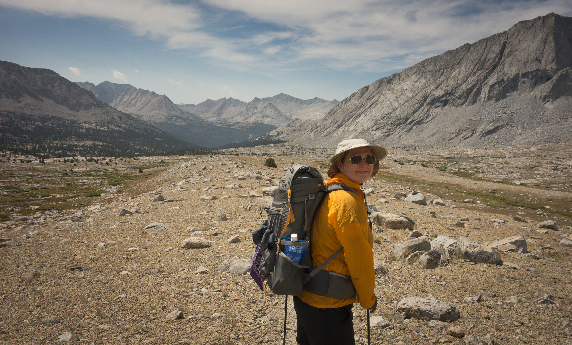
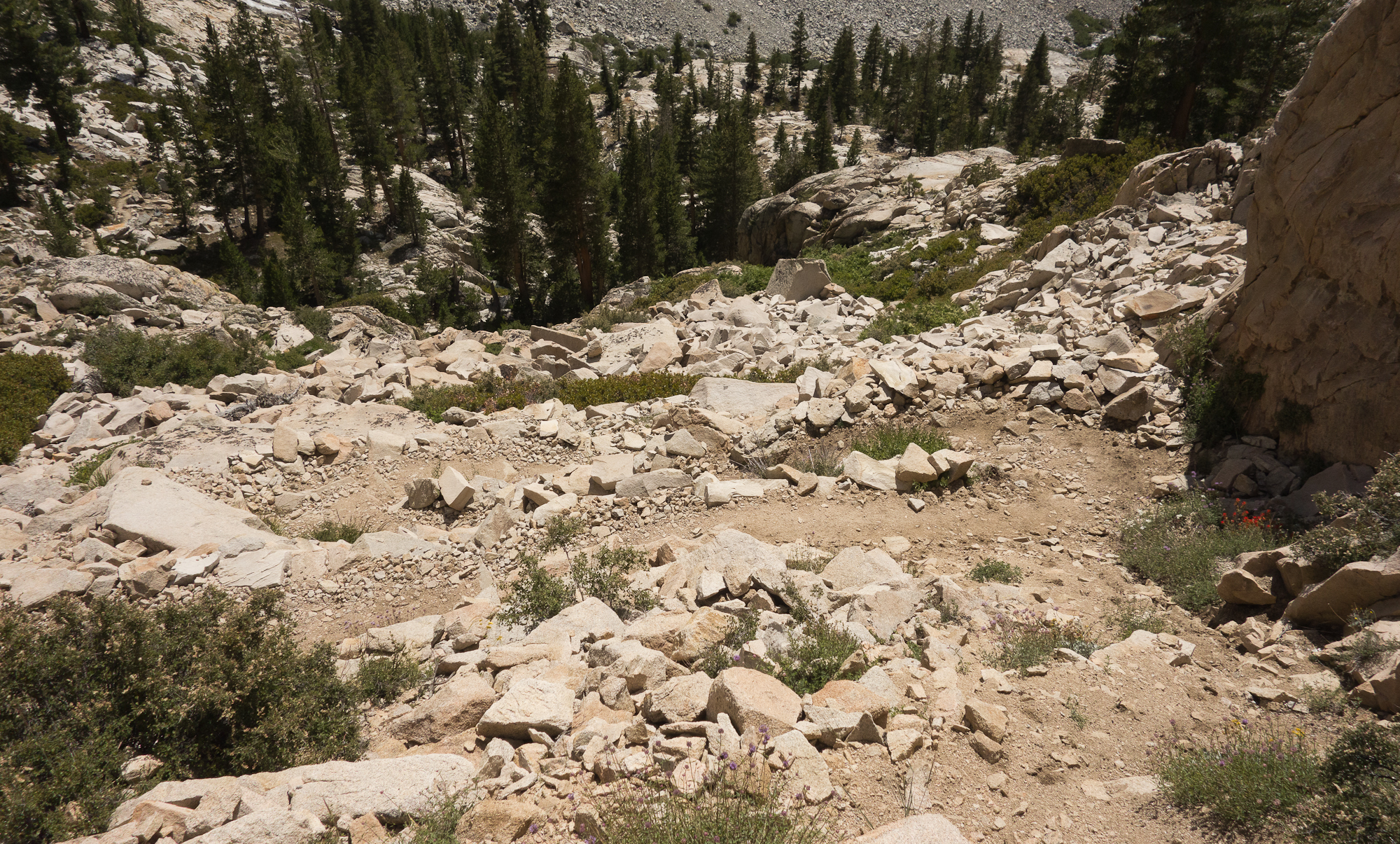
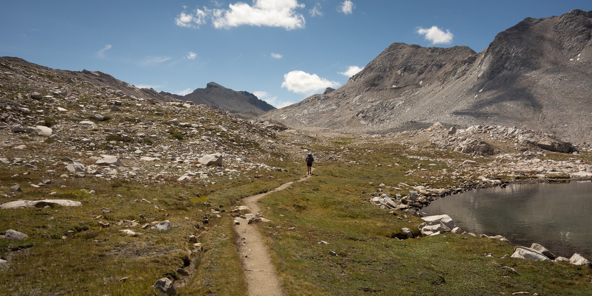
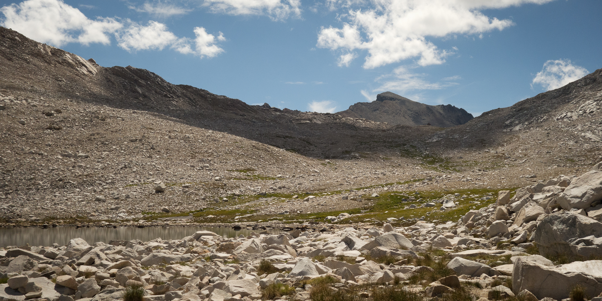
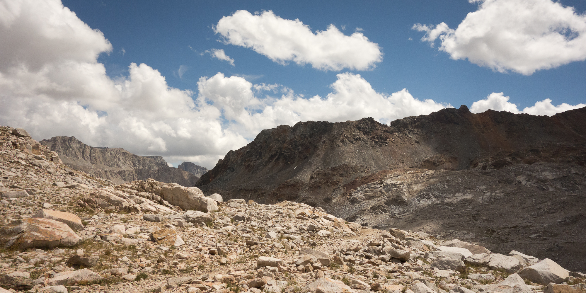
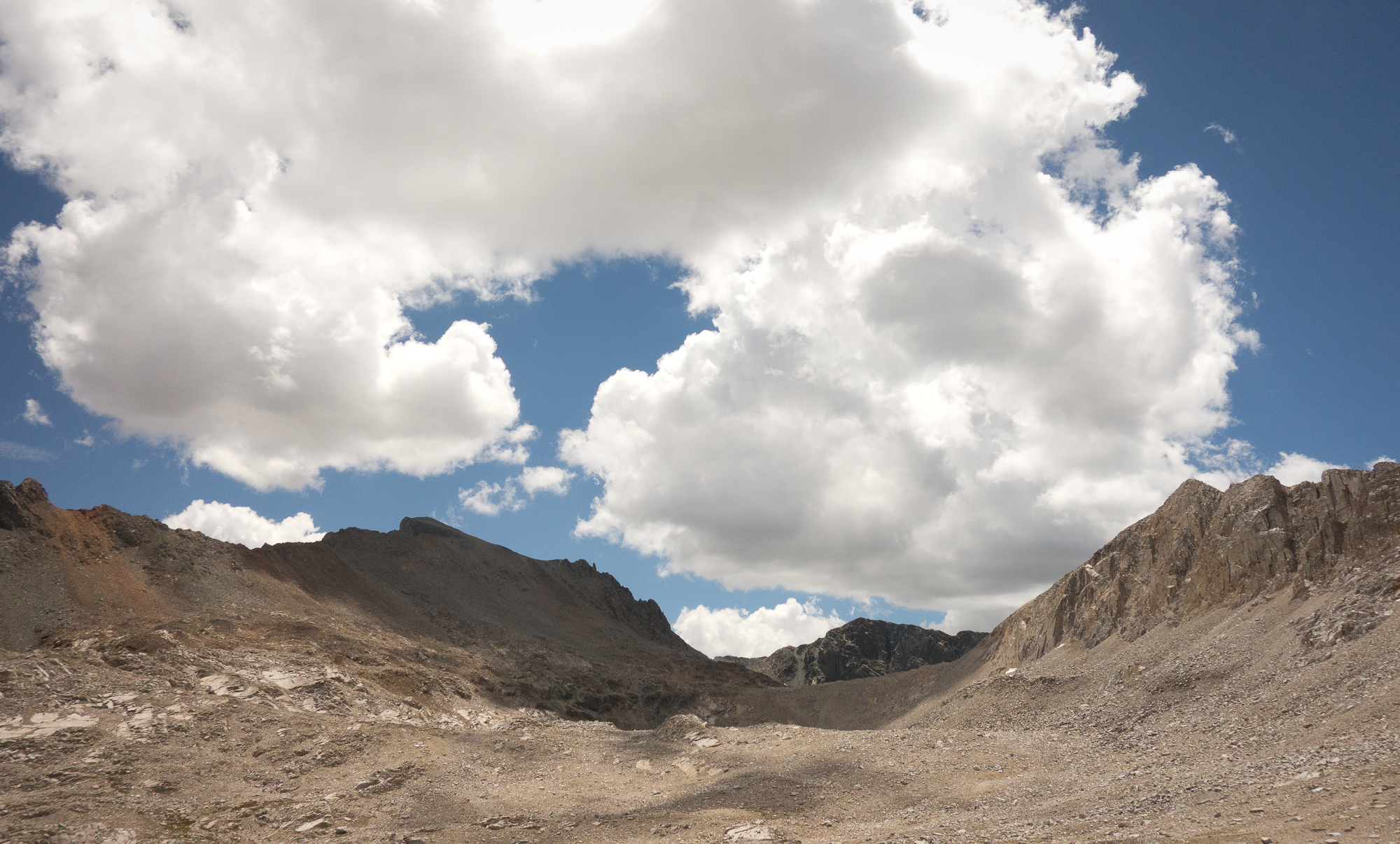
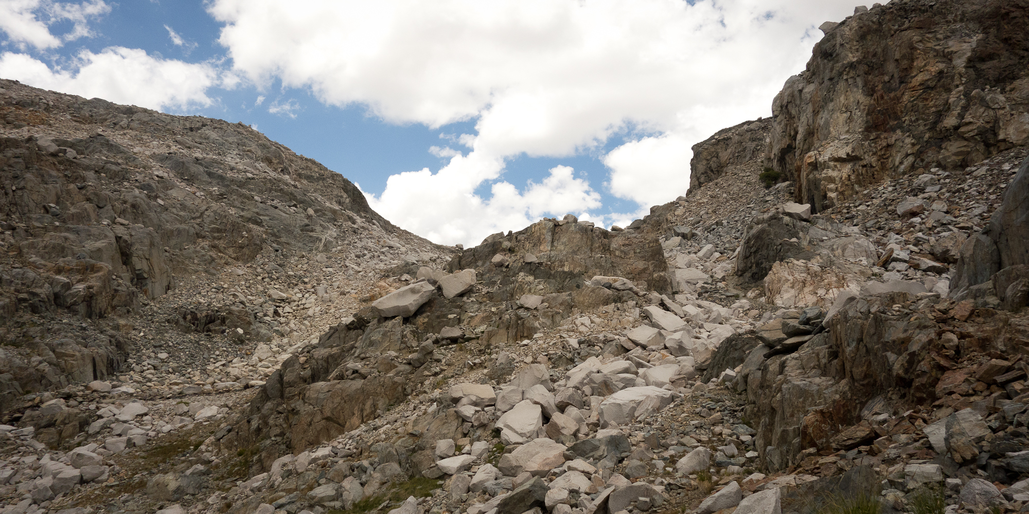
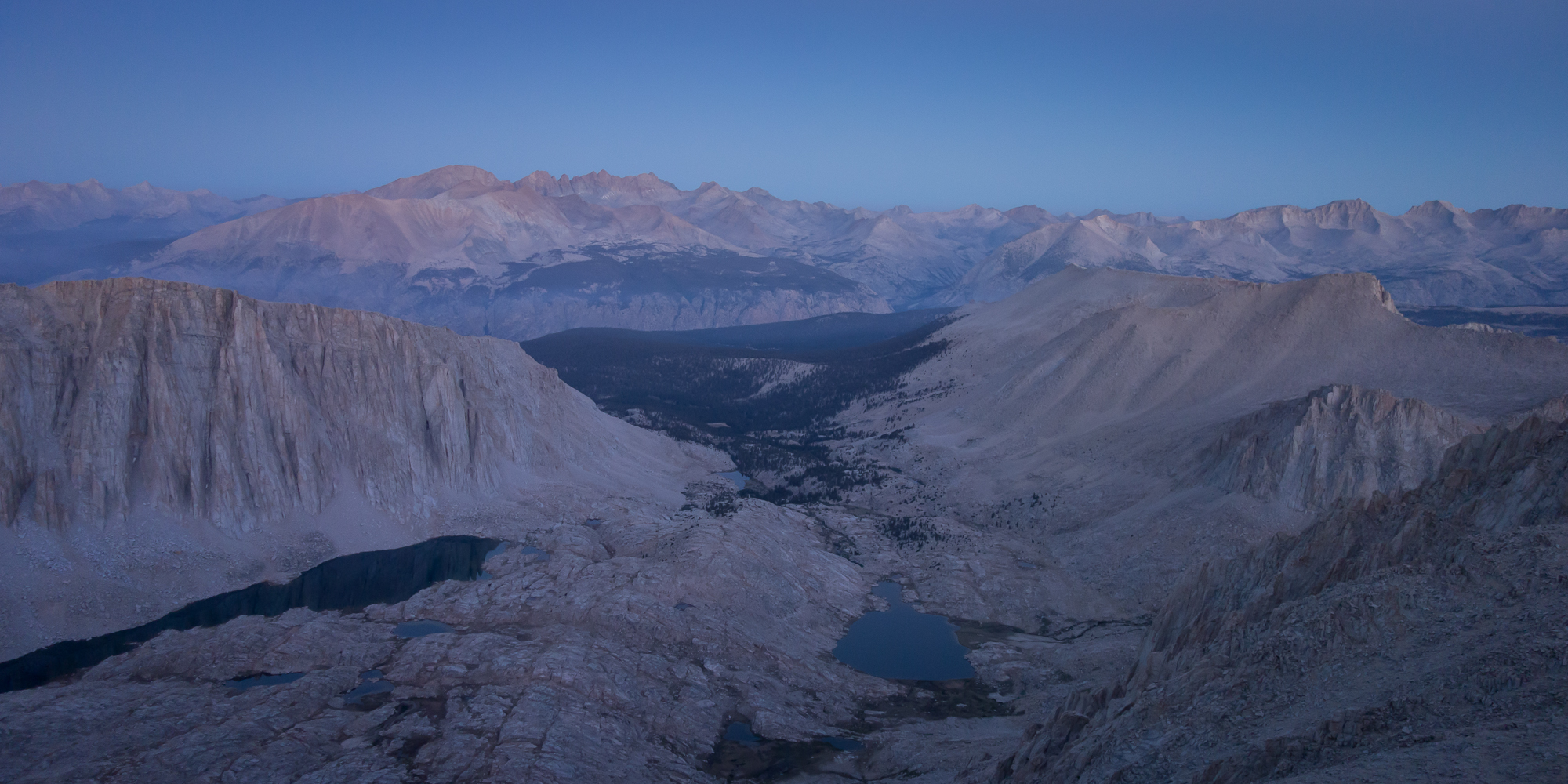
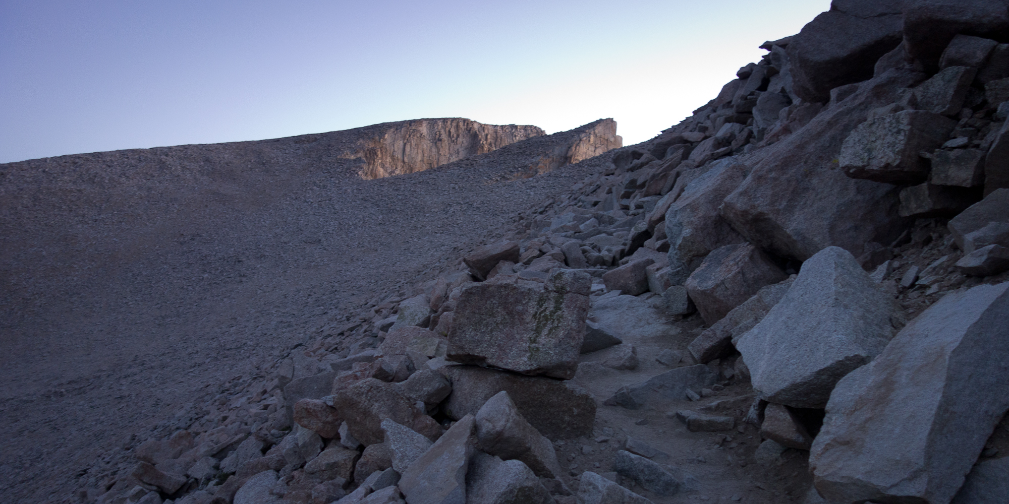
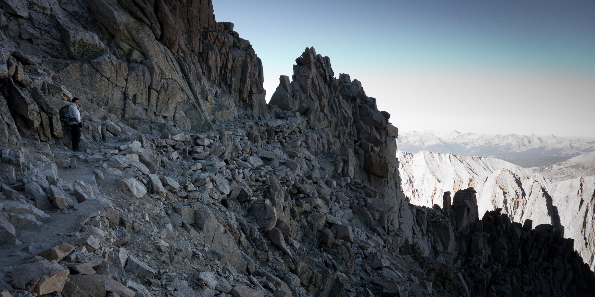
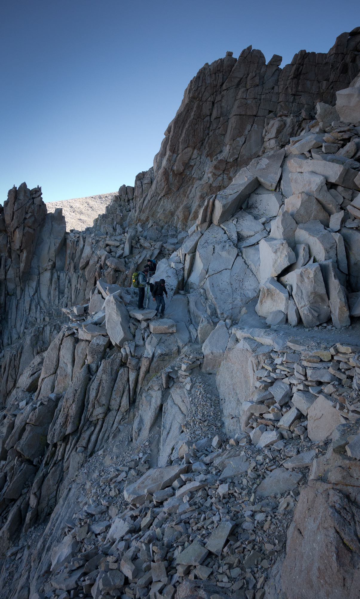
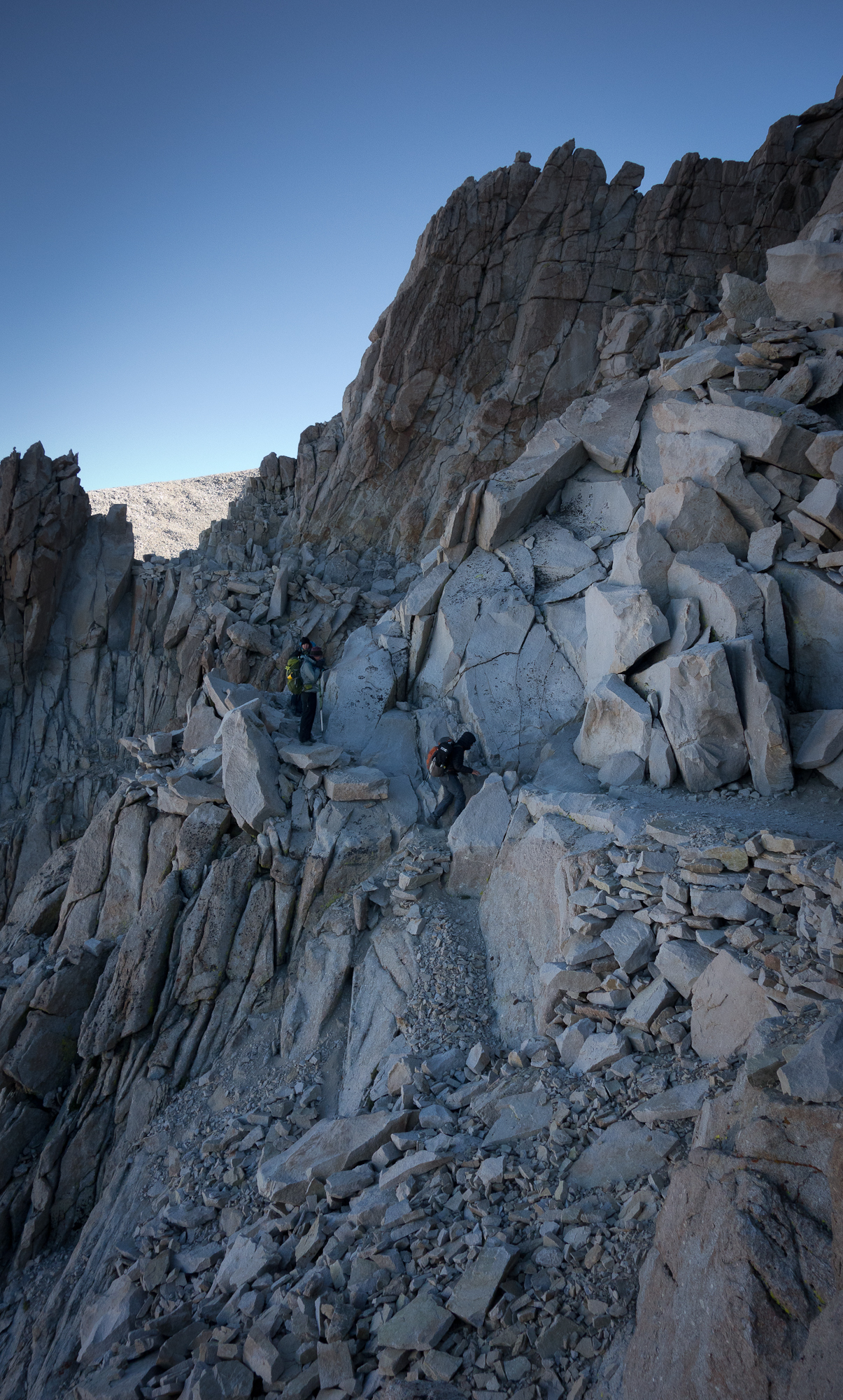
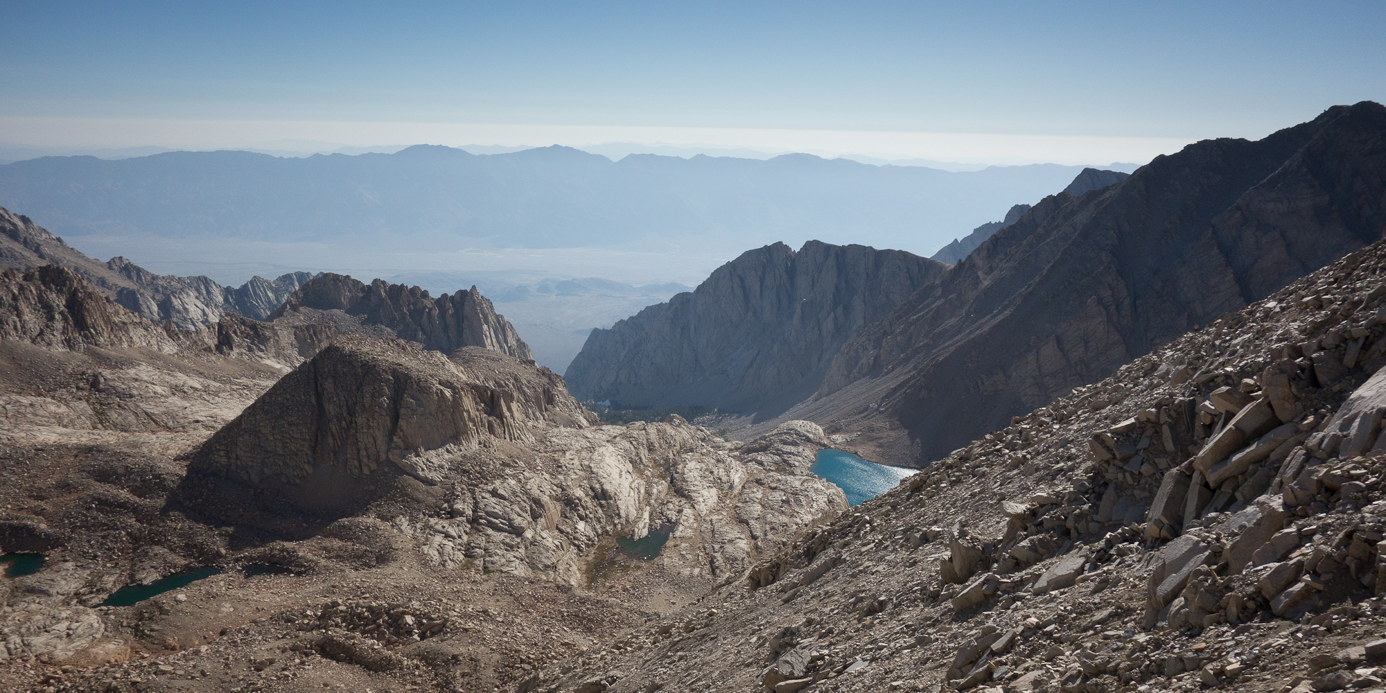
At times it was hard to pick out the trail among the rocks and boulders and my legs really felt spent. After about 3 hours we made it to the trail crest junction which meant we only had another 1.9 miles to go and 1,000′ more feet of up!  It was super slow going as it was along the crest of a mountain and just a tad bit treacherous. From the crest we caught our first glimpse of civilization and city lights. I realized I hadn’t seen city lights since Mammoth Lakes over a week prior. Many folks drop their packs at trail crest and make the last push with just a small bag. We opted to keep ours on as honestly, not much was inside our packs at this point, 2 days food, sleeping bag and tent. I doubt my bag weighed more than 16 lbs.

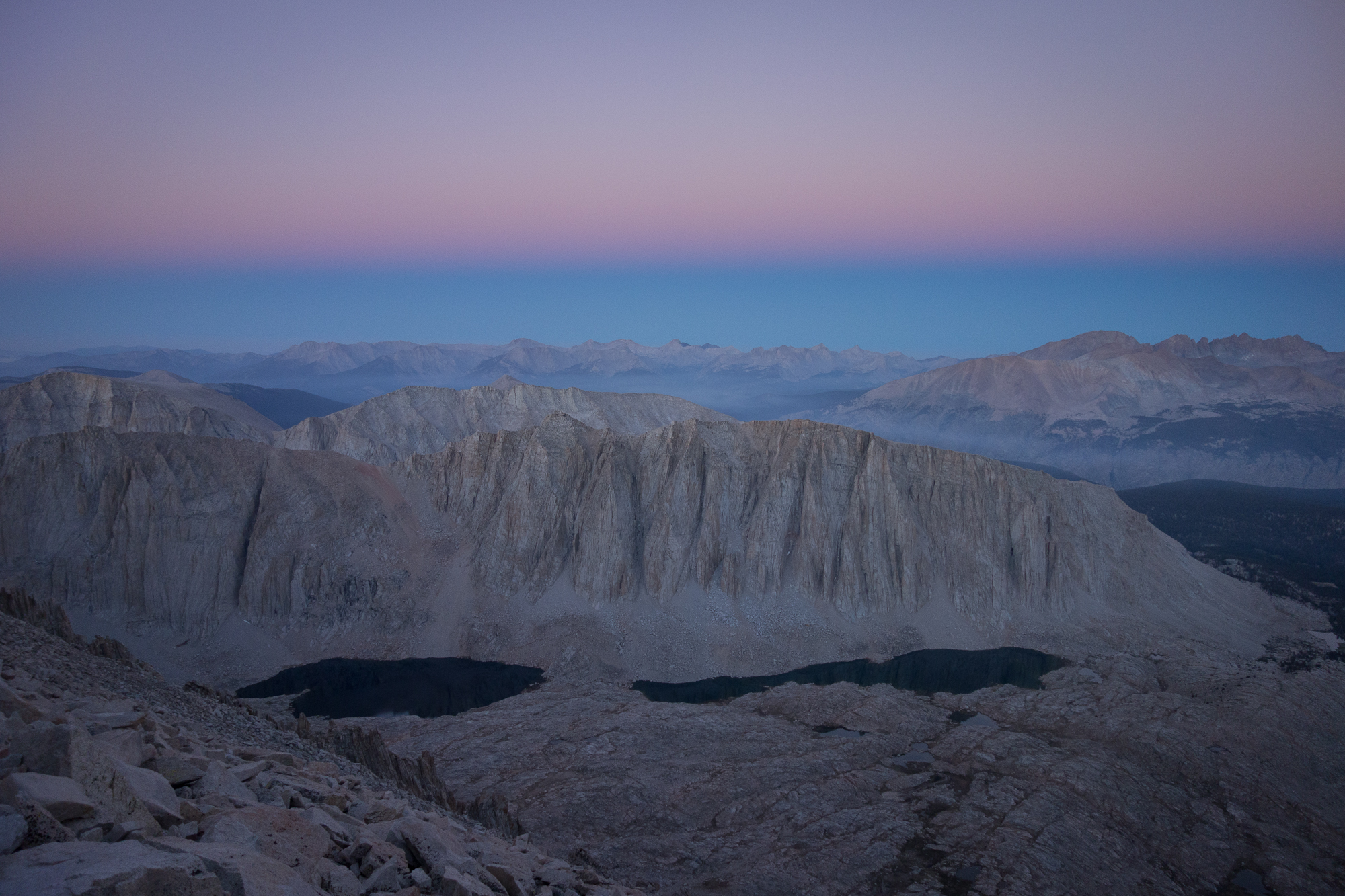
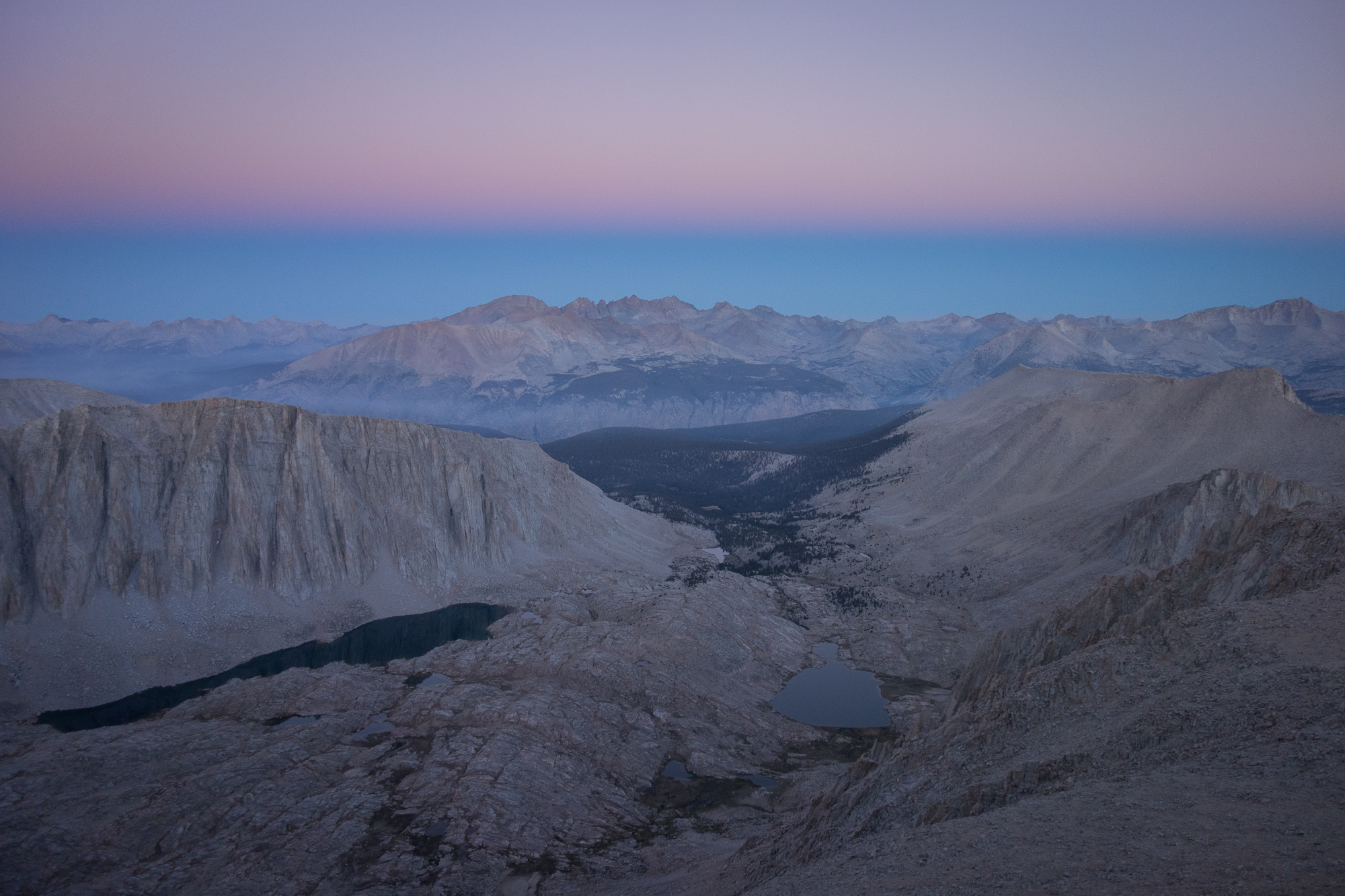
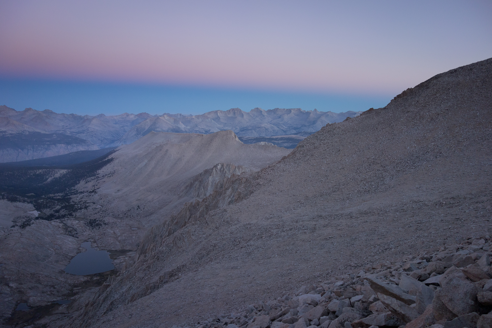
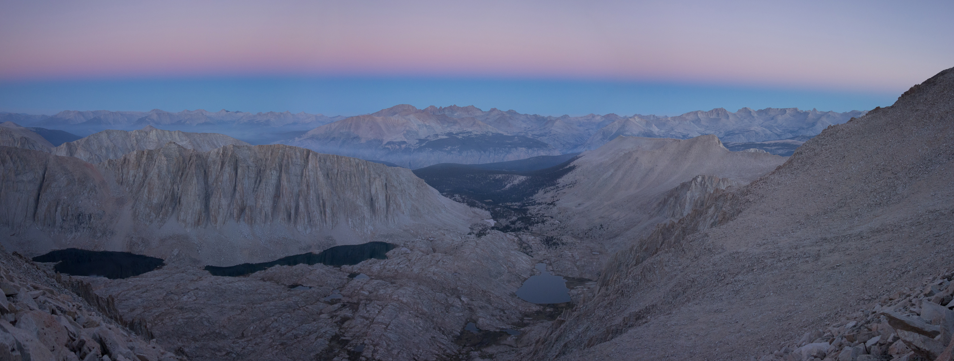
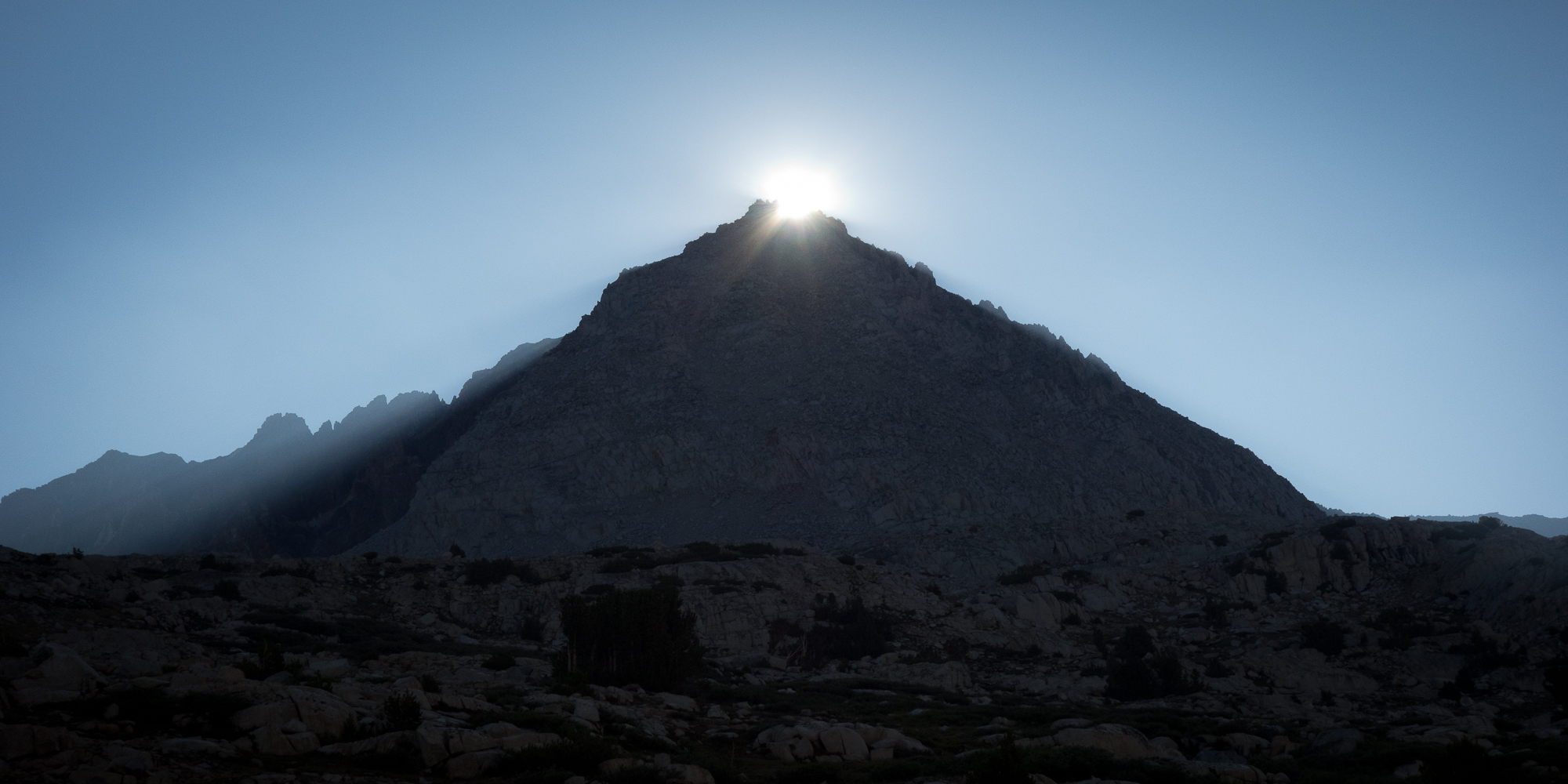
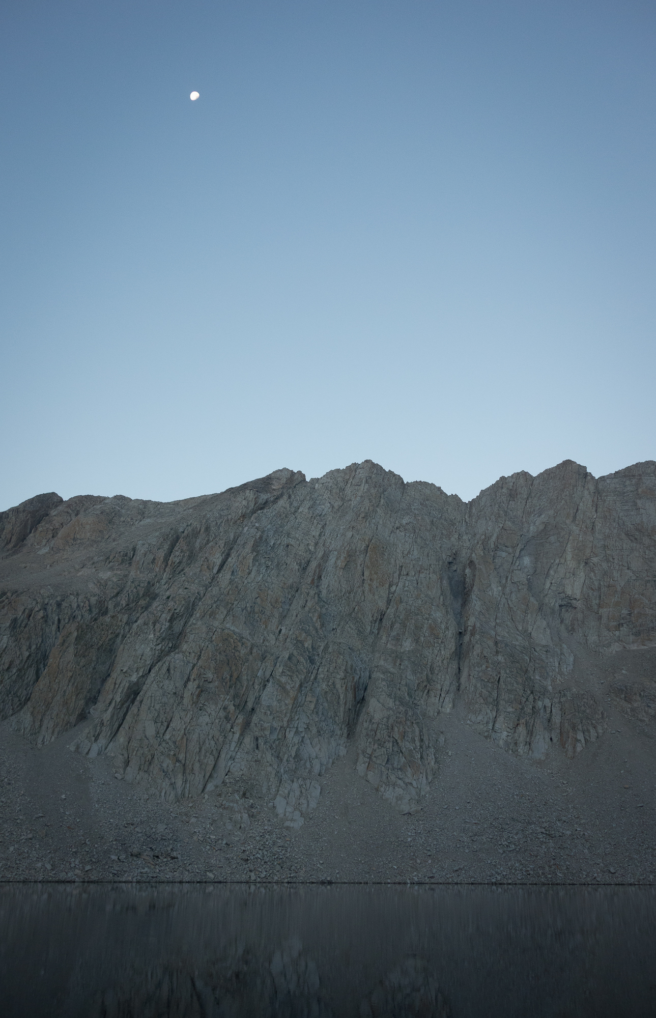
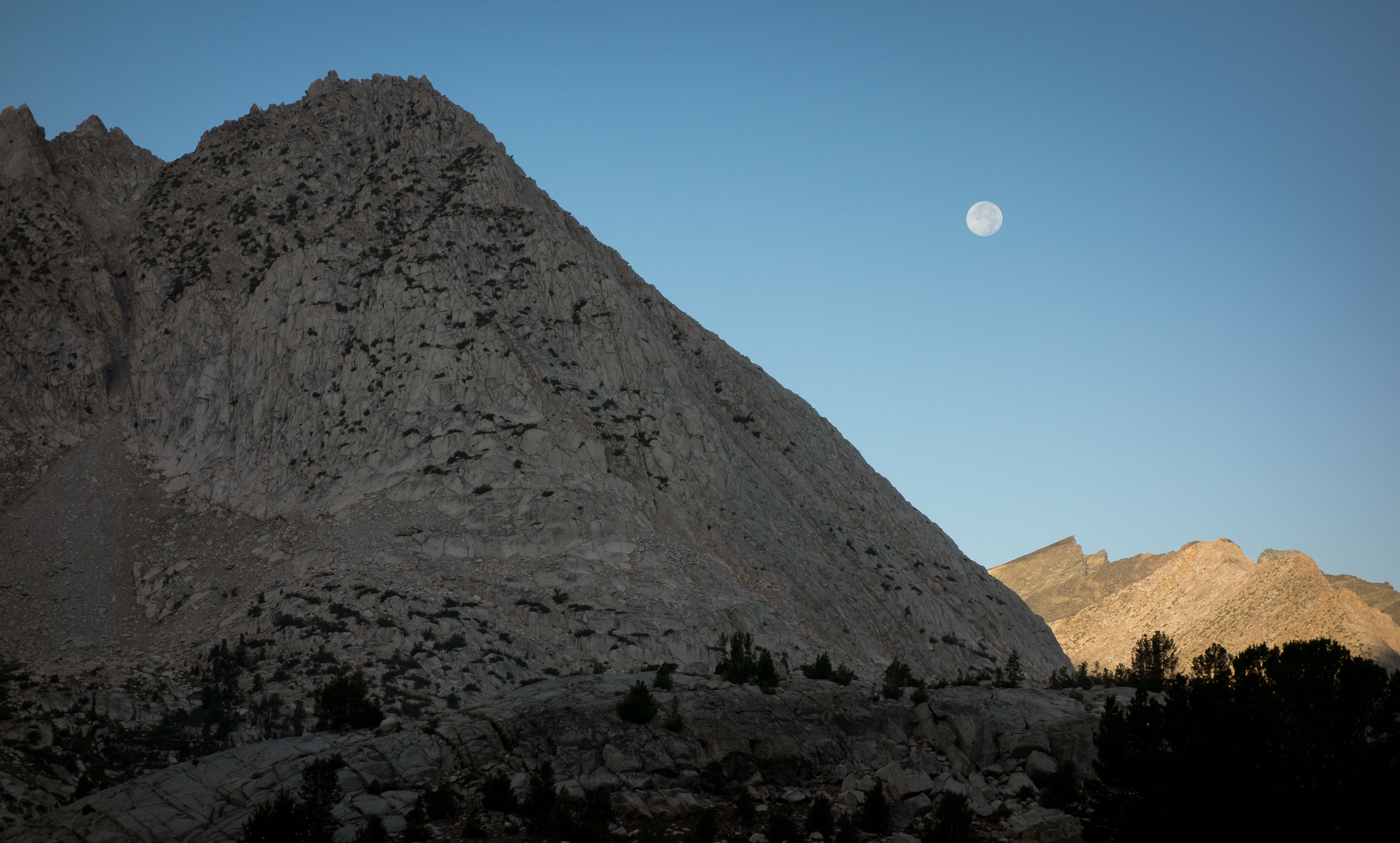
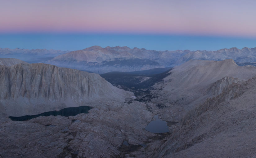
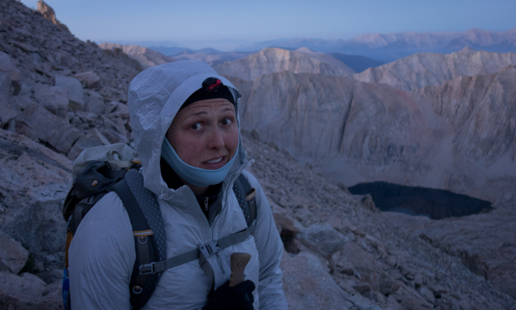
As we climbed along the ridge, daylight started to peak up and illuminate the eastern side. It was so cold the water in our bottles froze. It took a lot of determination to keep pushing up. I was repeating in my head “if this were easy, everyone would do it” and “I am strong”.

First light in the east
First light in the east.
Stunning View to the west. Guitar lake down below
Stunning View to the west. Guitar lake campsite down below.
Final push to the summit of Mt. Whitney
Final push to the summit of Mt. Whitney.
Wearing everything I brought with me. I am freezing cold.

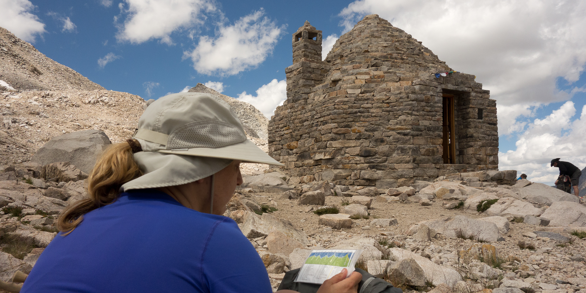
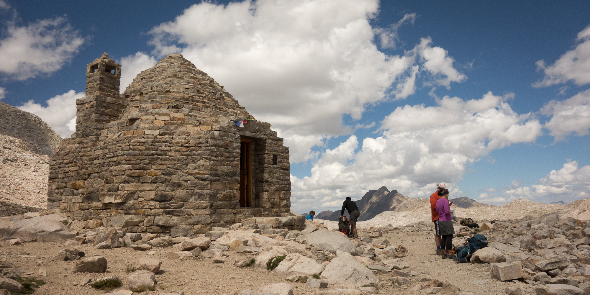
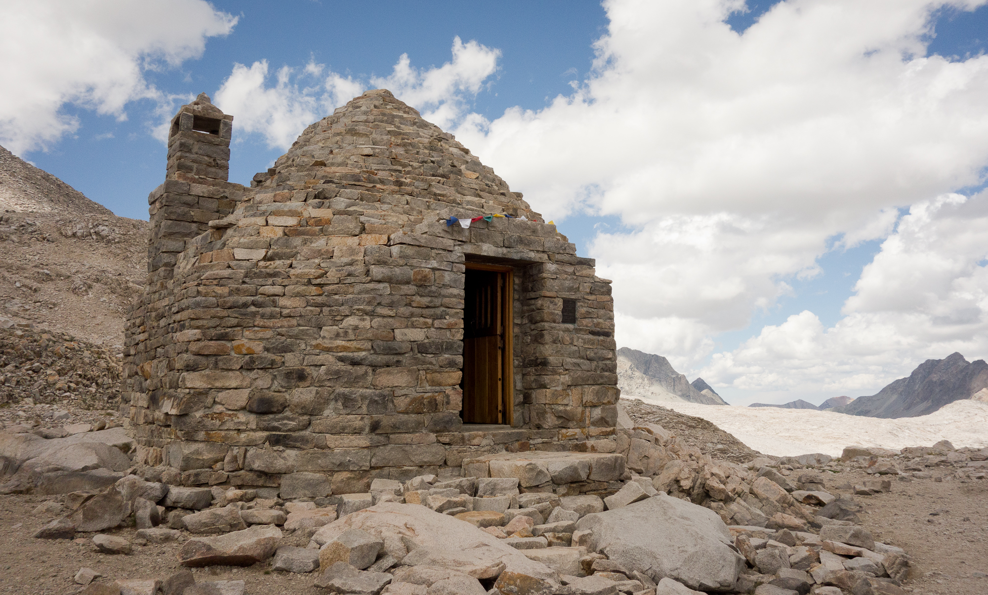
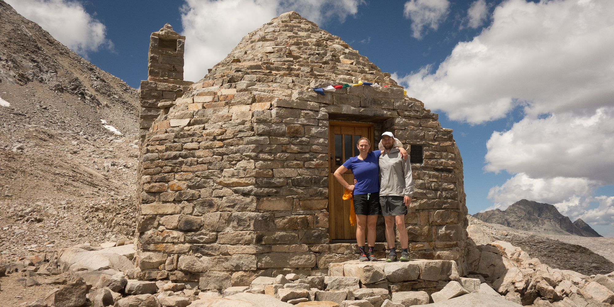
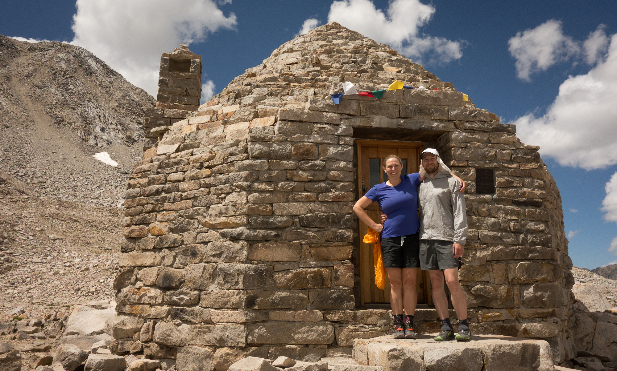
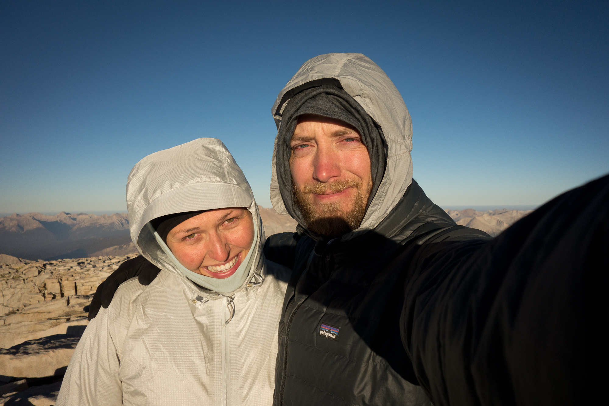
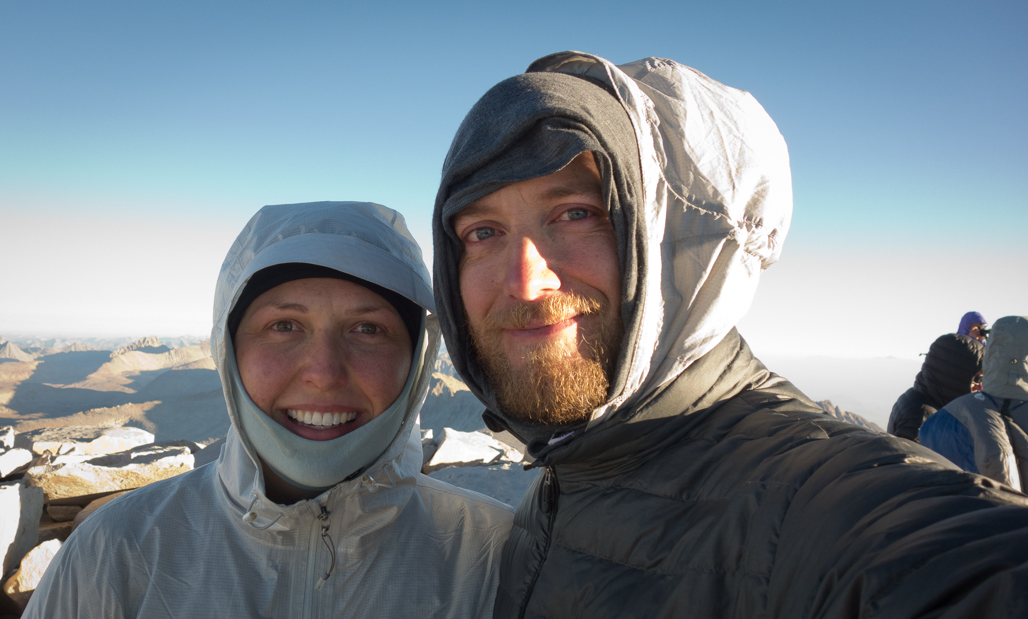
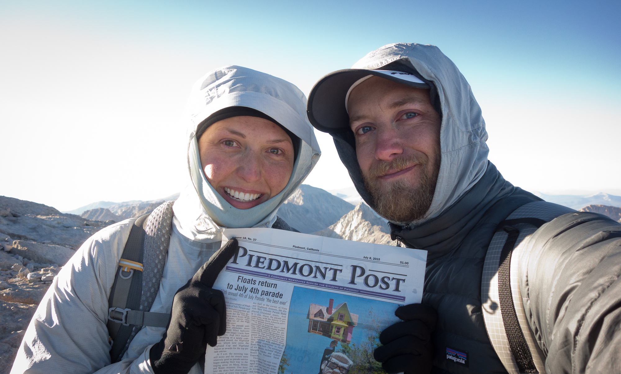
Lyell, Stuart, Steve, and Emma were coming down from the summit and told us we had just a couple hundred more feet. They looked so cold! Before I knew it the warming hut was in sight and we were at the summit of Mt. Whitney. I cried. I cried stupid blubbering tears.

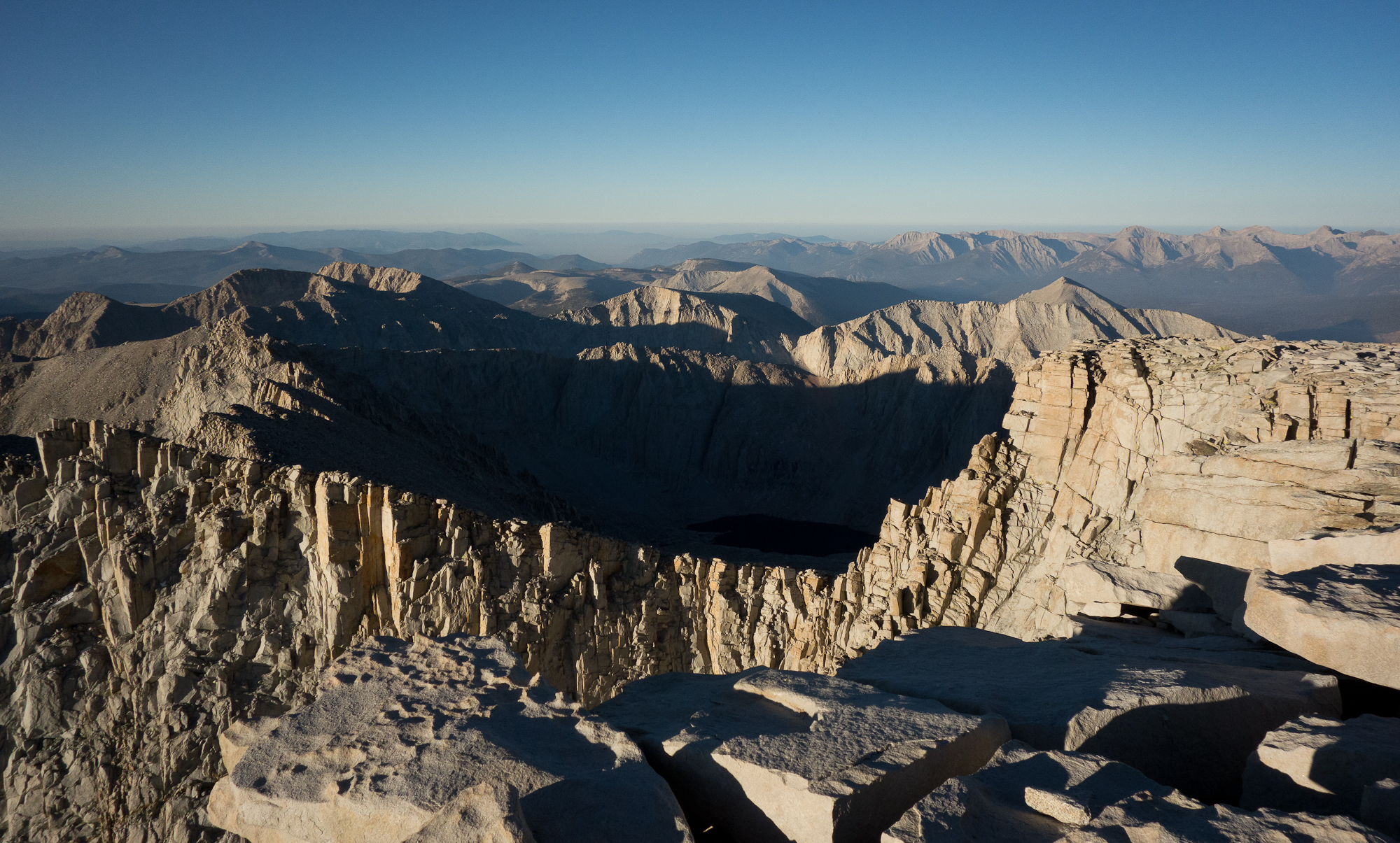
We went all the way to the eastern edge of the mountain (the highest part) and stared into the rising sun.

We made it to the top of Mt. Whitney and the end of the John Muir Trail!
Mt. Whitney
Another shot with less sun in our face.
Mt Whitney Warming Hut
Mt Whitney Warming Hut.
Looking south on Trail Crest
Looking south on Trail Crest.
Mt. Whitney Summit looking southwest
Mt. Whitney Summit looking southwest.
Signing the trail book. I'm crying.
Signing the trail book. I’m crying.
Mom made us hike with the Piedmont Post
Mom made us hike with the Piedmont Post.

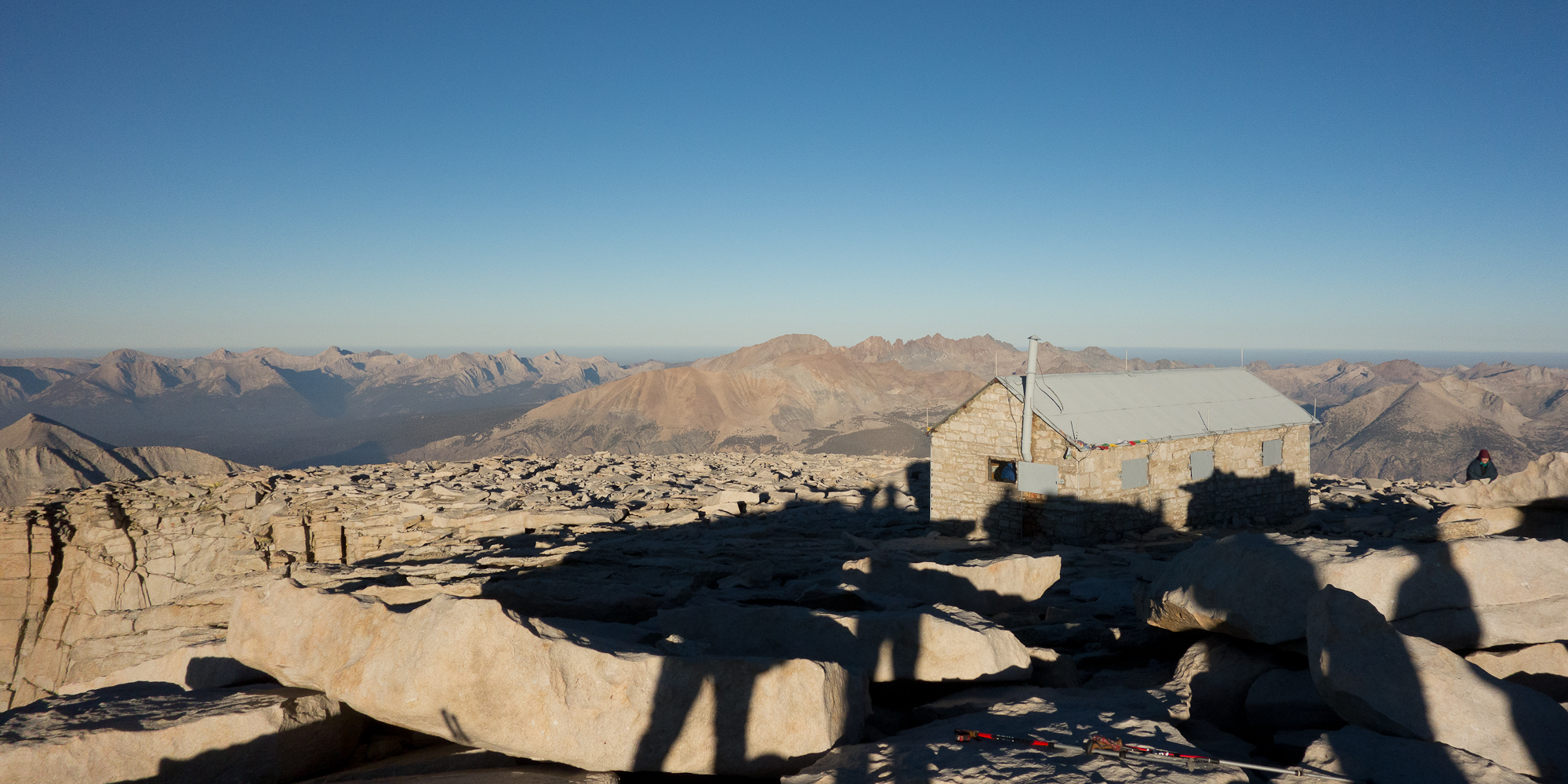
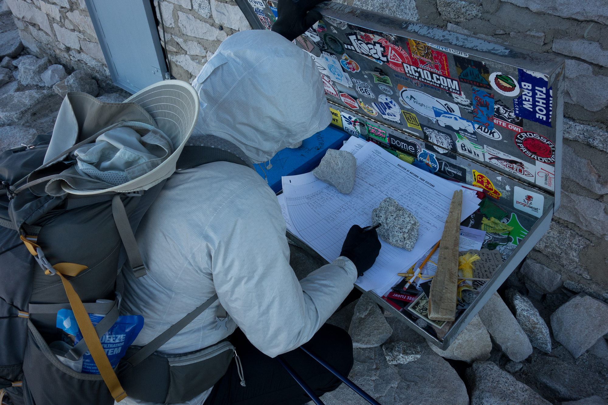
We went back to the warming hut to find Dick, Manuela, their son Theo, and Dave. Apparently Theo had astronaut ice cream on him to celebrate his dad’s birthday. Incredible. He was a tad bit cold and had his dad’s sleeping bag wrapped around him like a caterpillar.

John Muir Trail
Looking north over all the mountains we hiked through.
Guitar Lake from Mt. Whitney
Mt Hitchcock
Mt Hitchcock

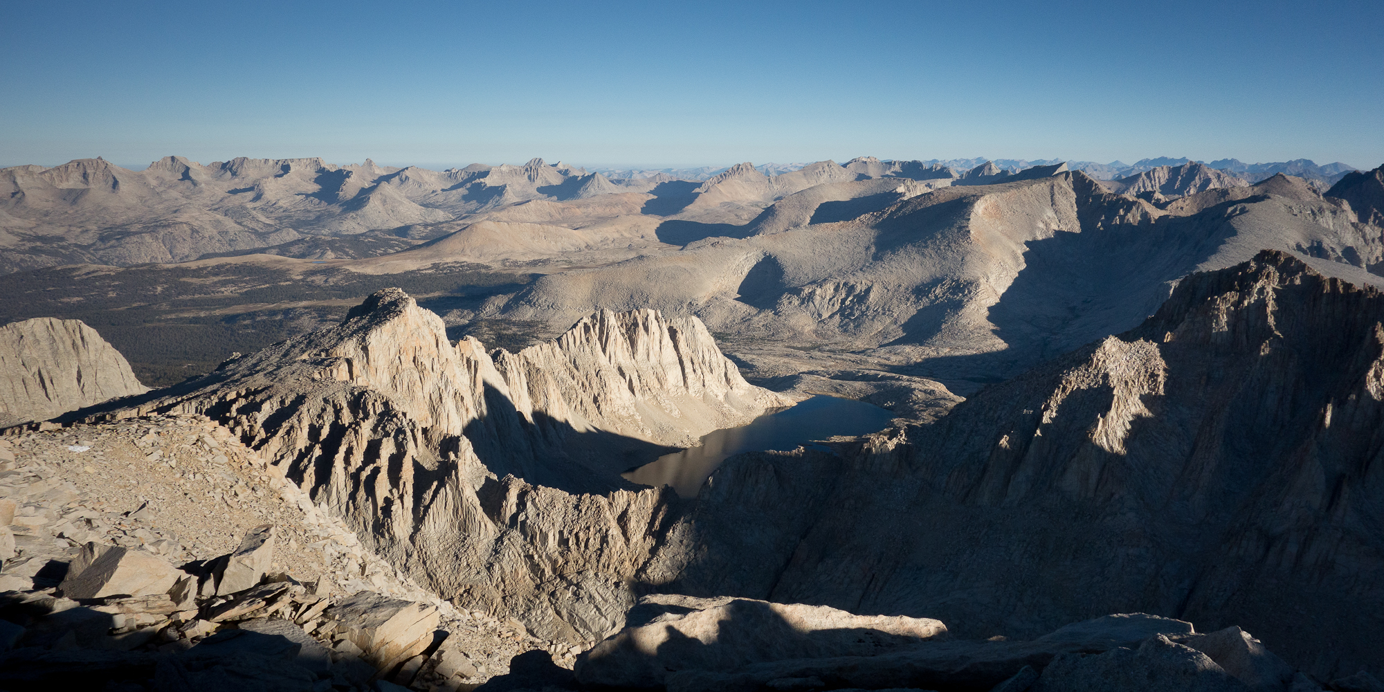
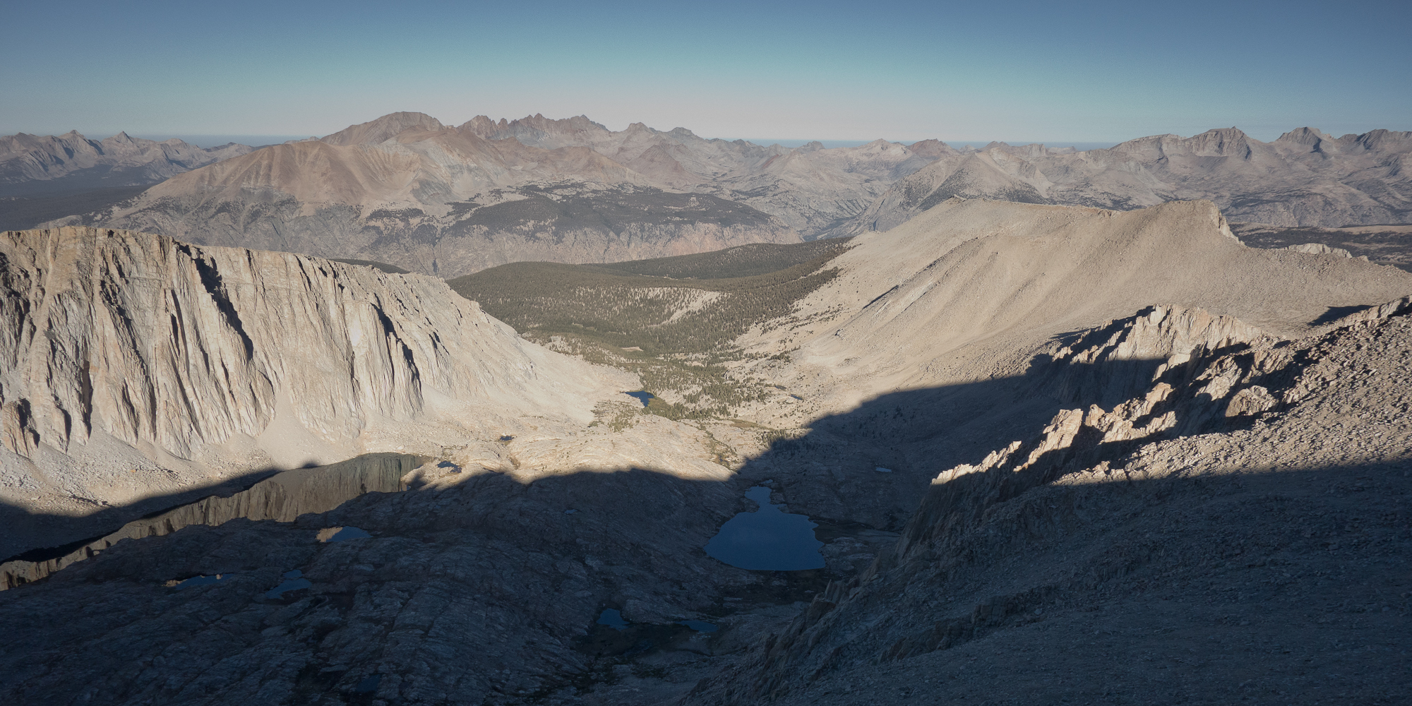
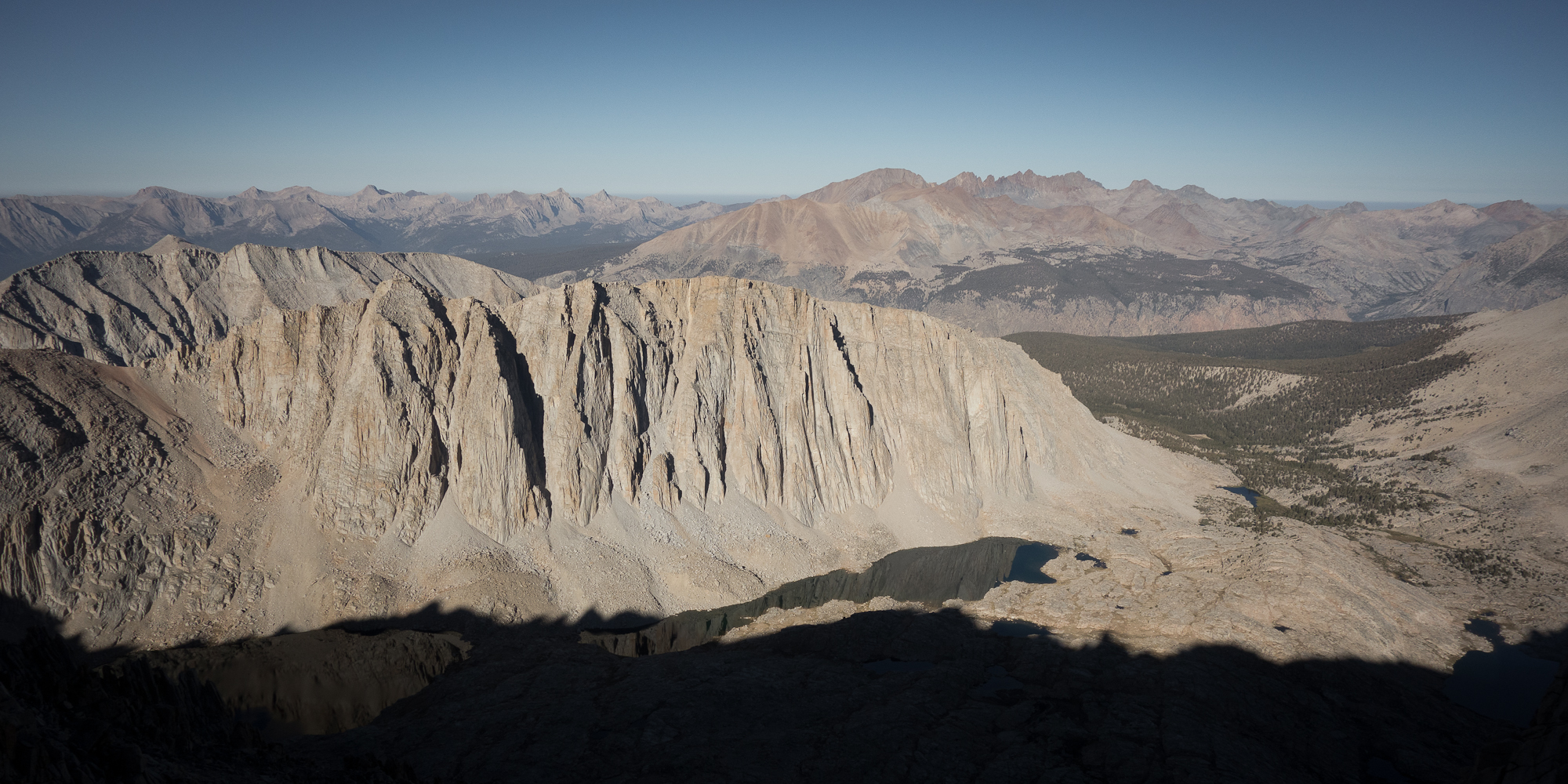
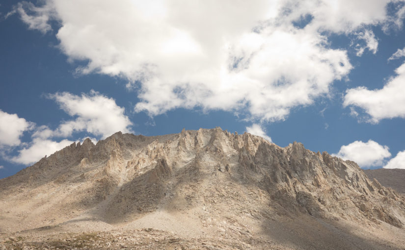
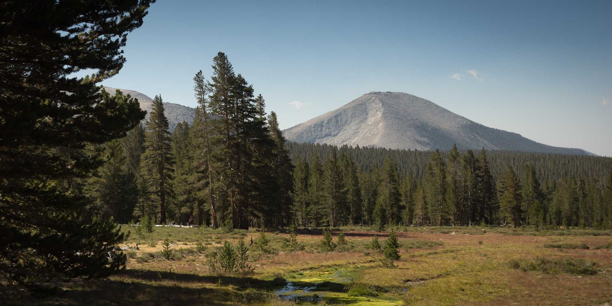
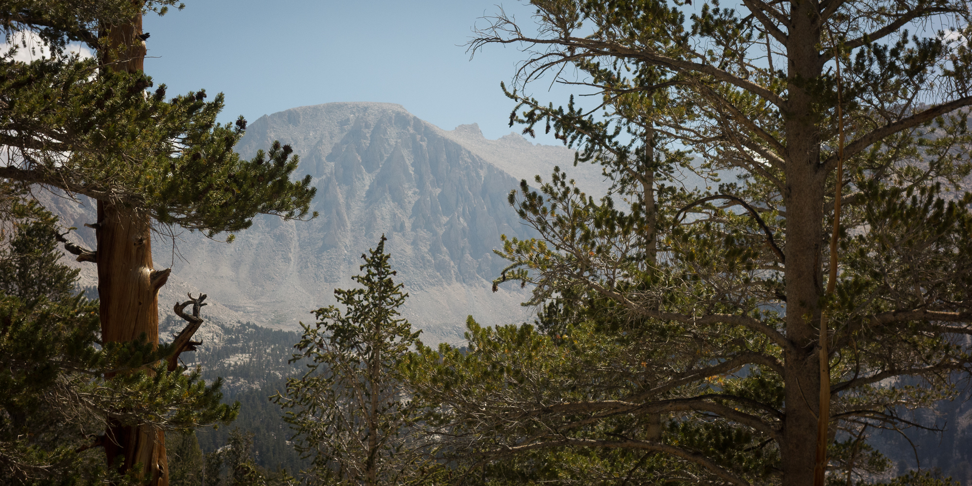
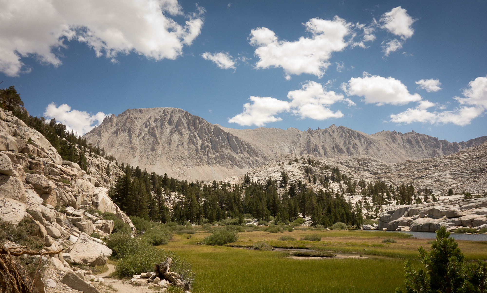
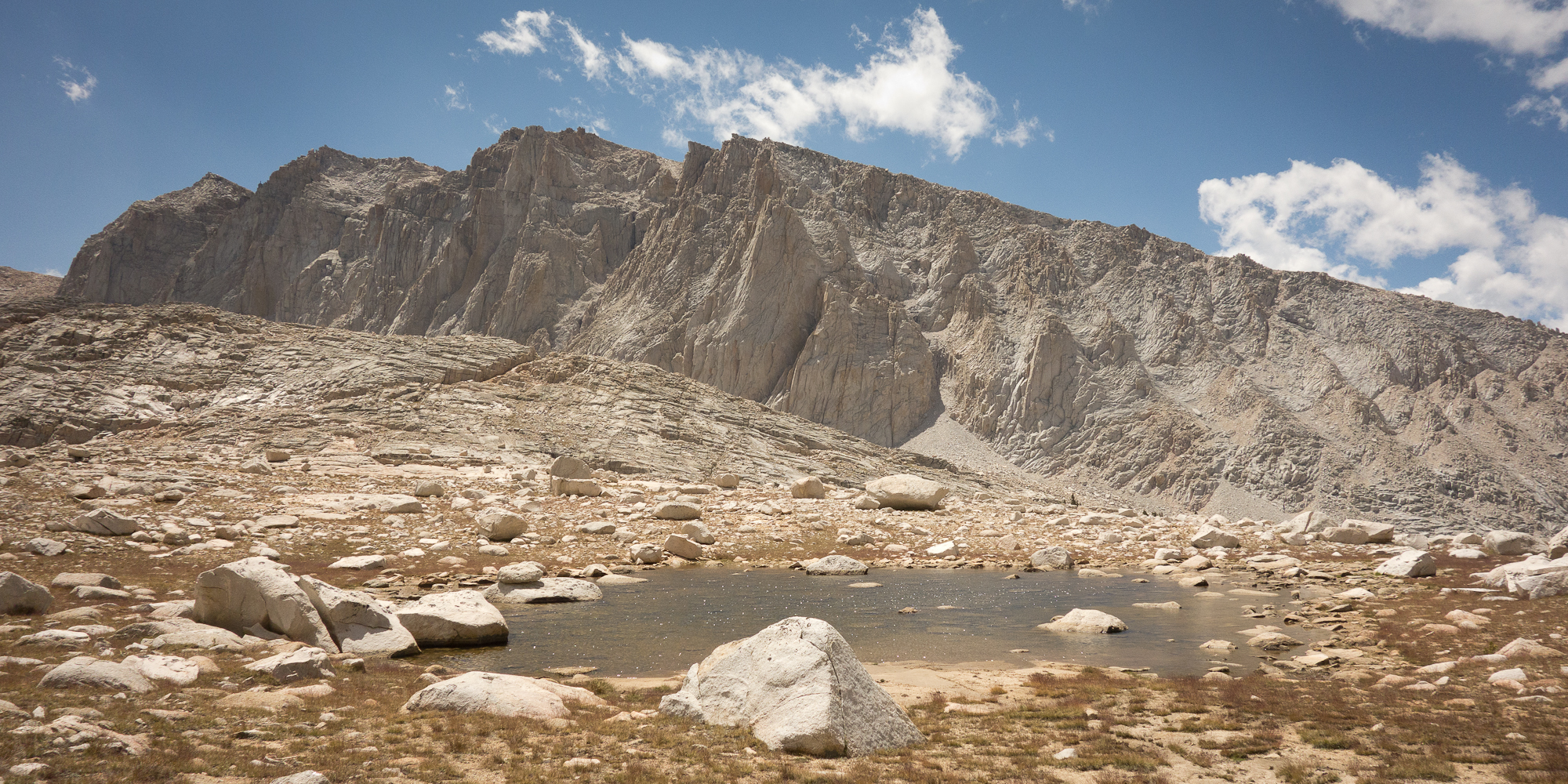
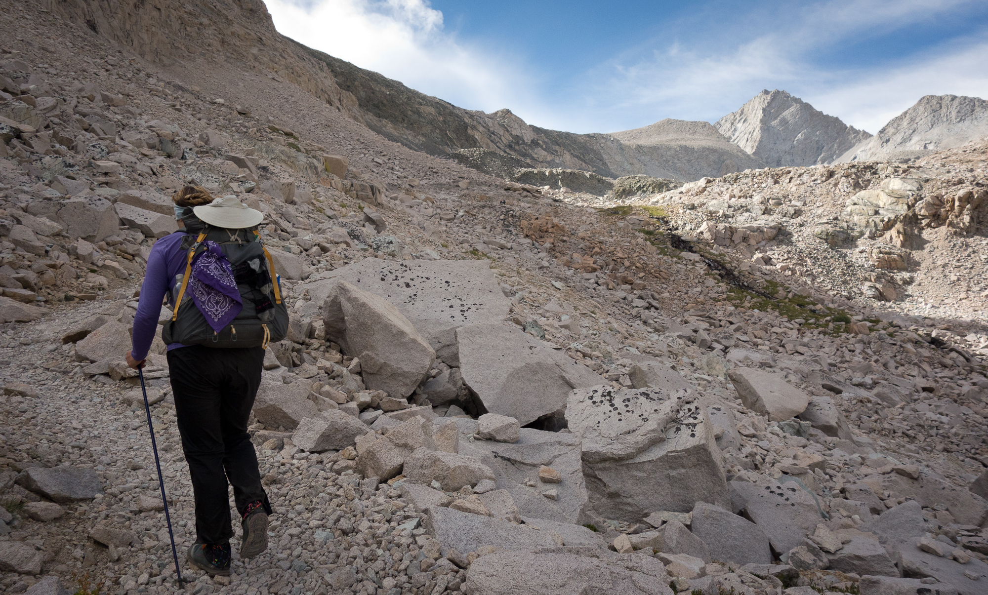
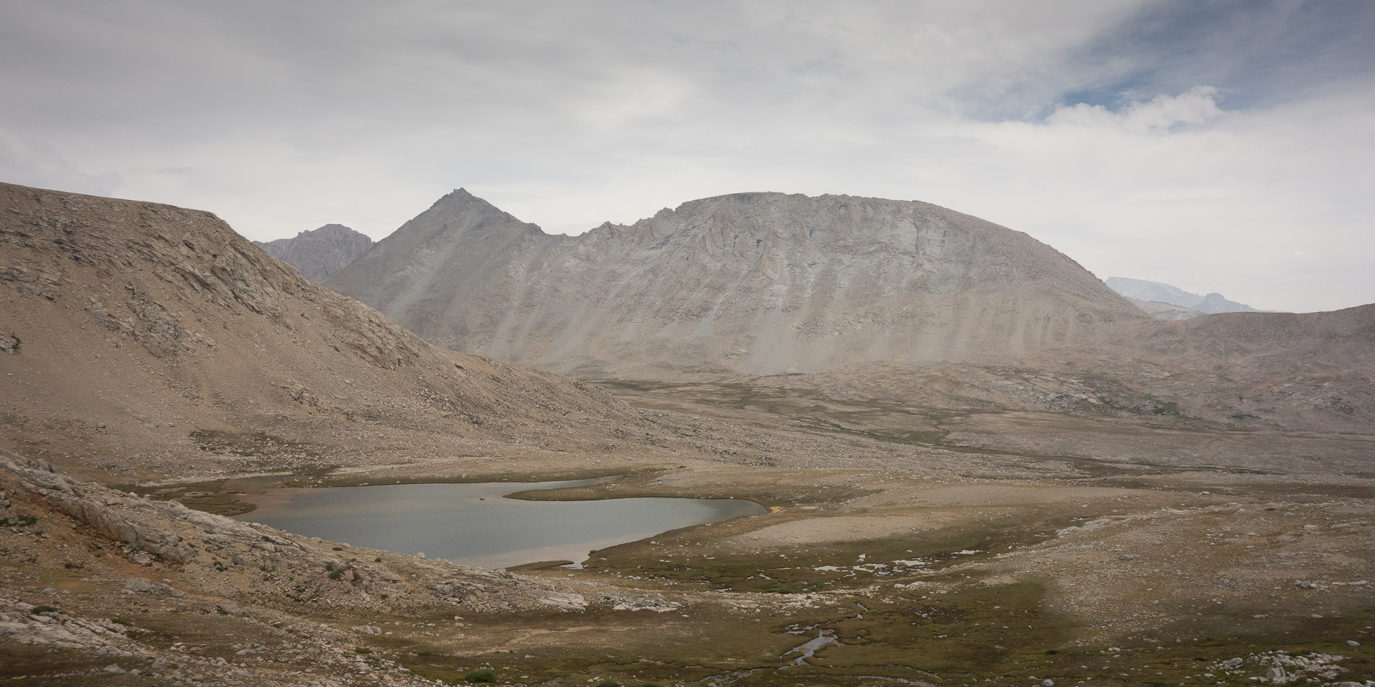
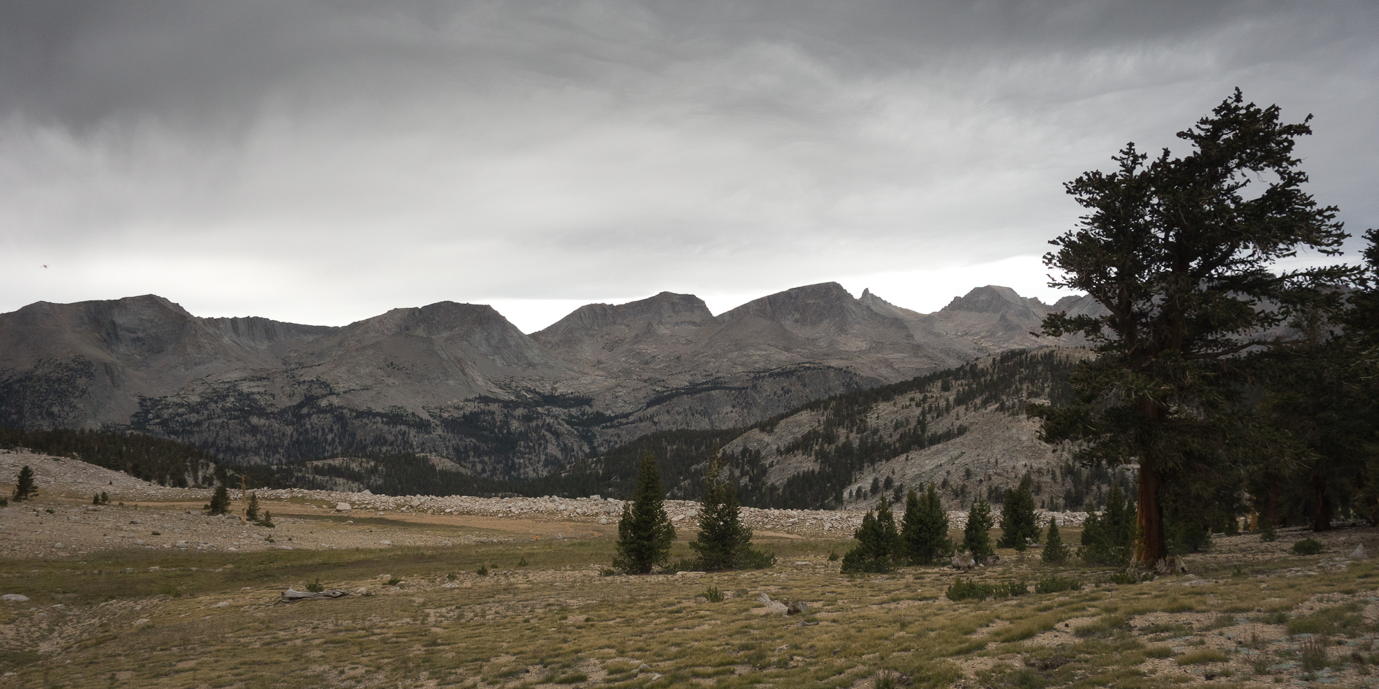
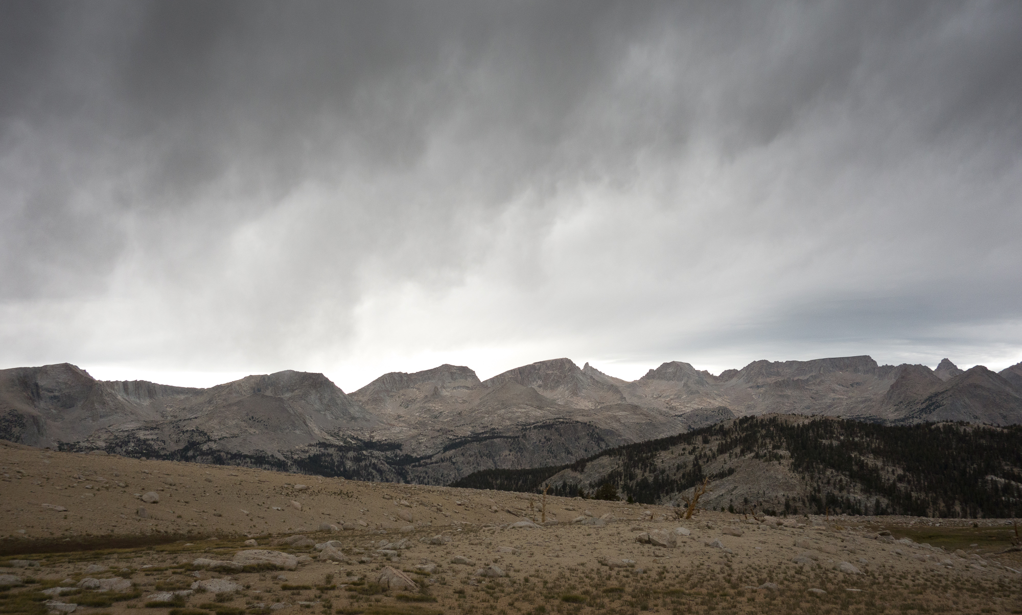
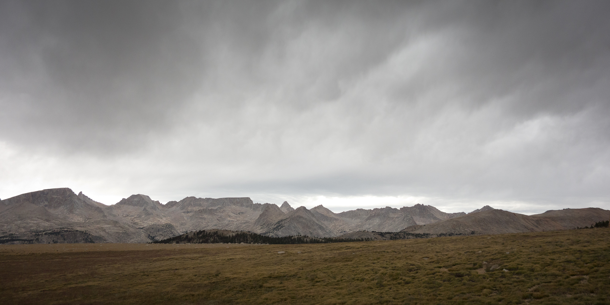
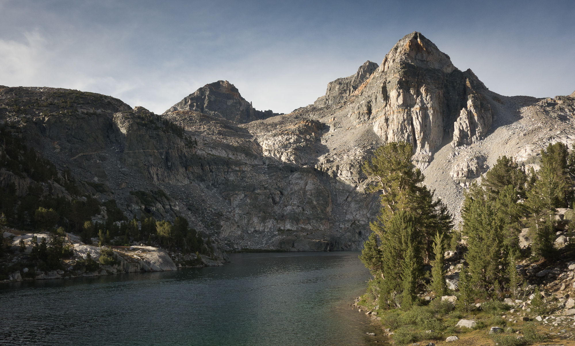
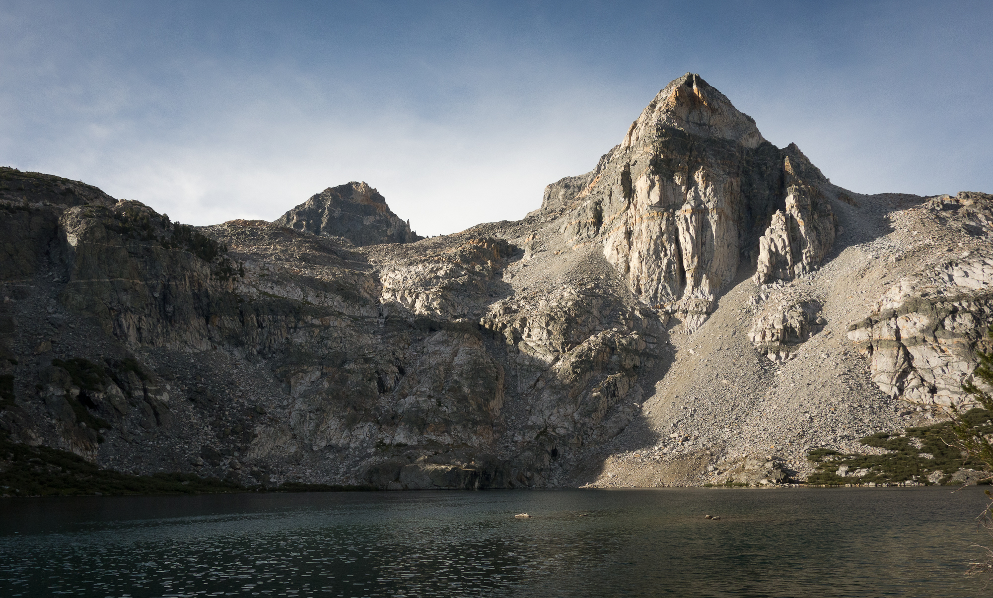
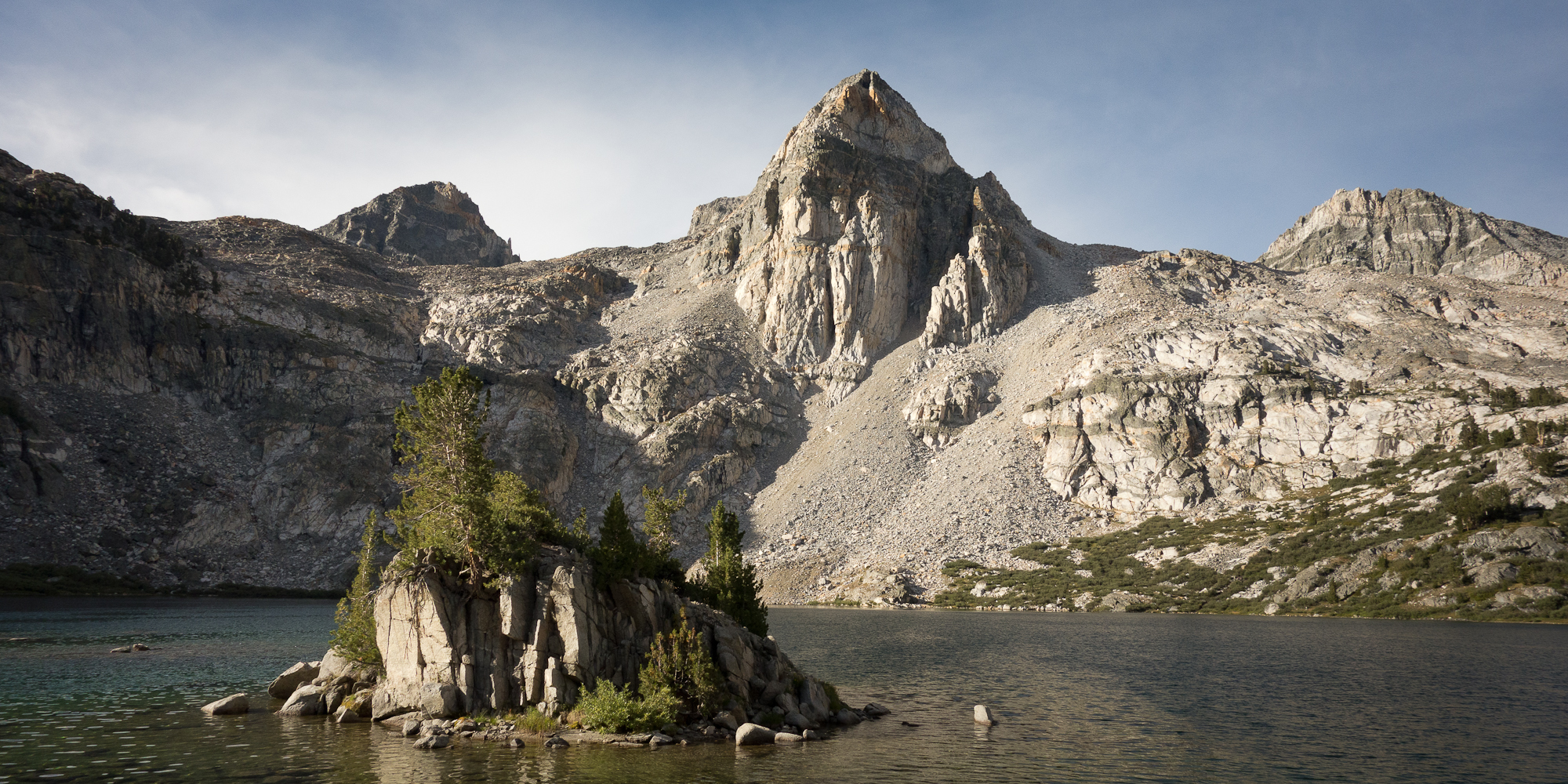
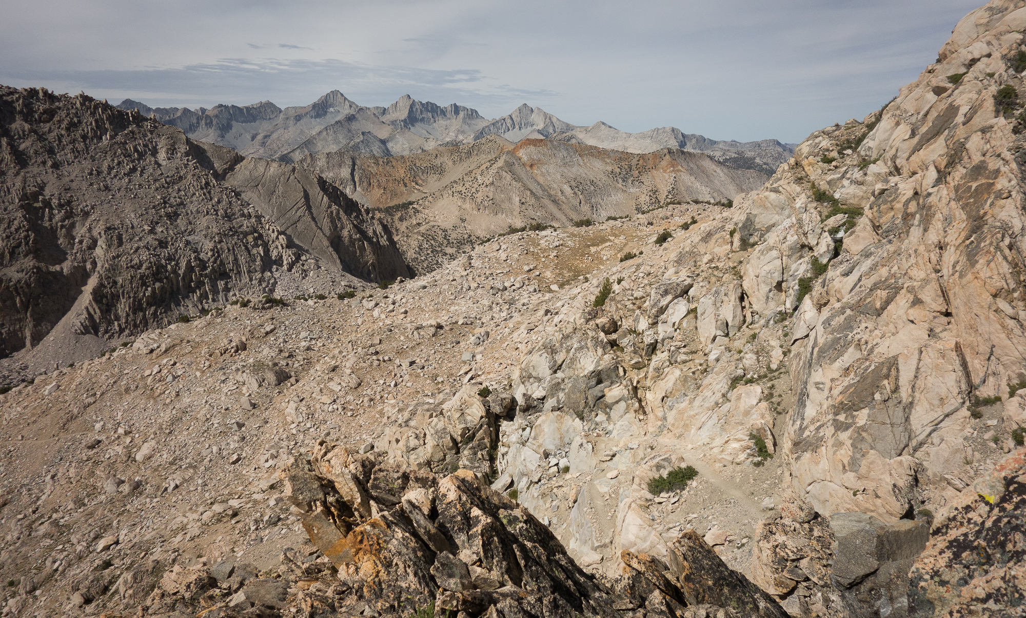
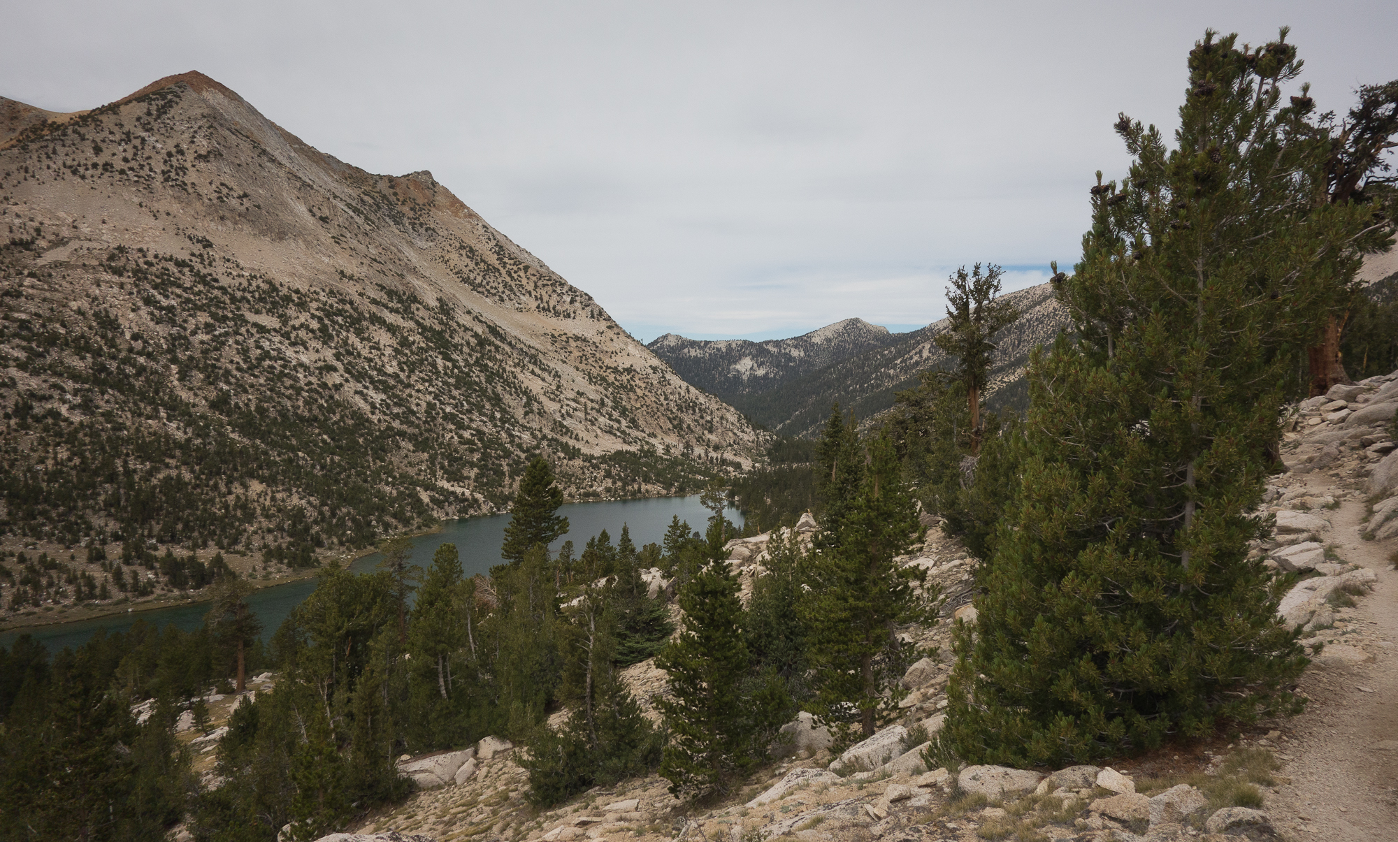
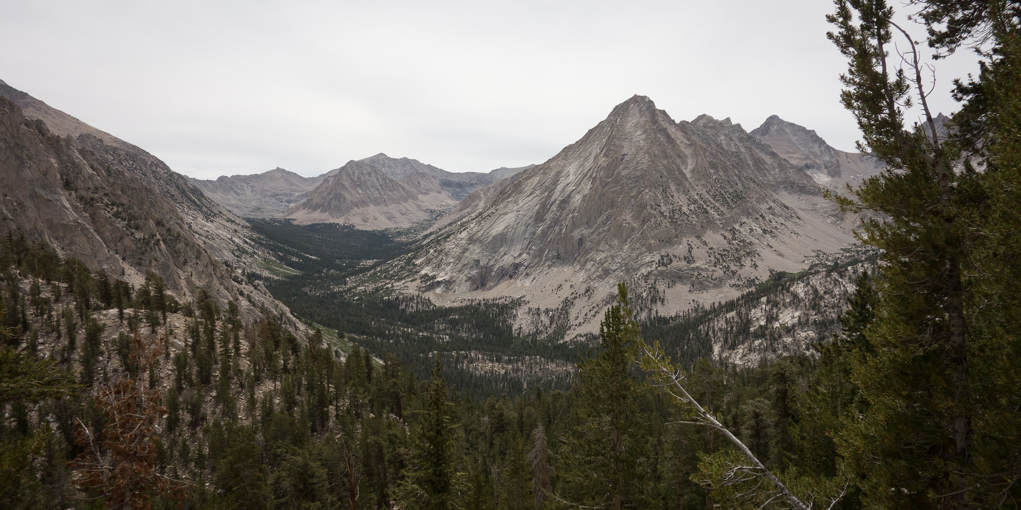
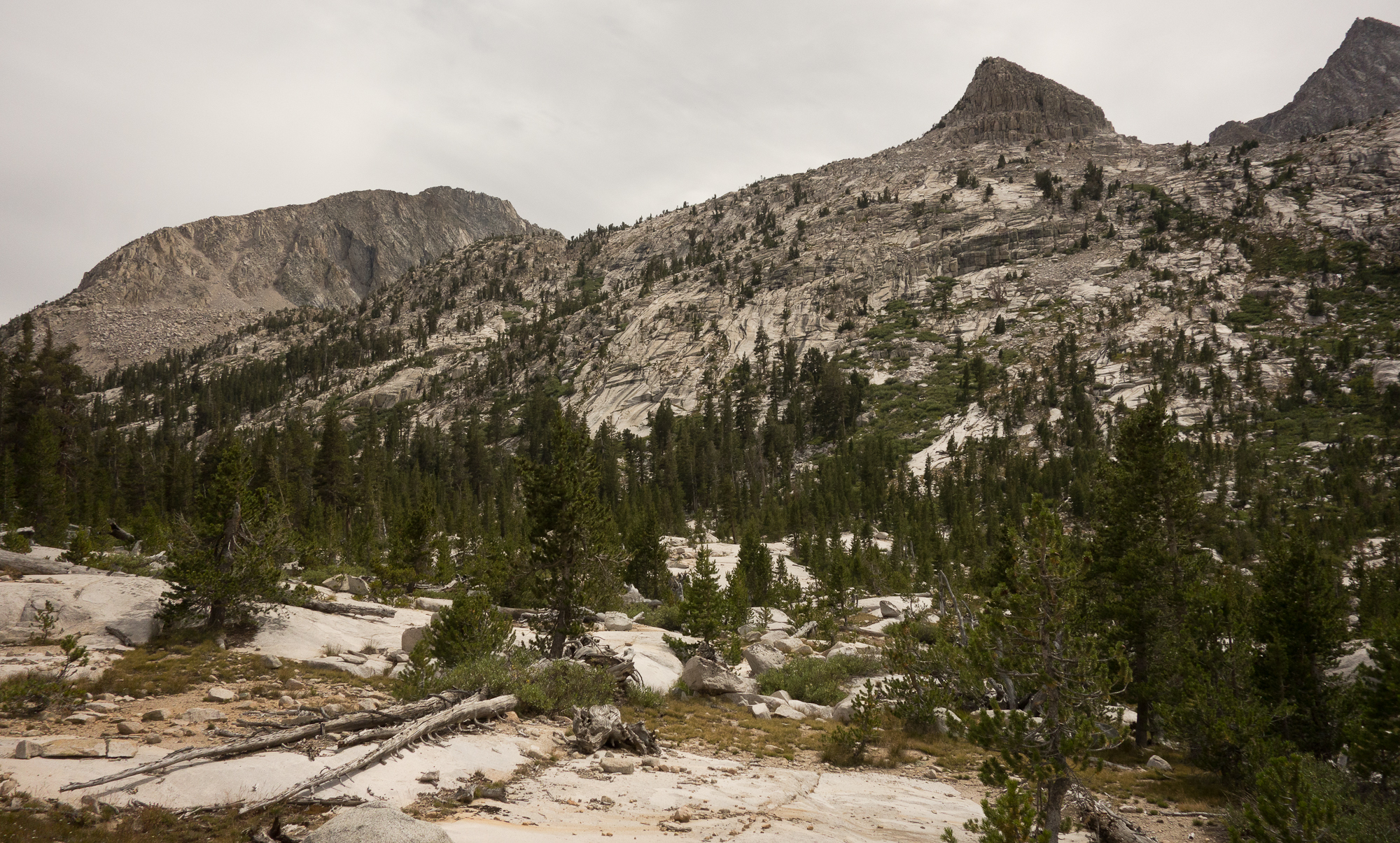
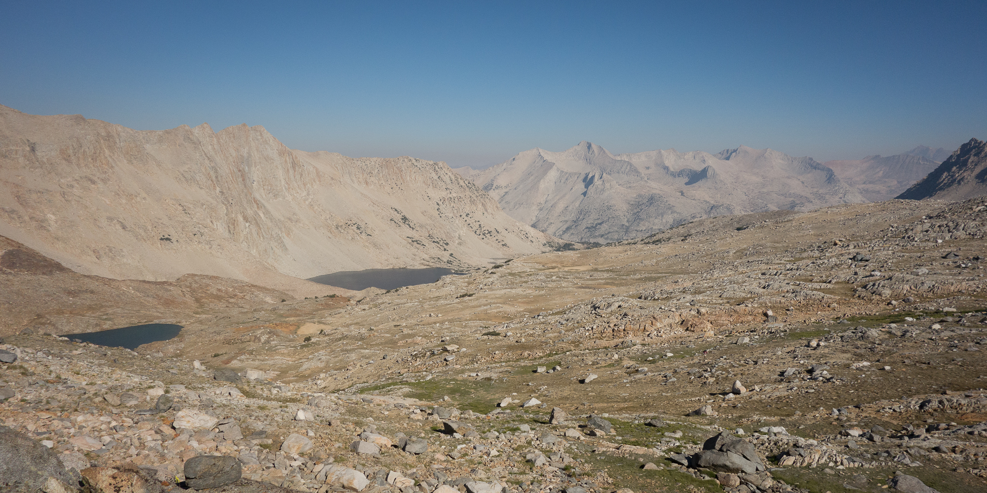
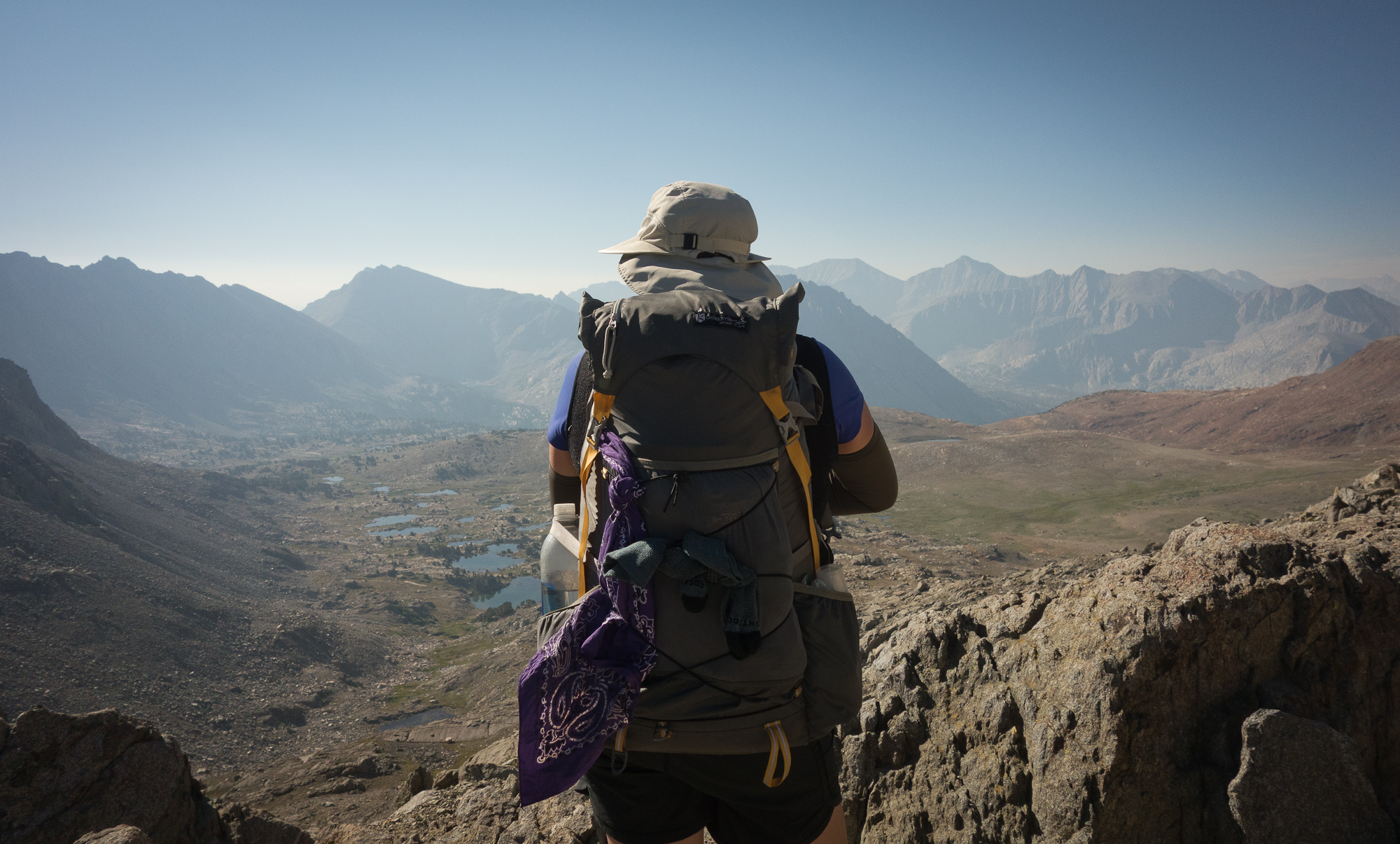
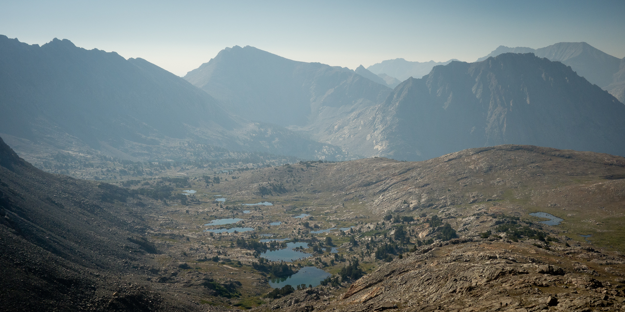
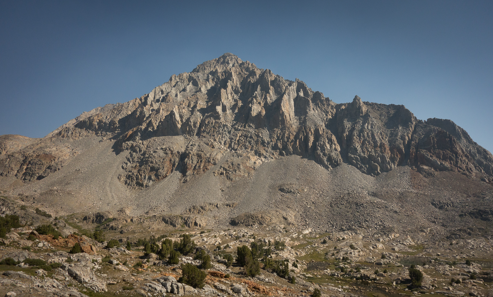
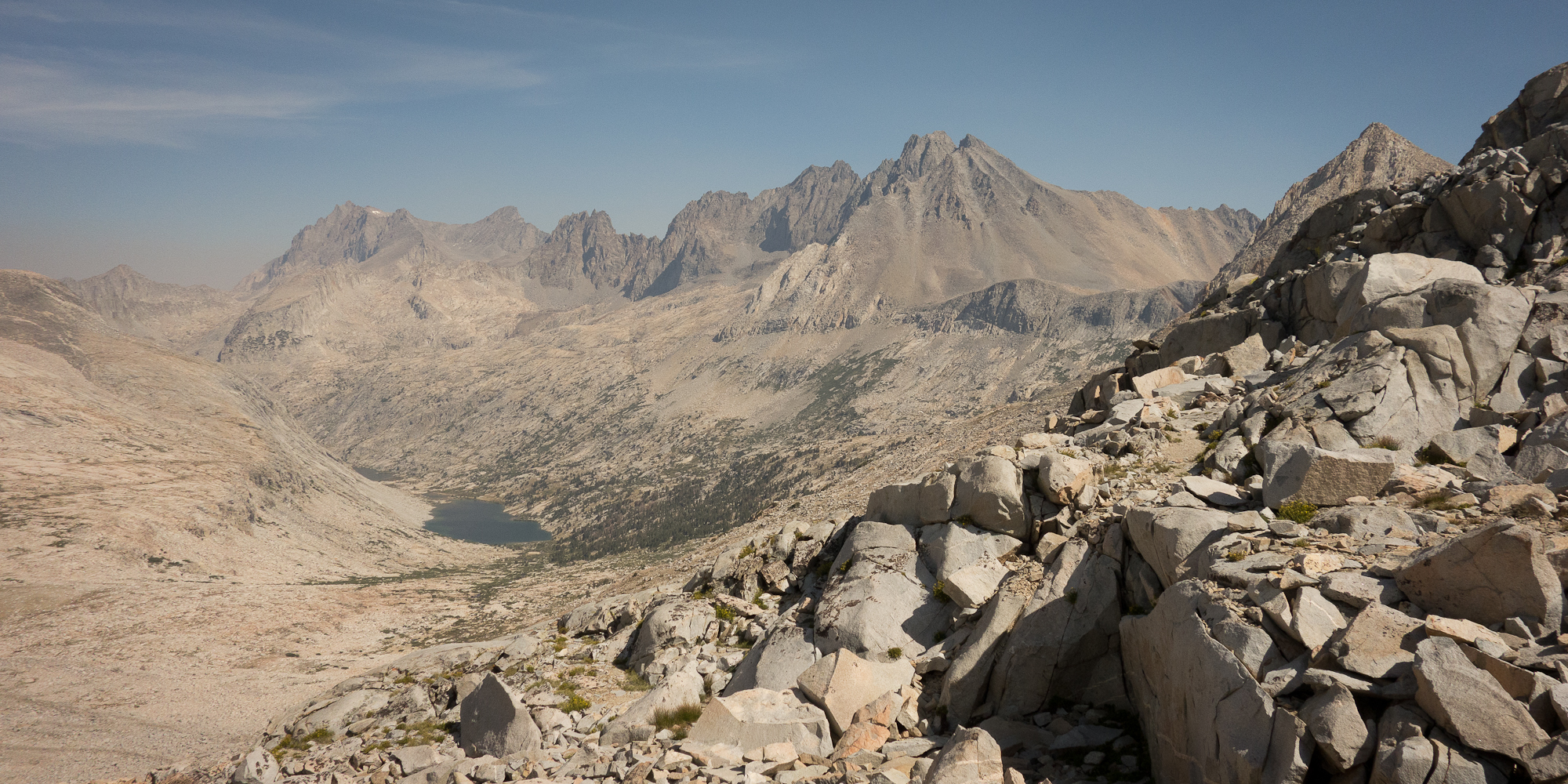
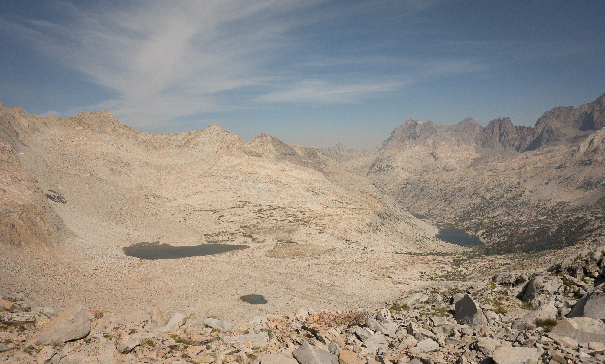
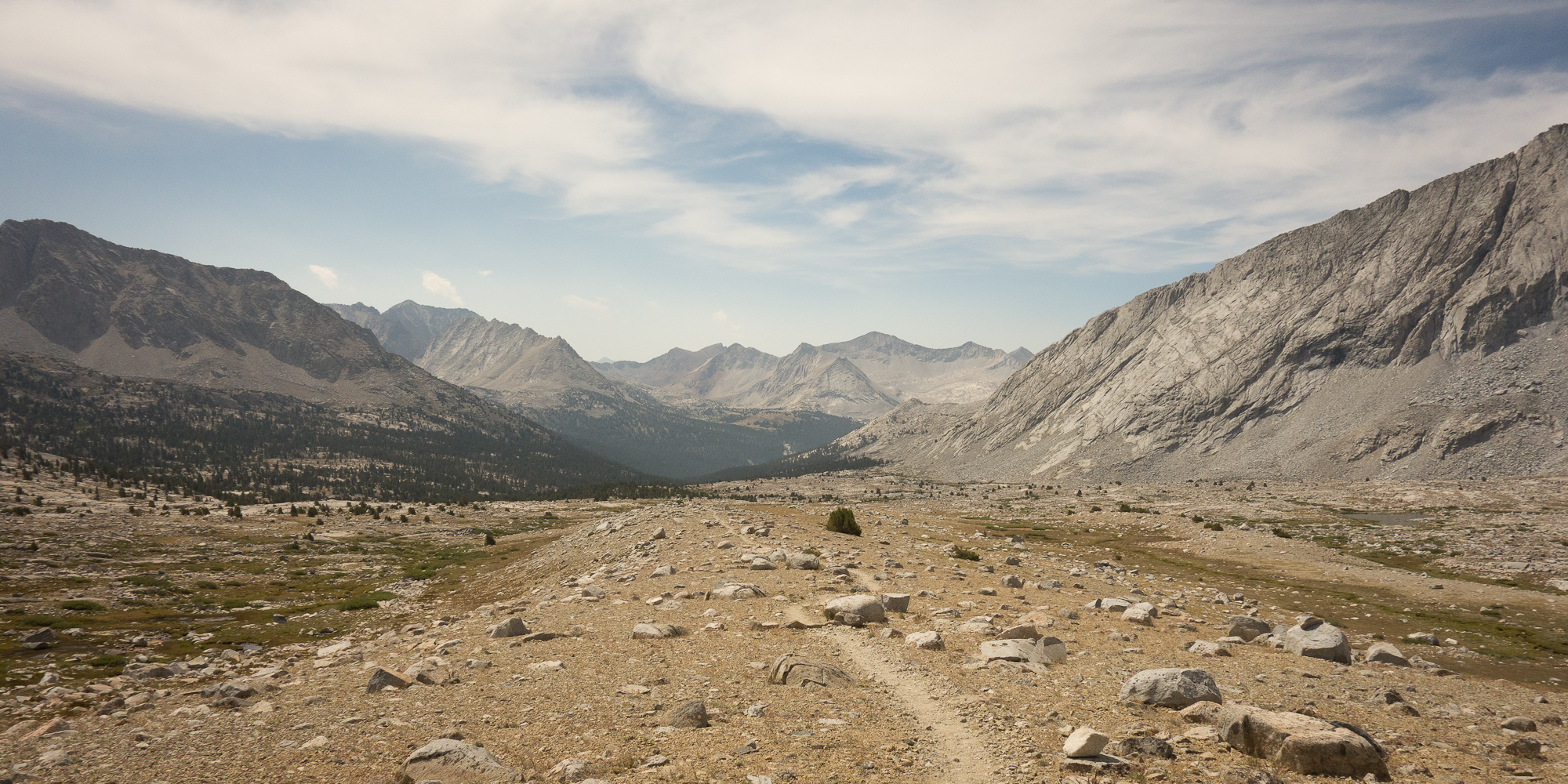
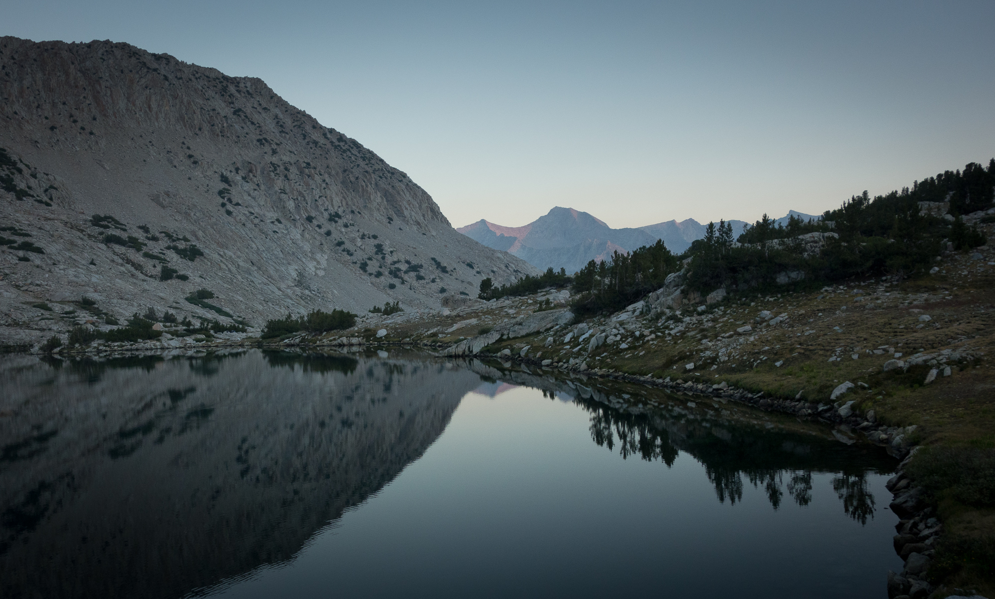
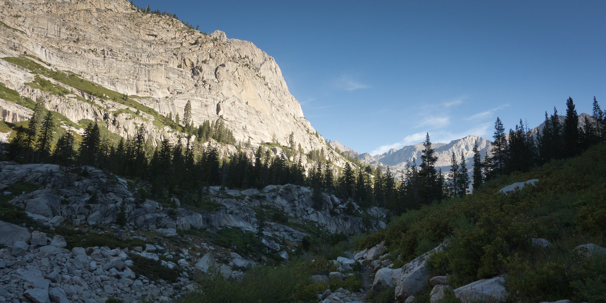
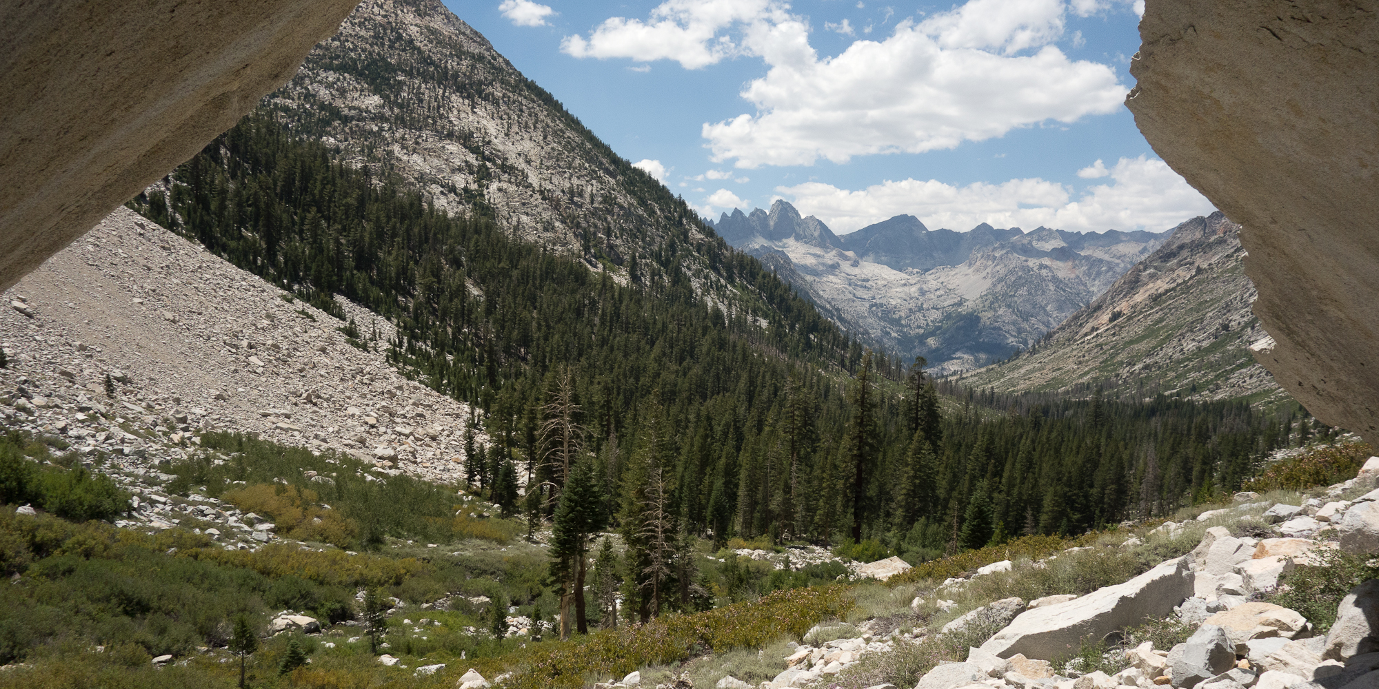
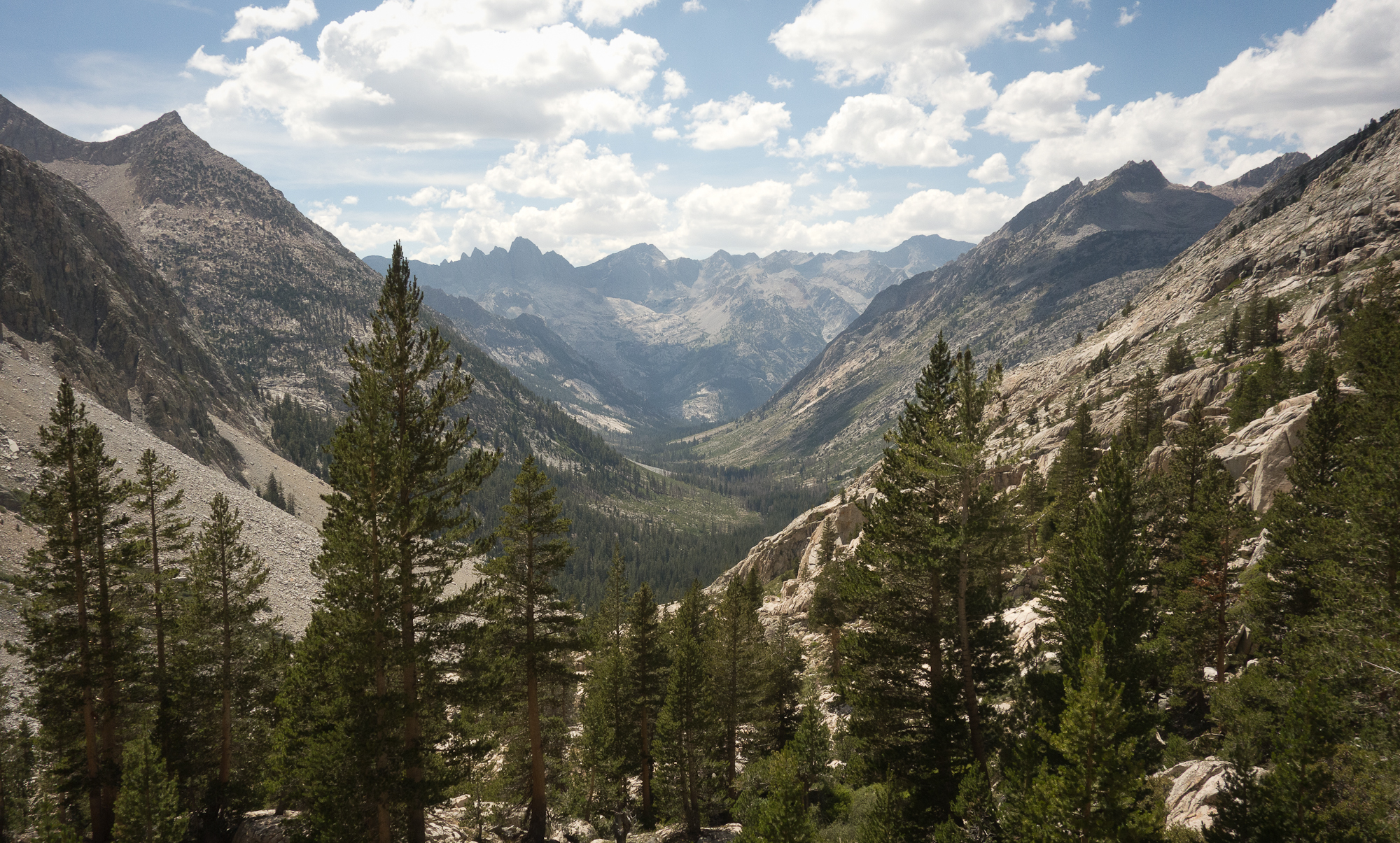
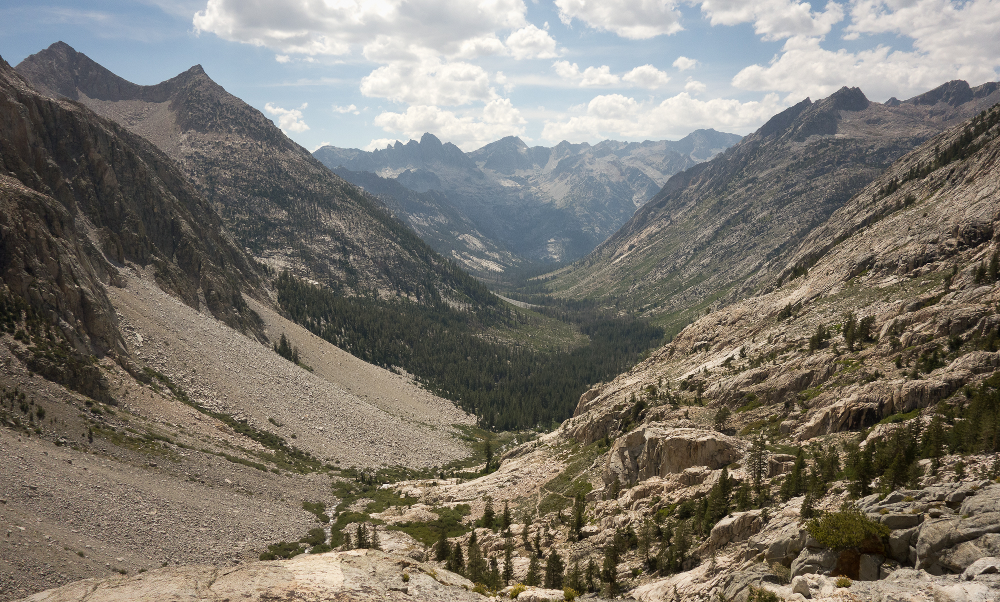
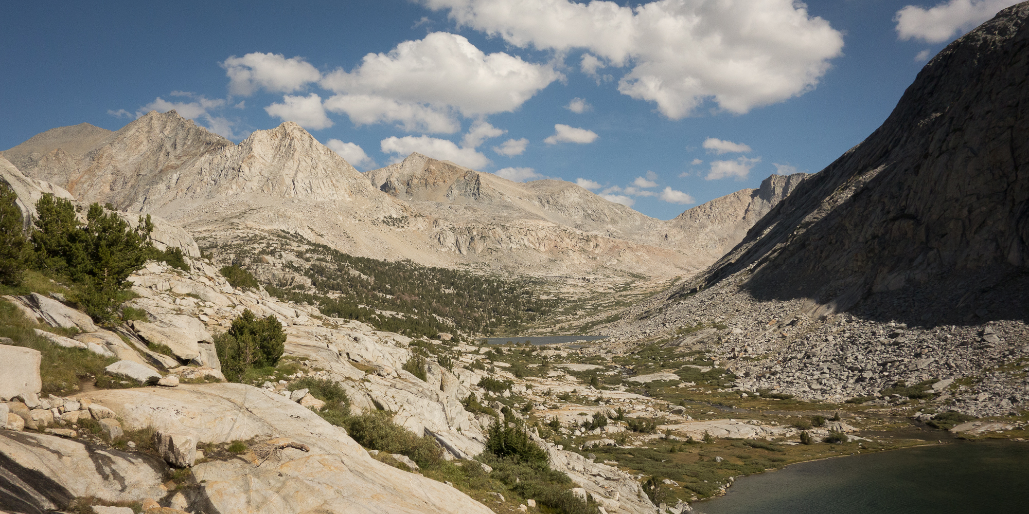
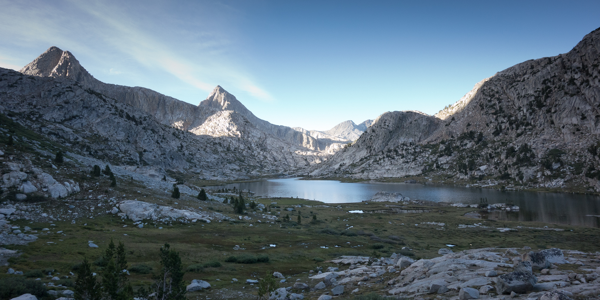
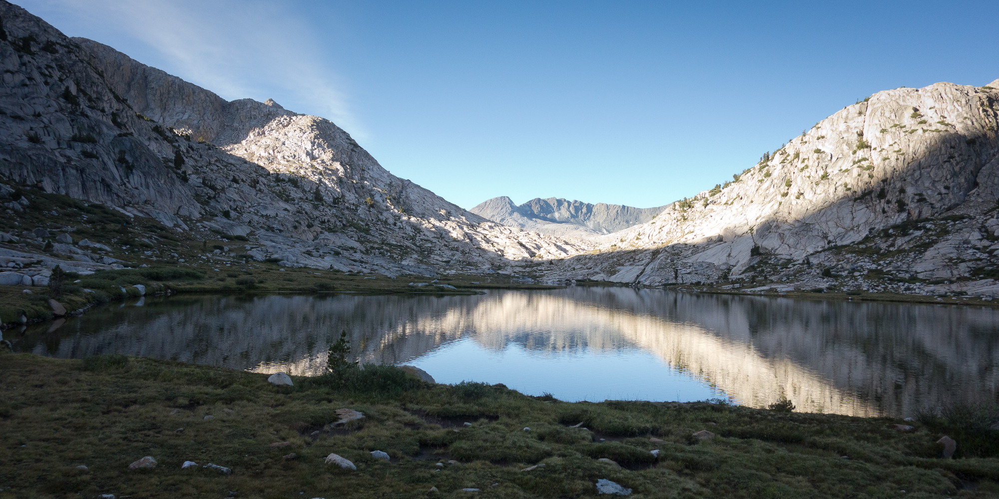
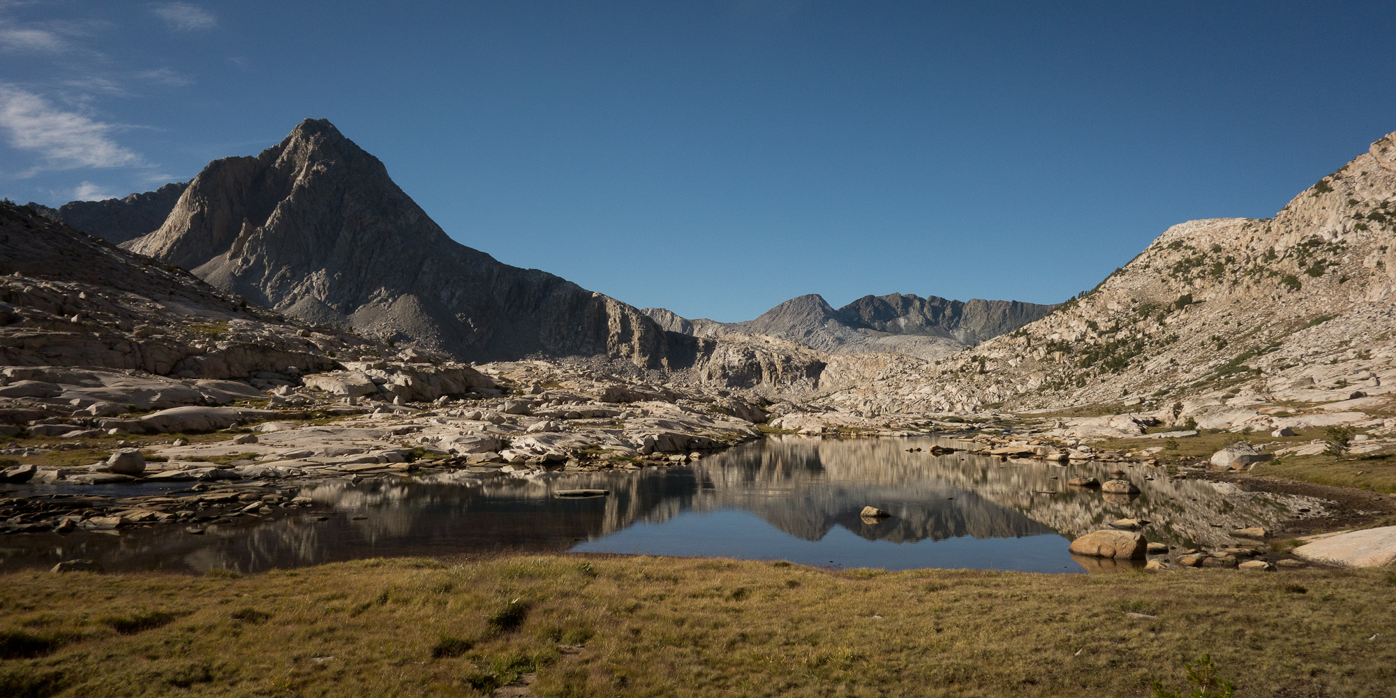
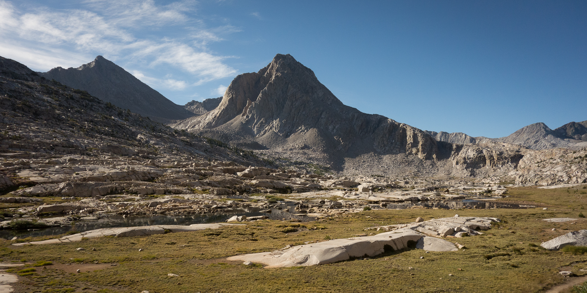
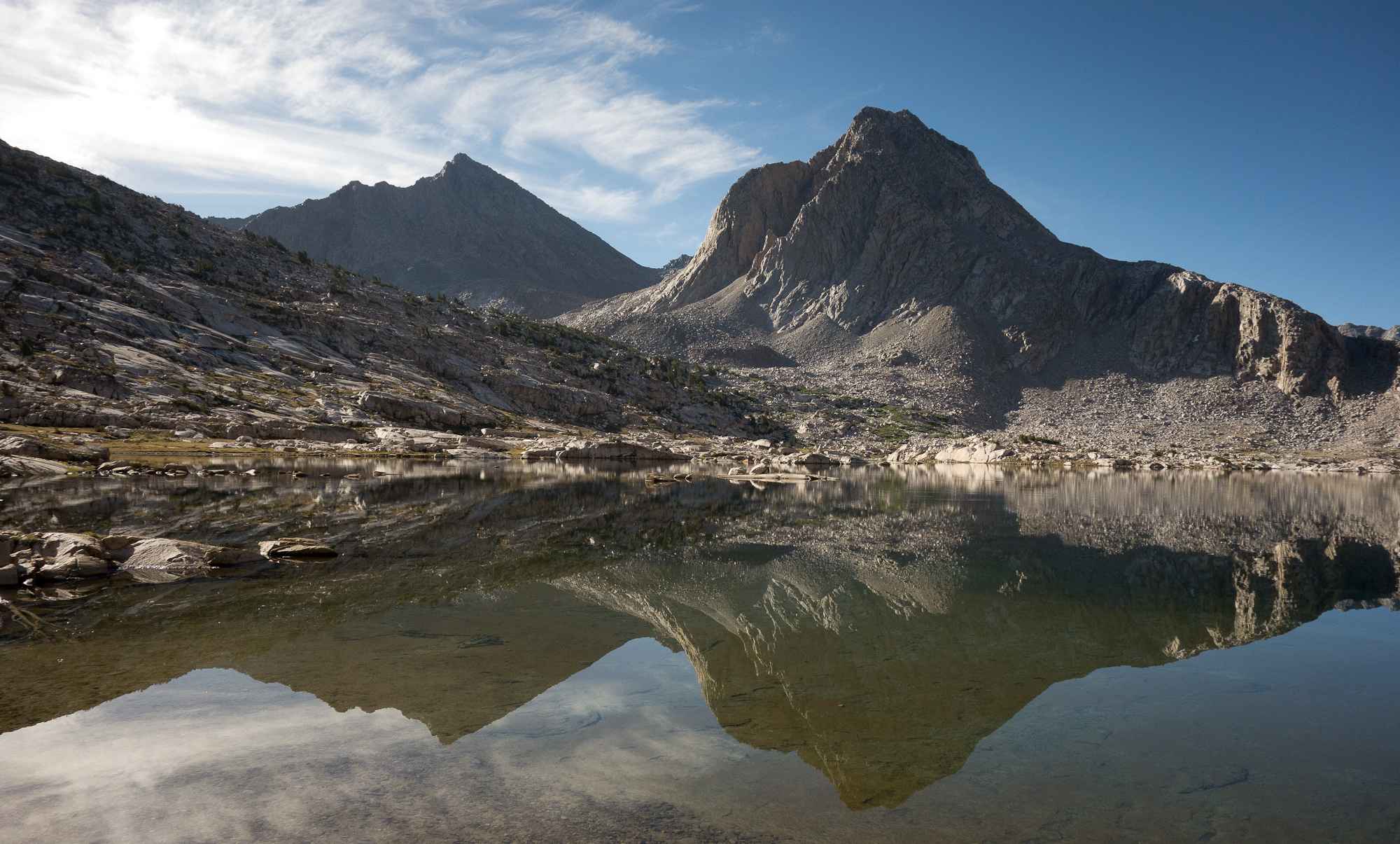
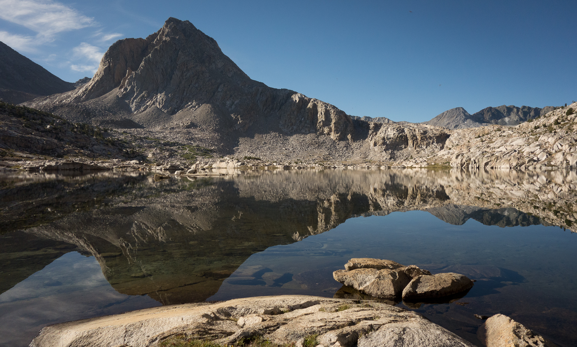
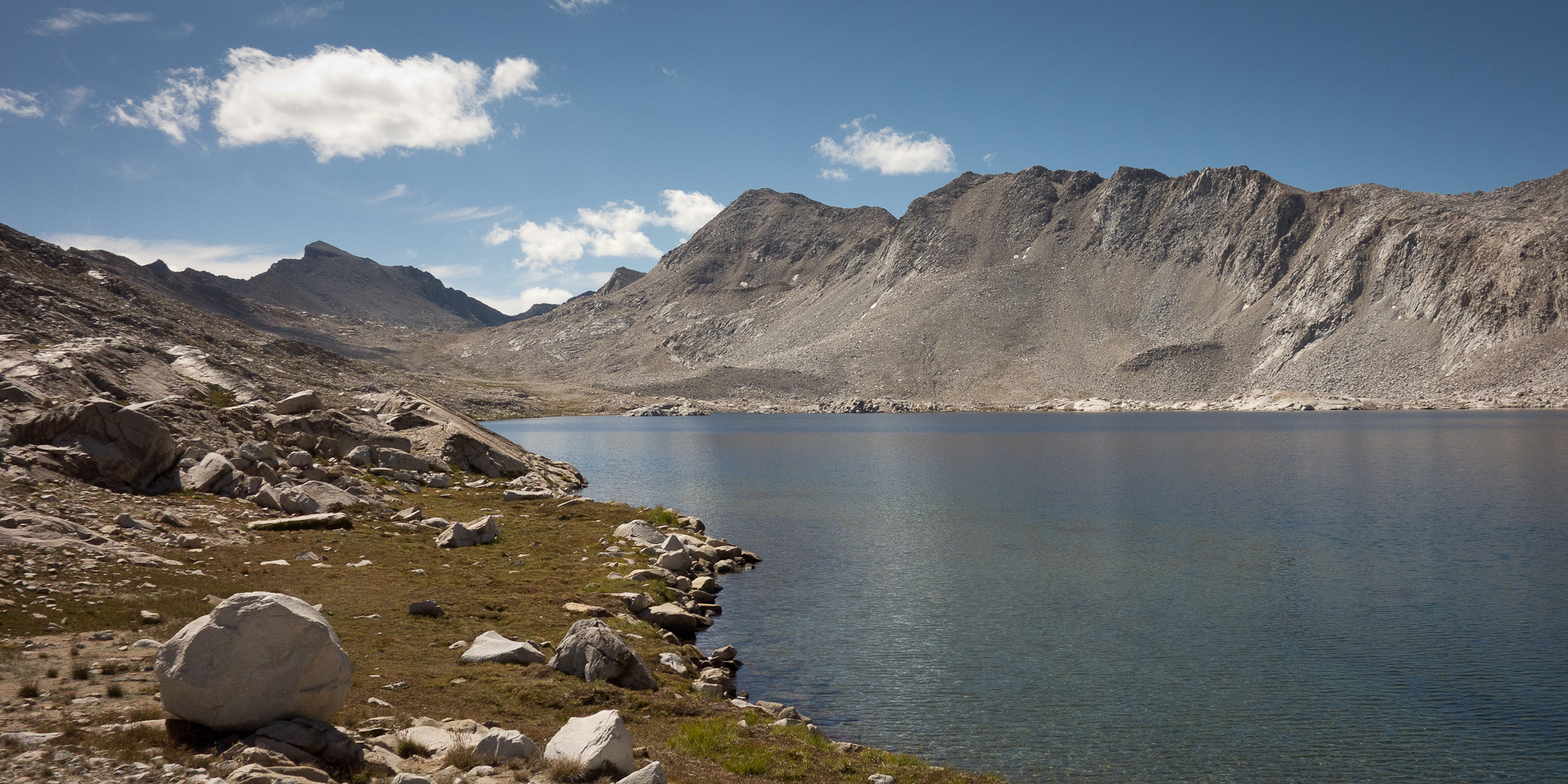
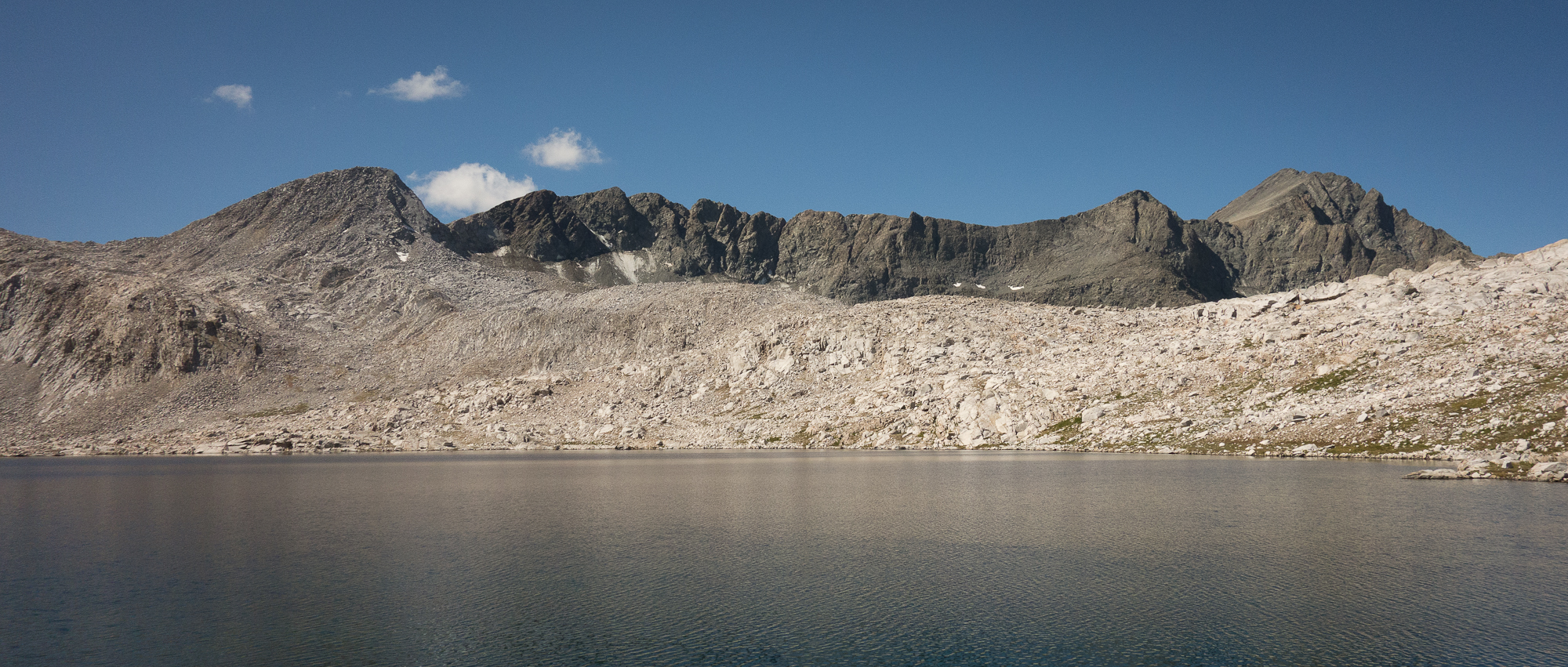
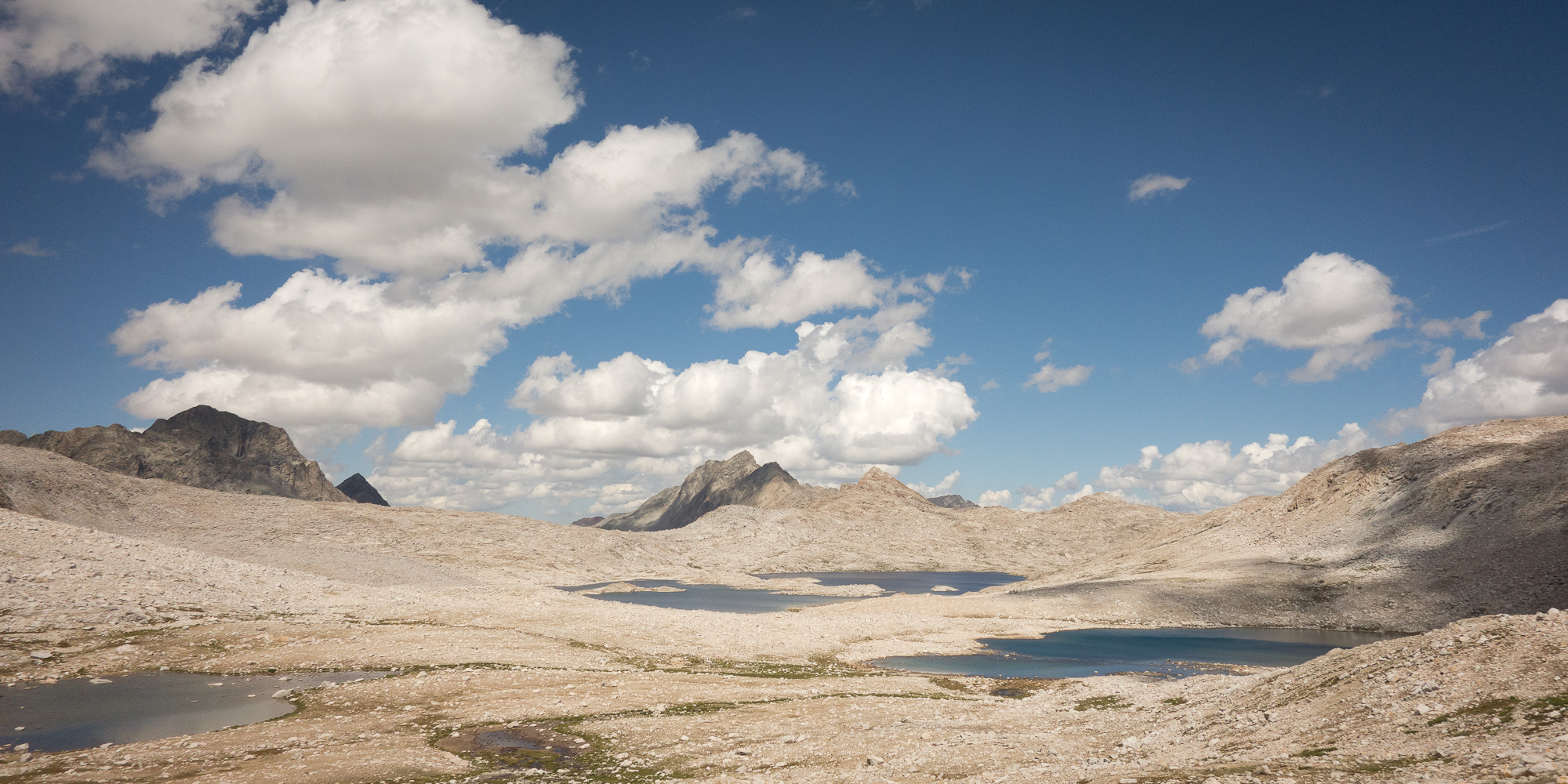
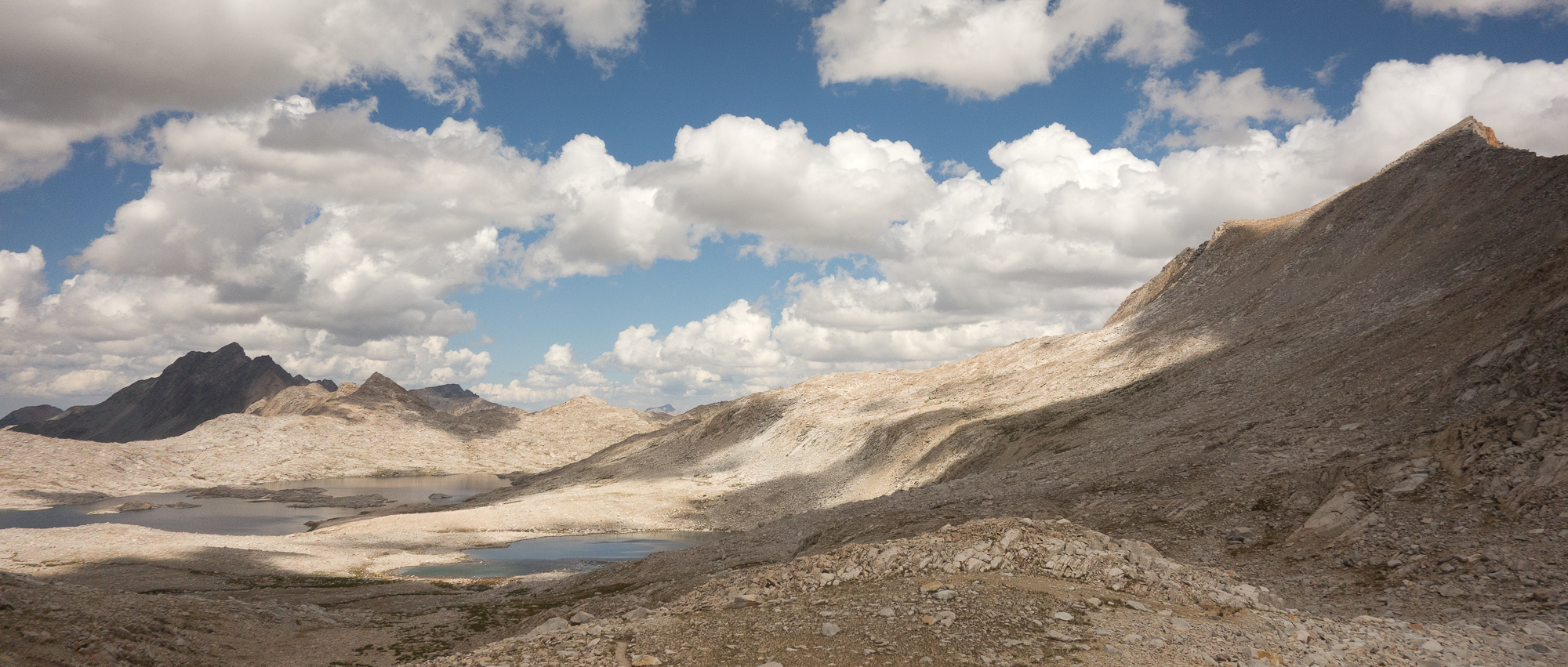
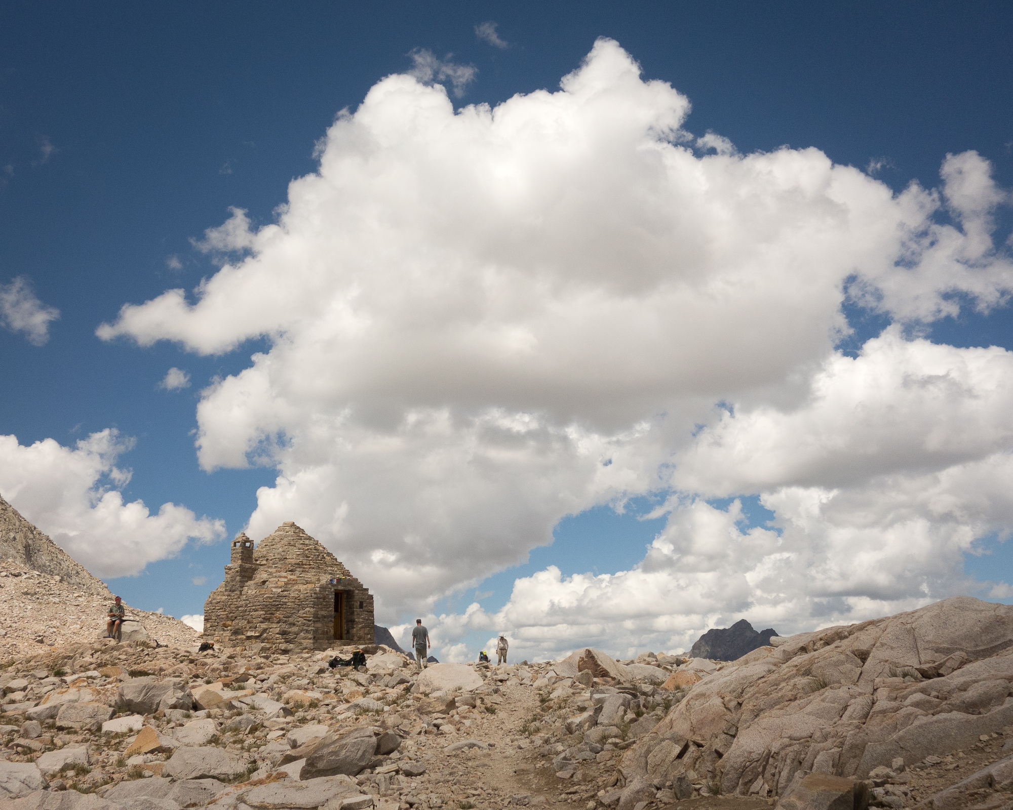
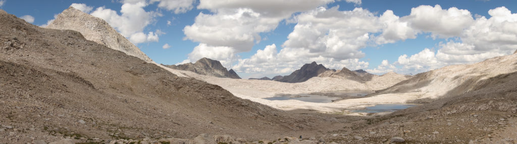
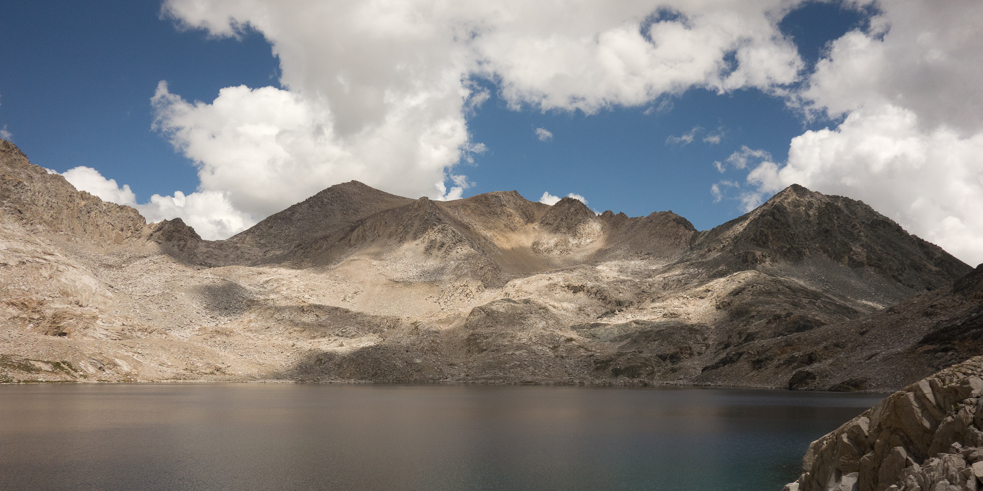
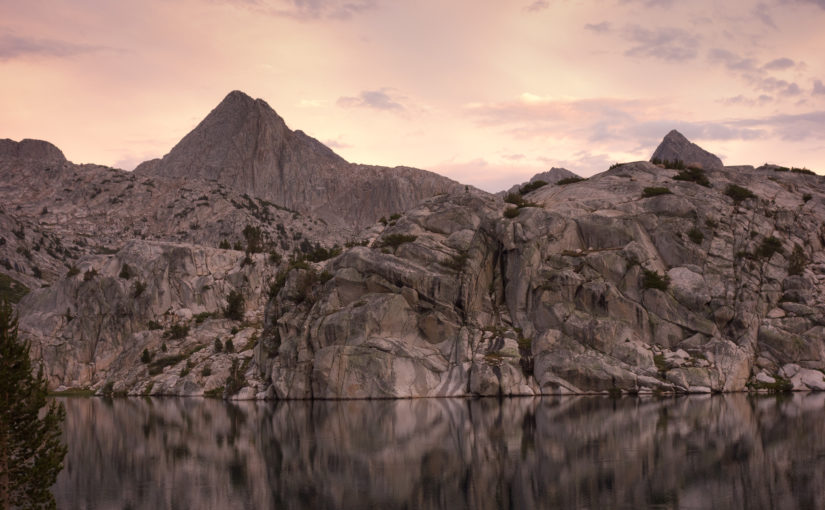
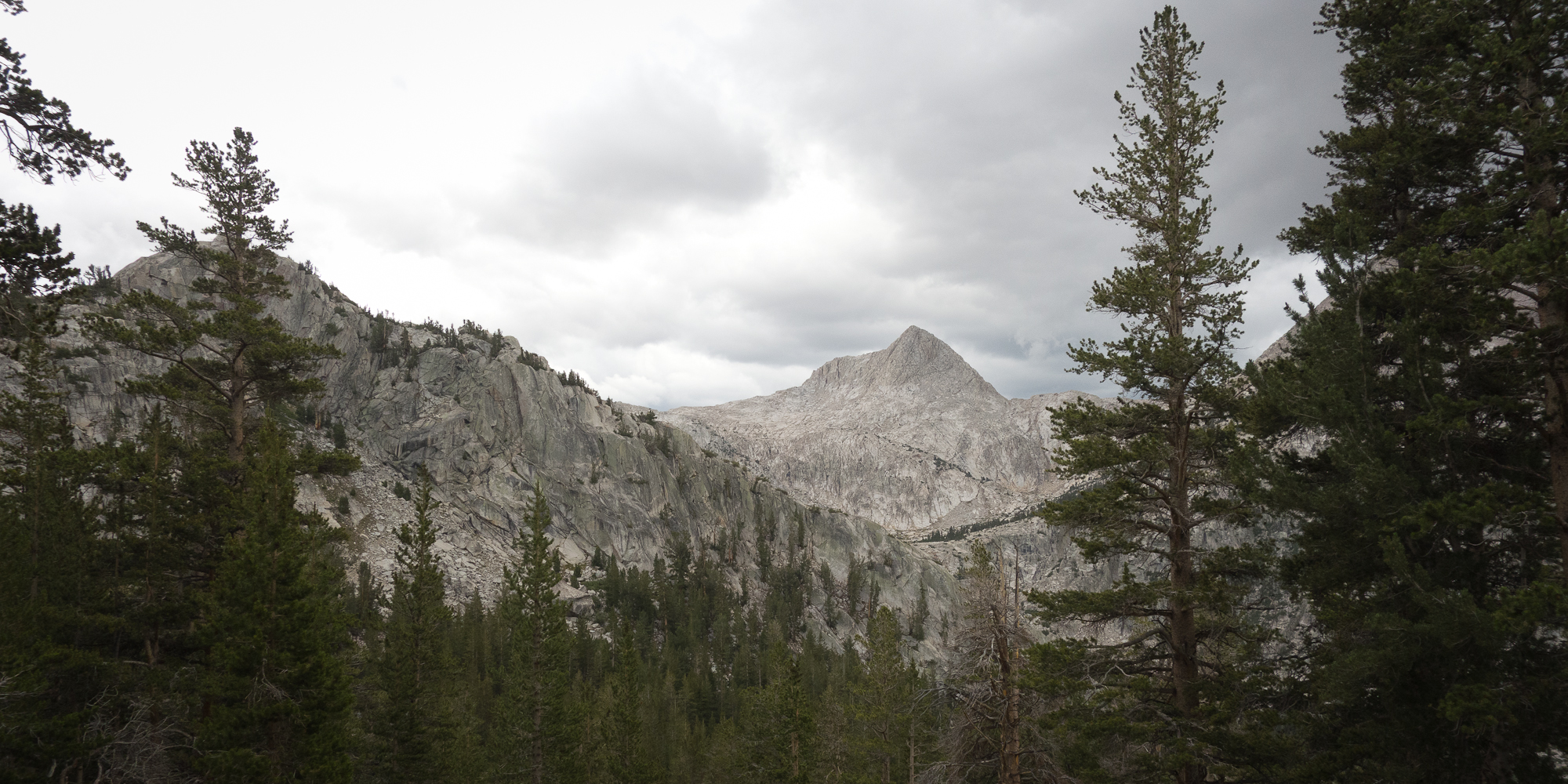
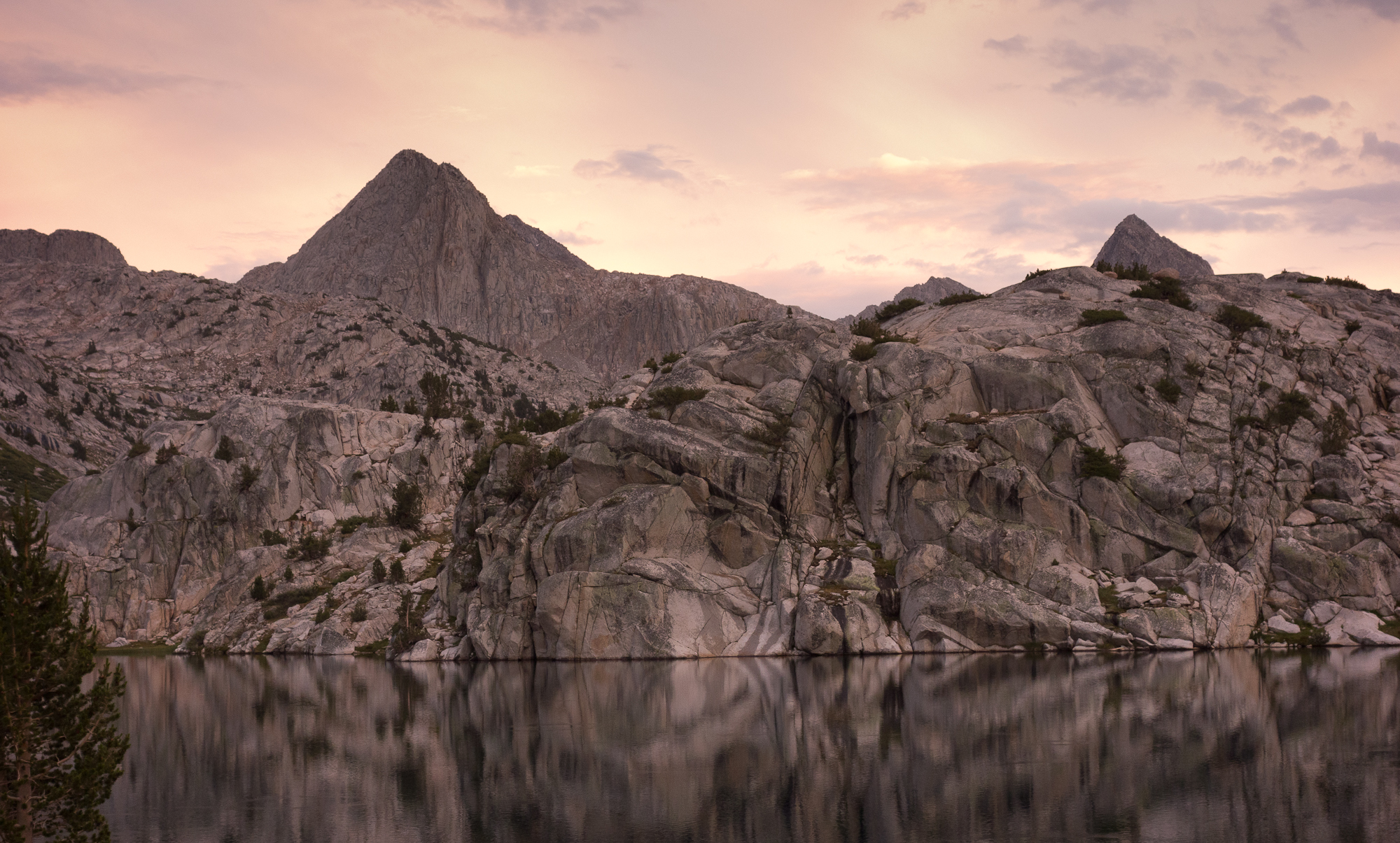
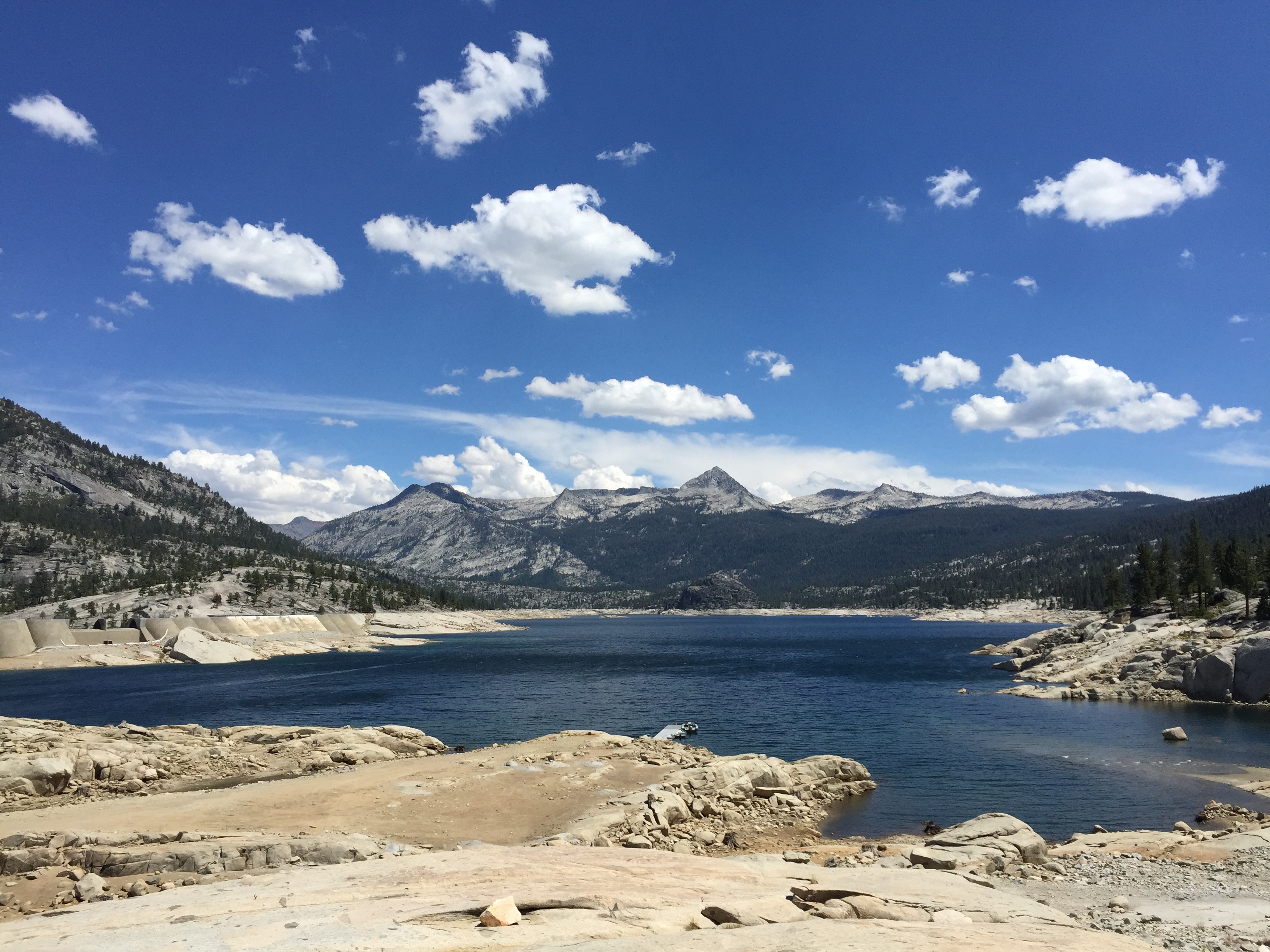
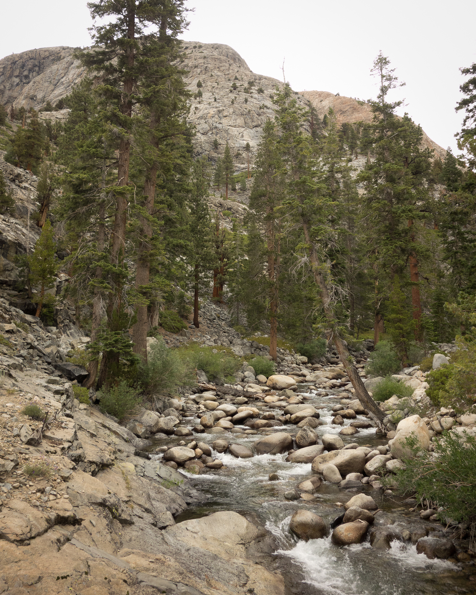
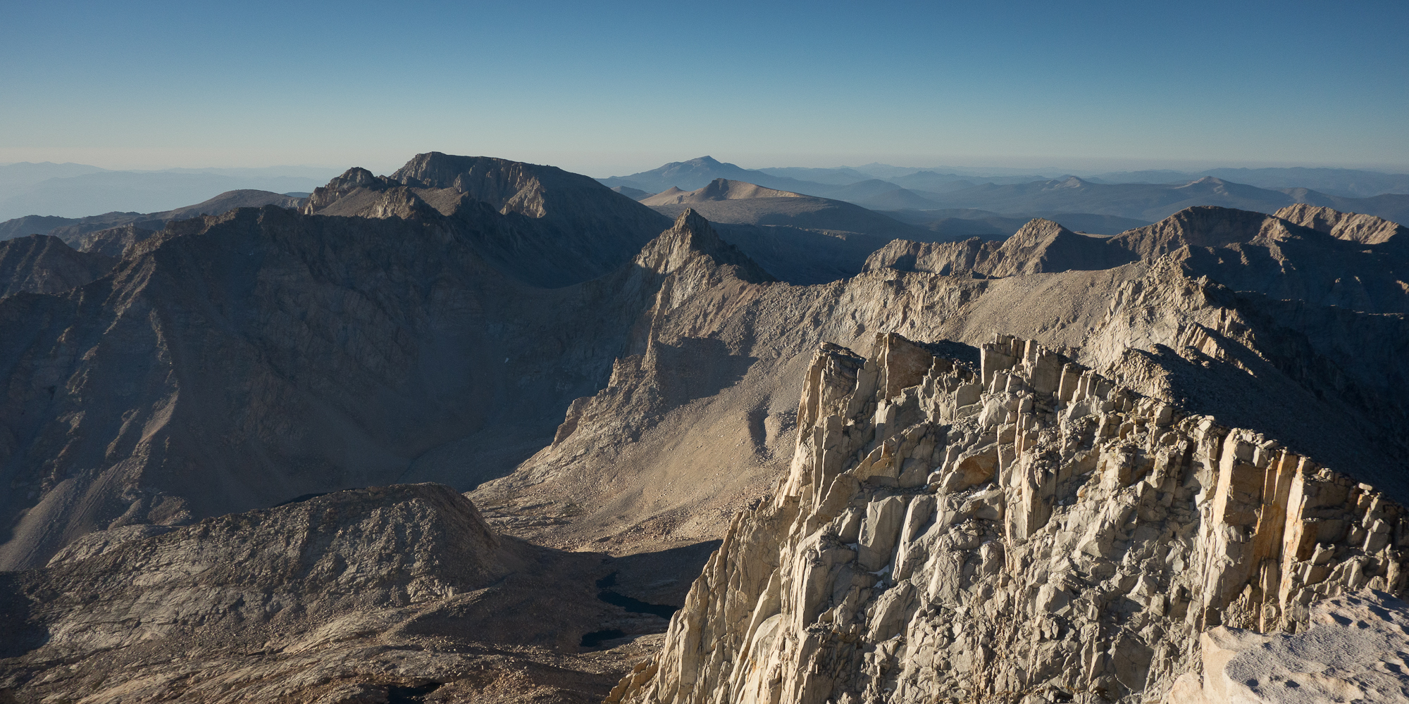
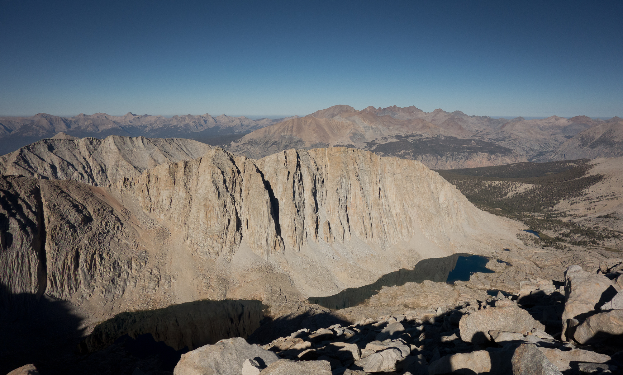
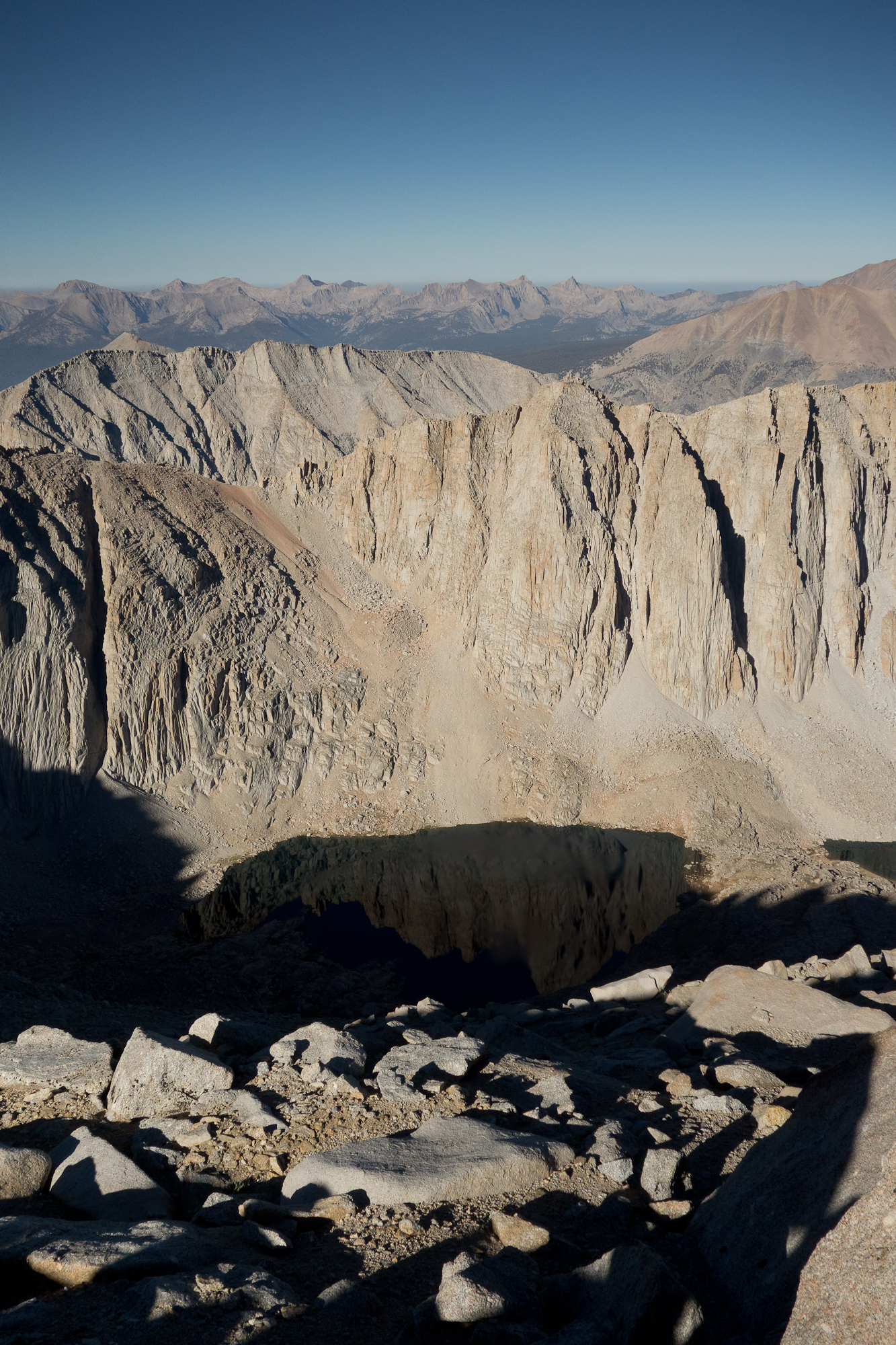
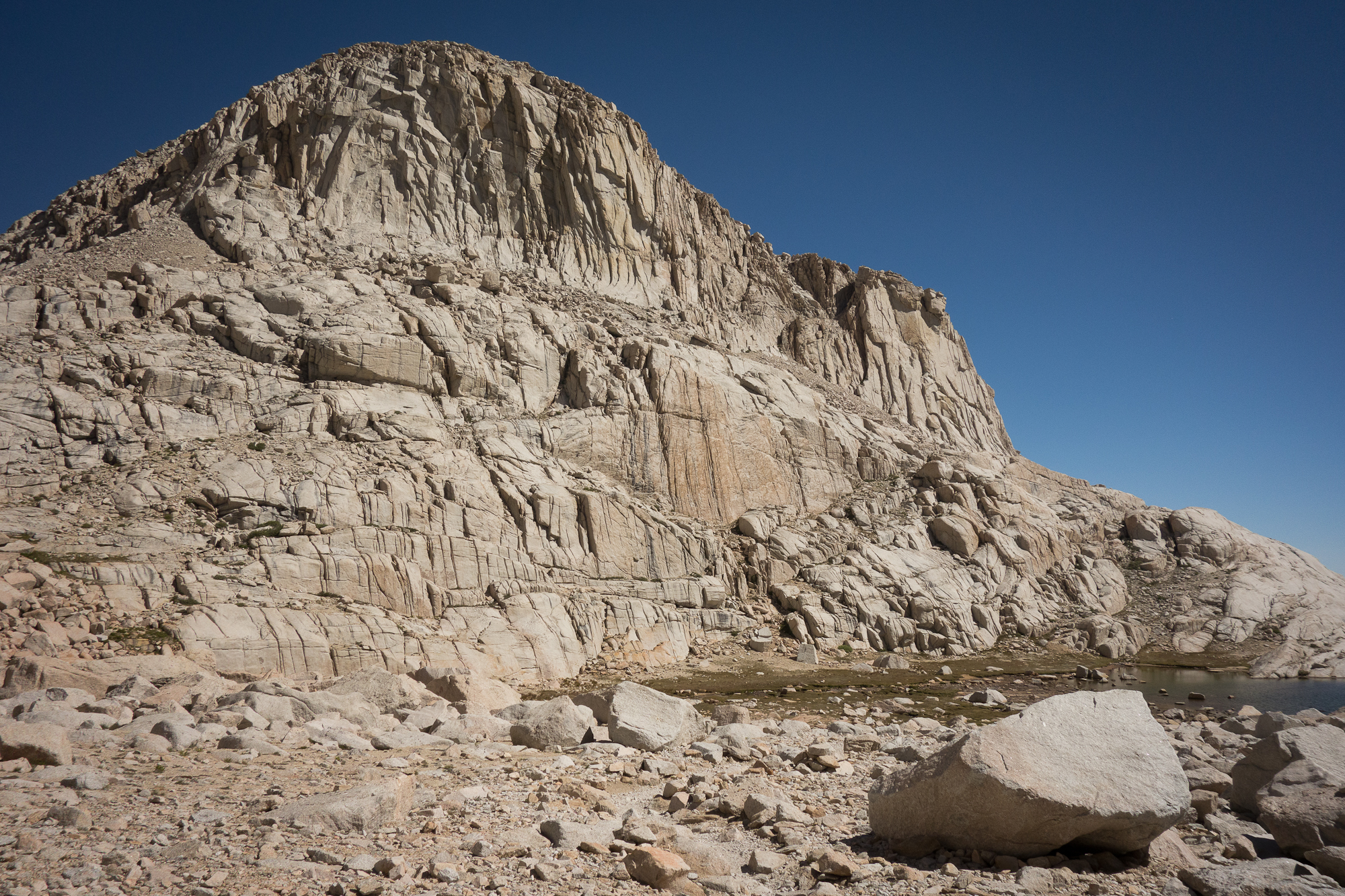
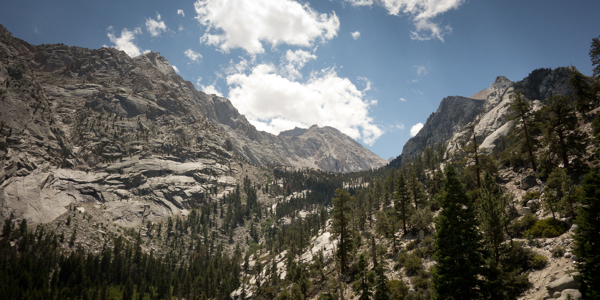
We didn’t stay on the summit that long. Looking back I’m bummed we didn’t hang out longer and take more photos but it was truly freezing cold and we knew we had about 11 miles more to do to get to Whitney Portal. In daylight we had a much clearer view of what we had just hiked up and it was kinda nutso!

The crest trail in daylight

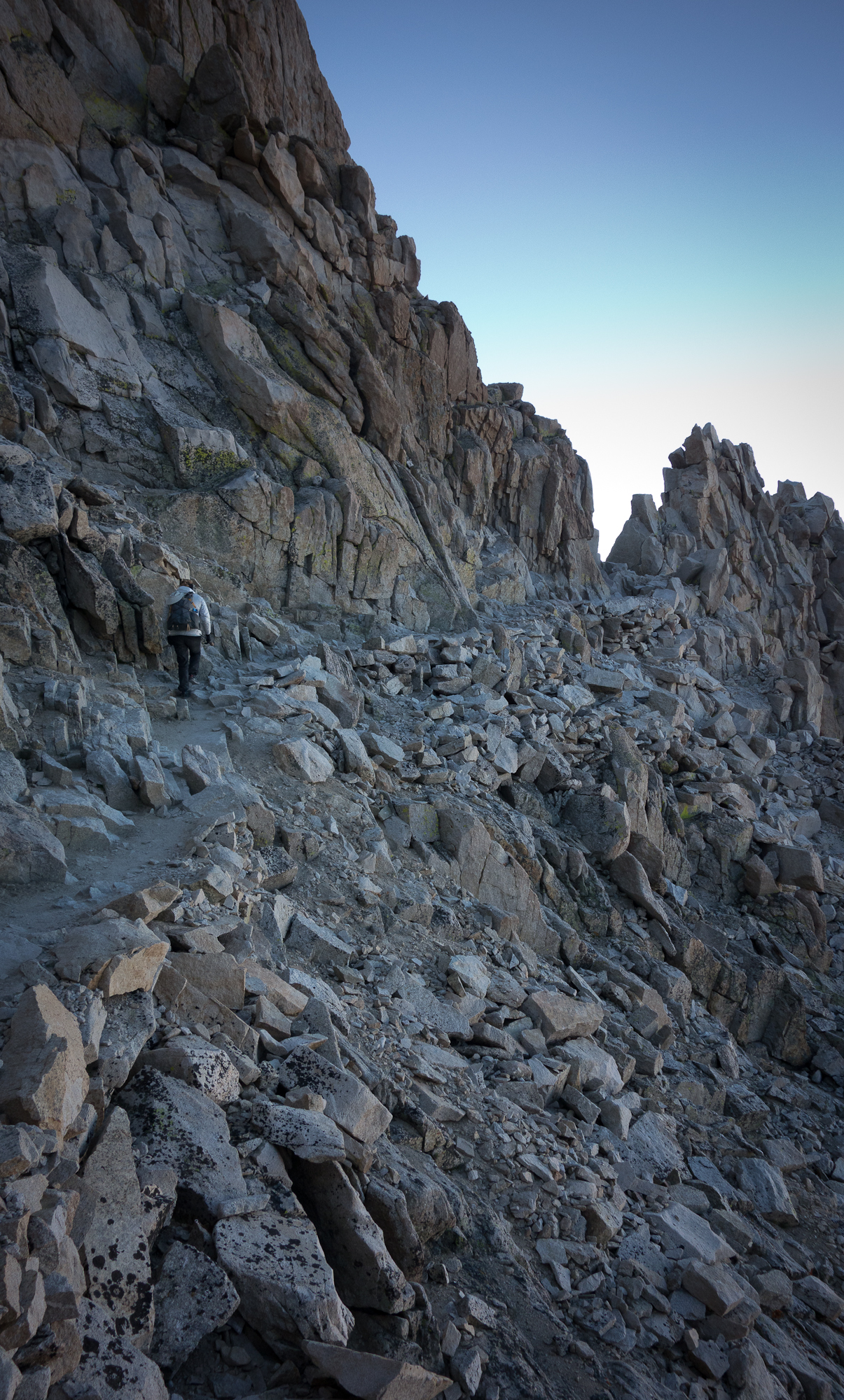
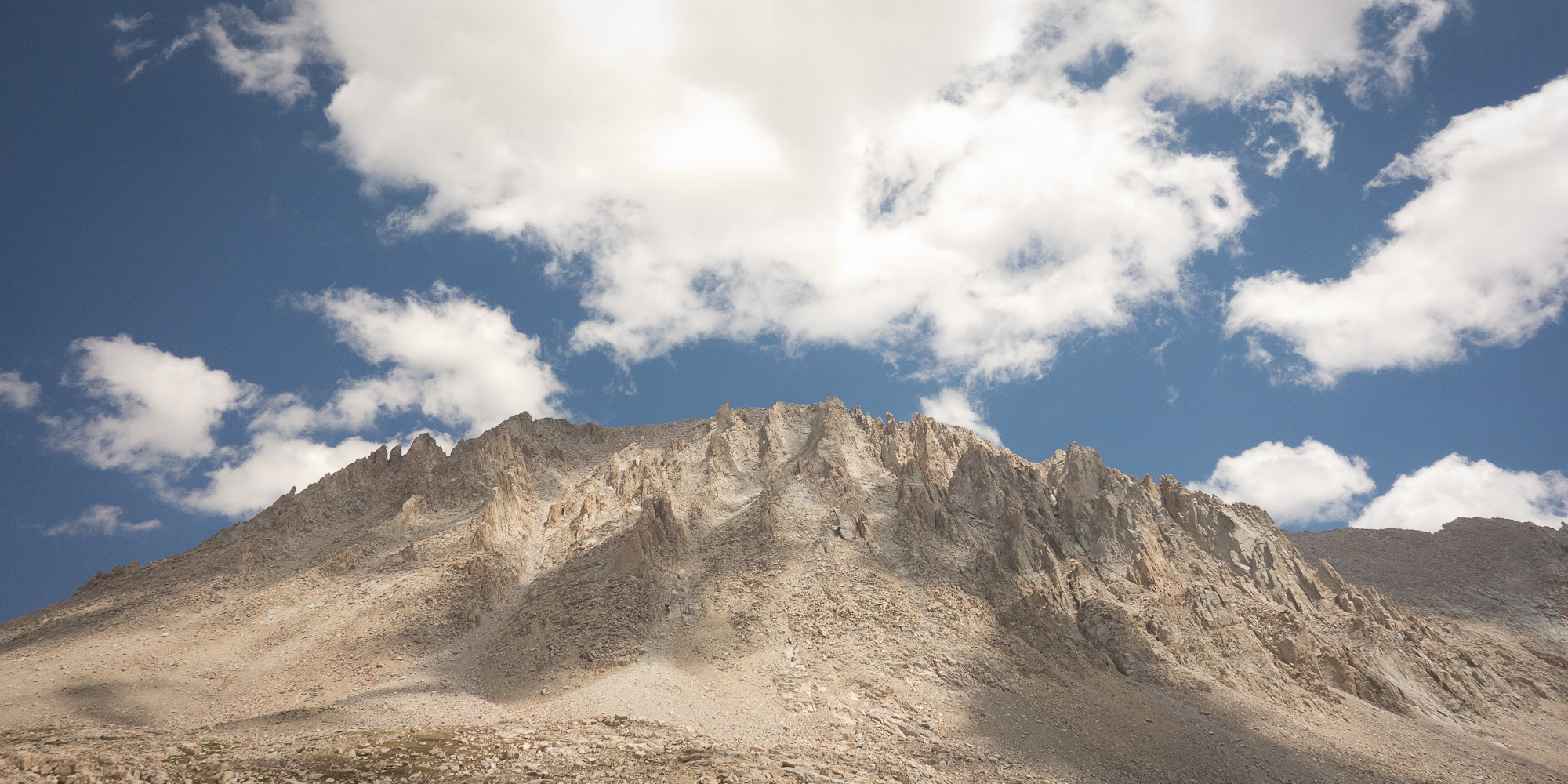
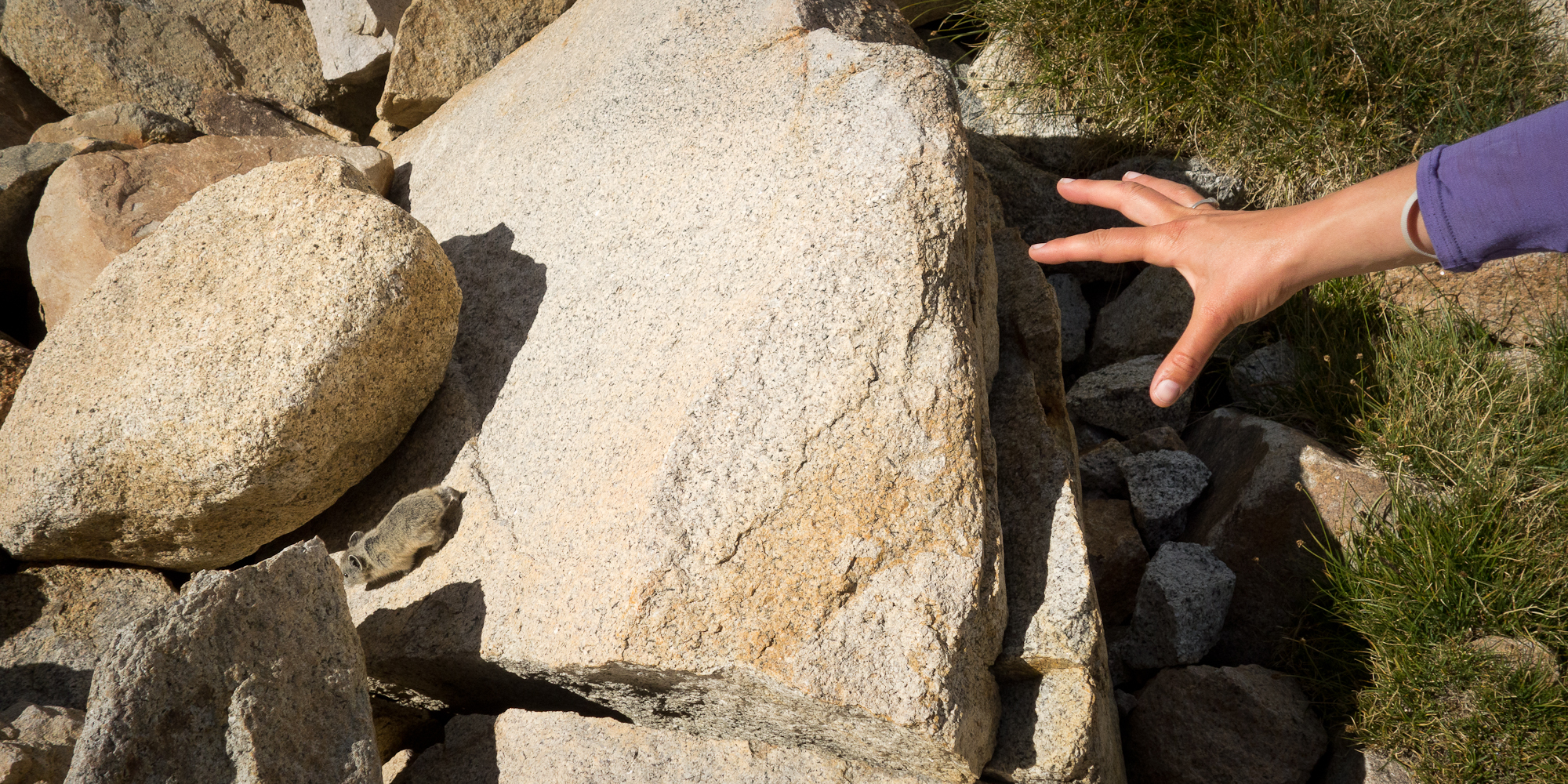
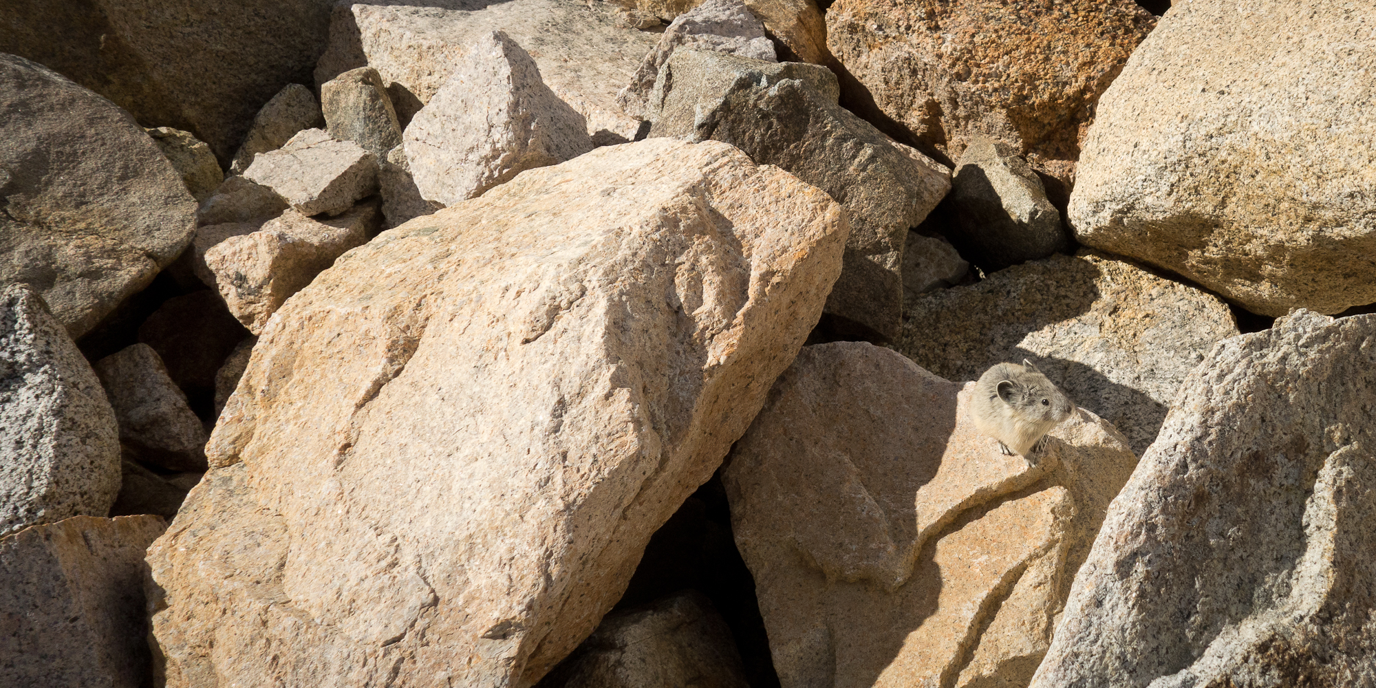
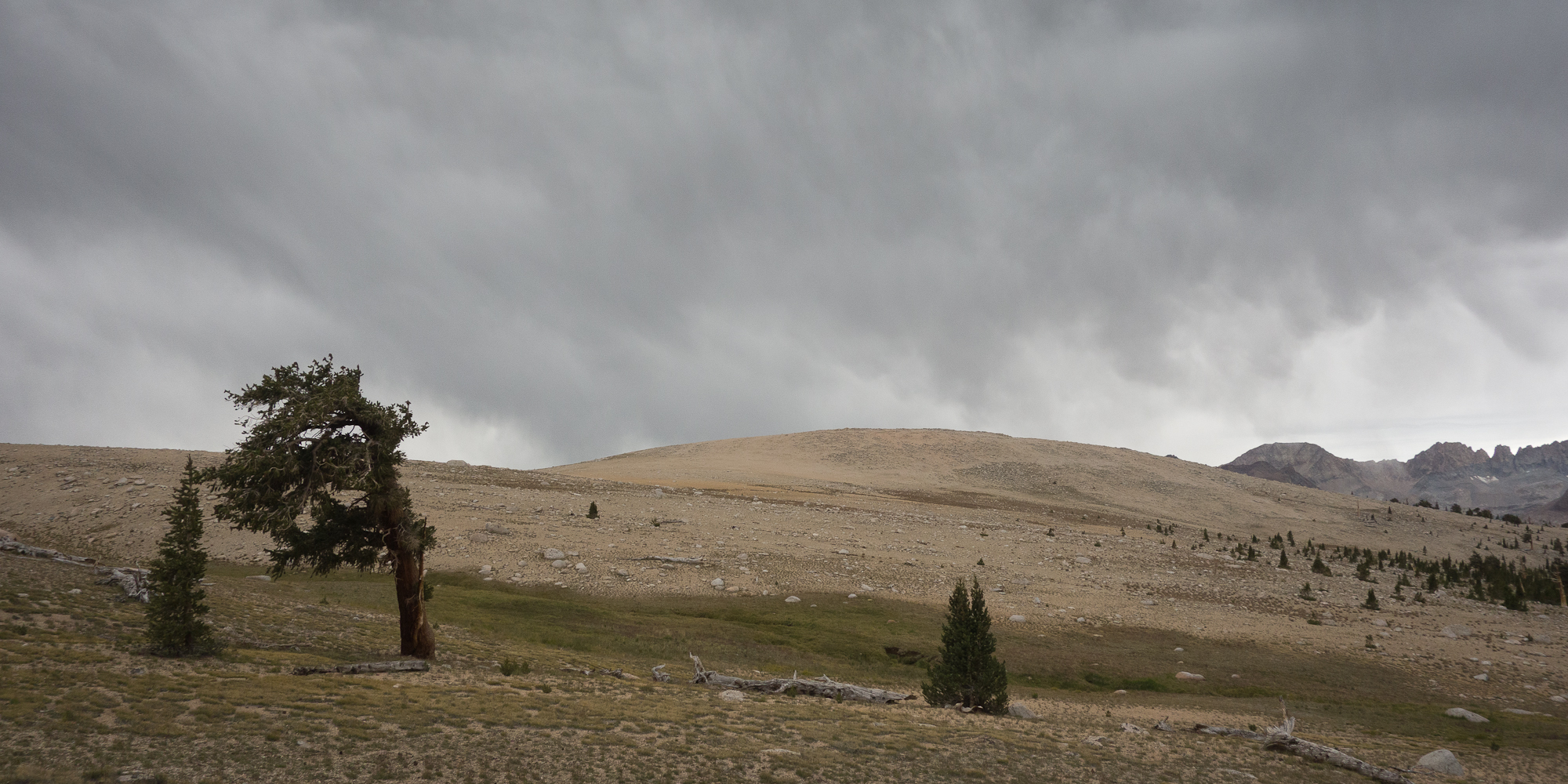
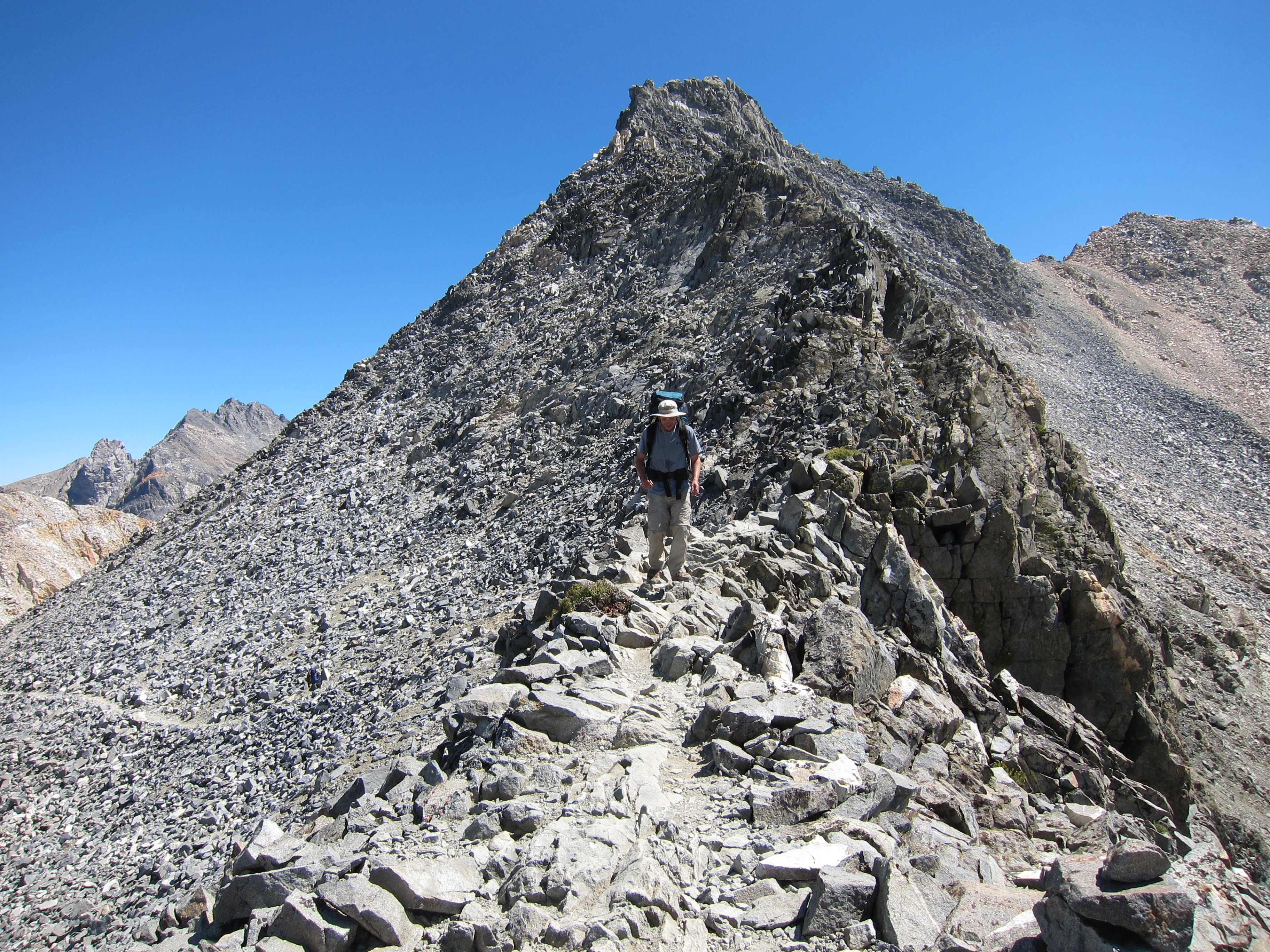
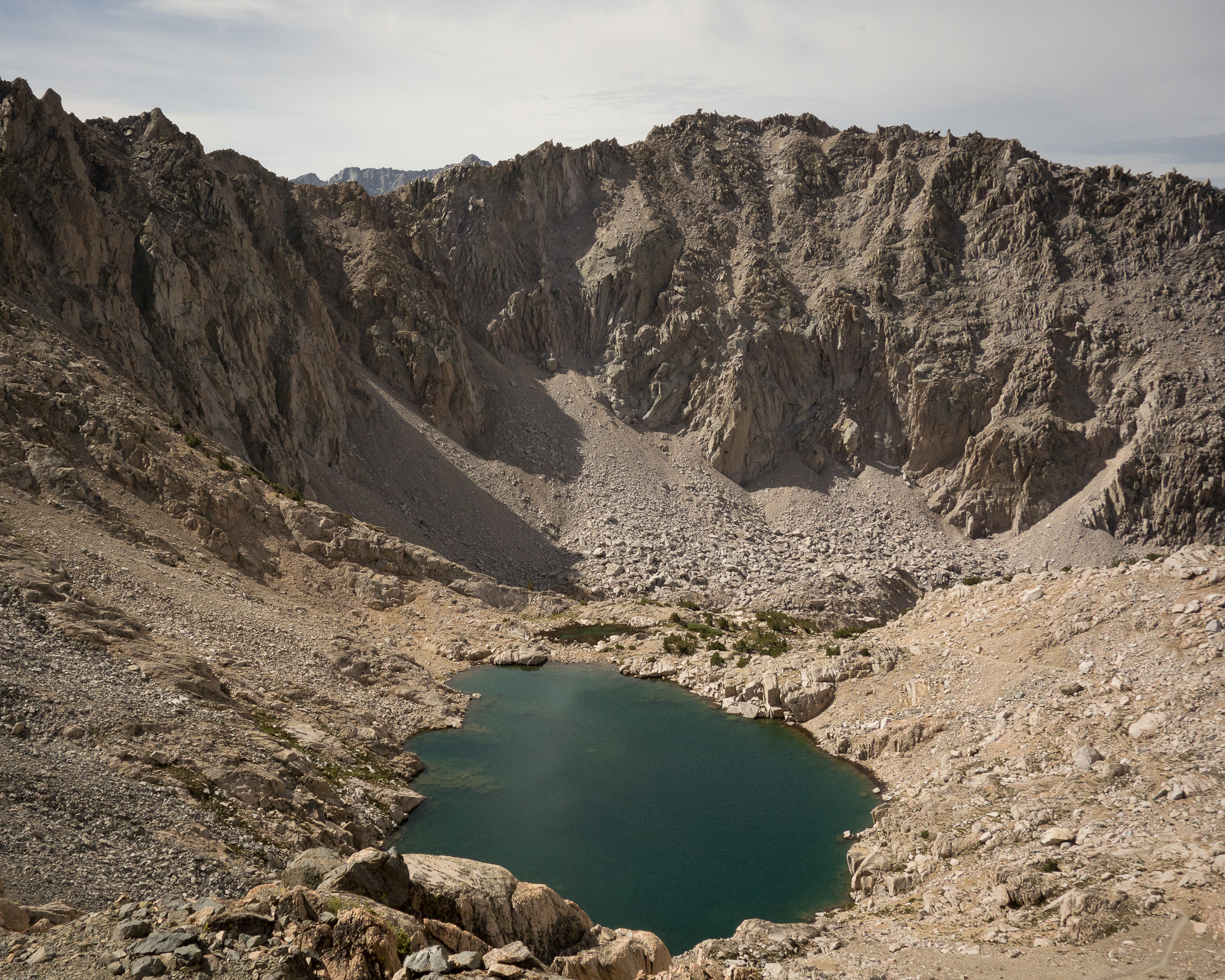
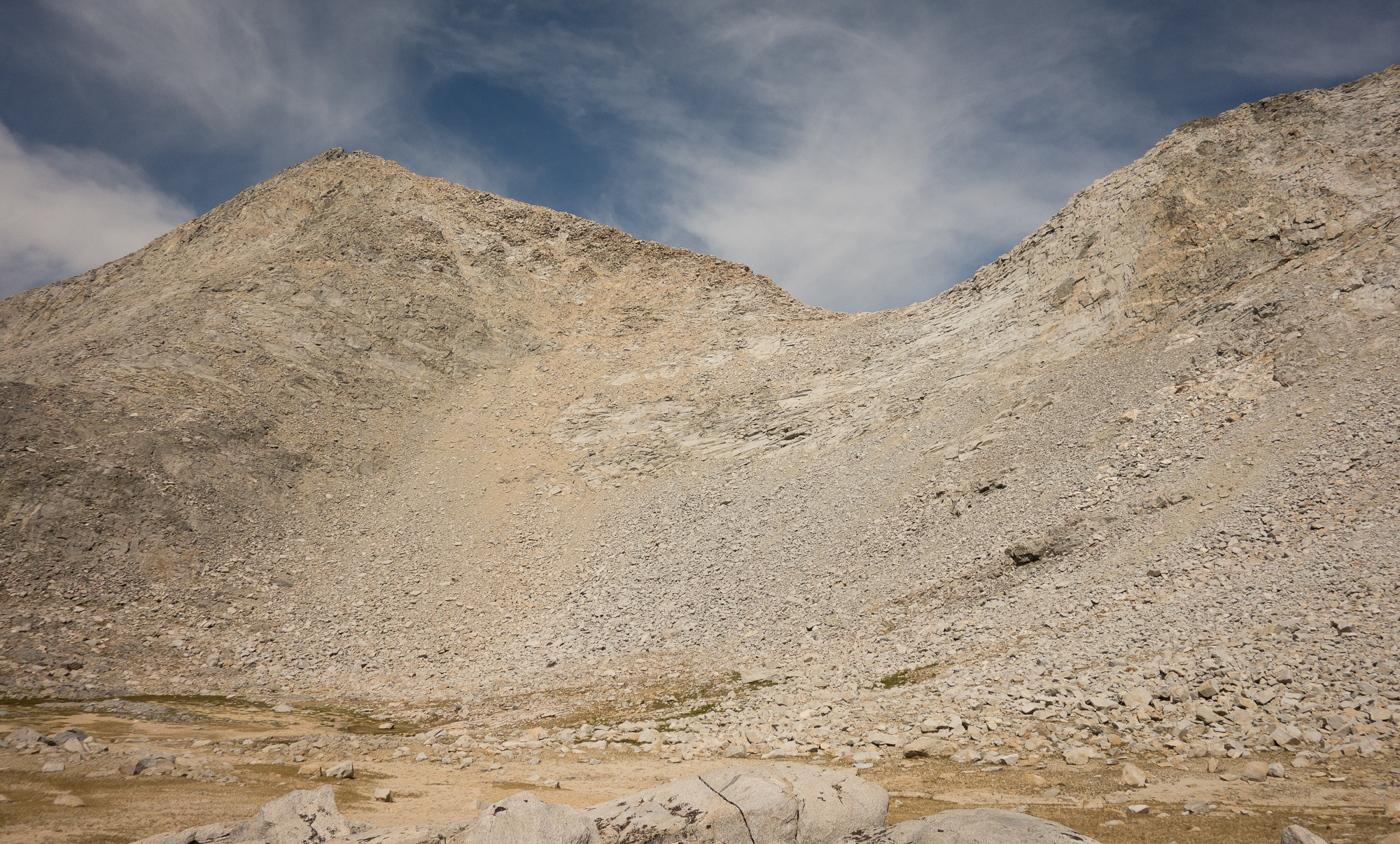
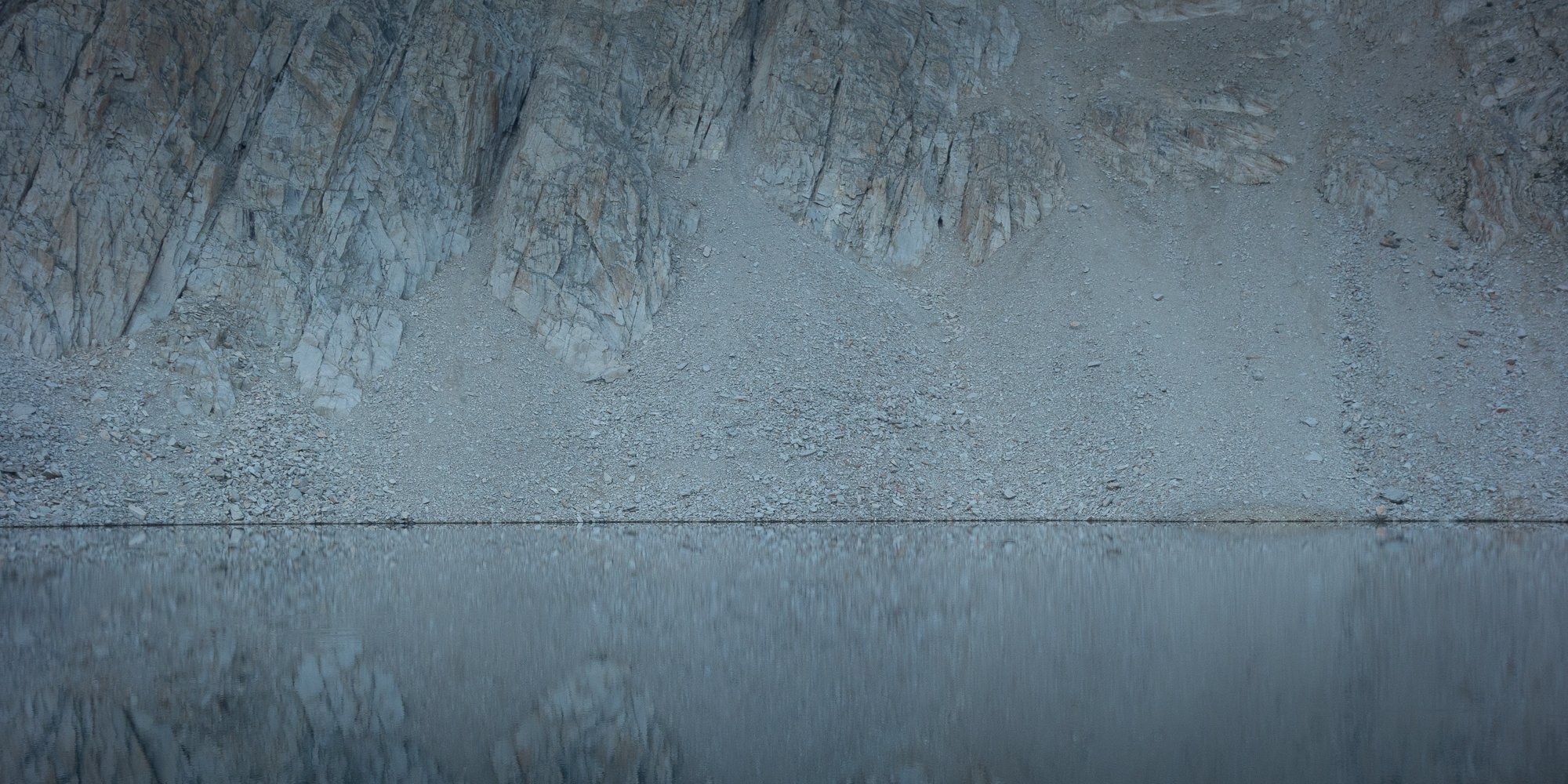
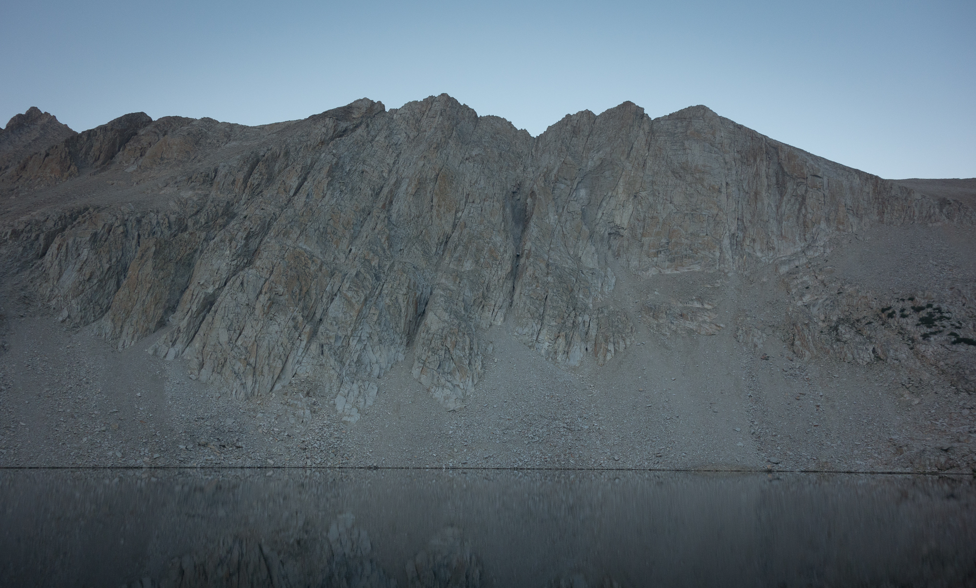
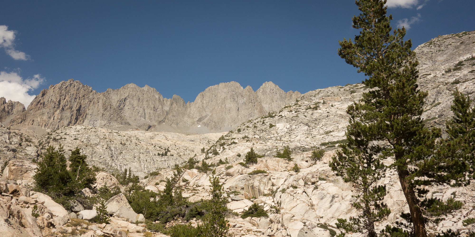
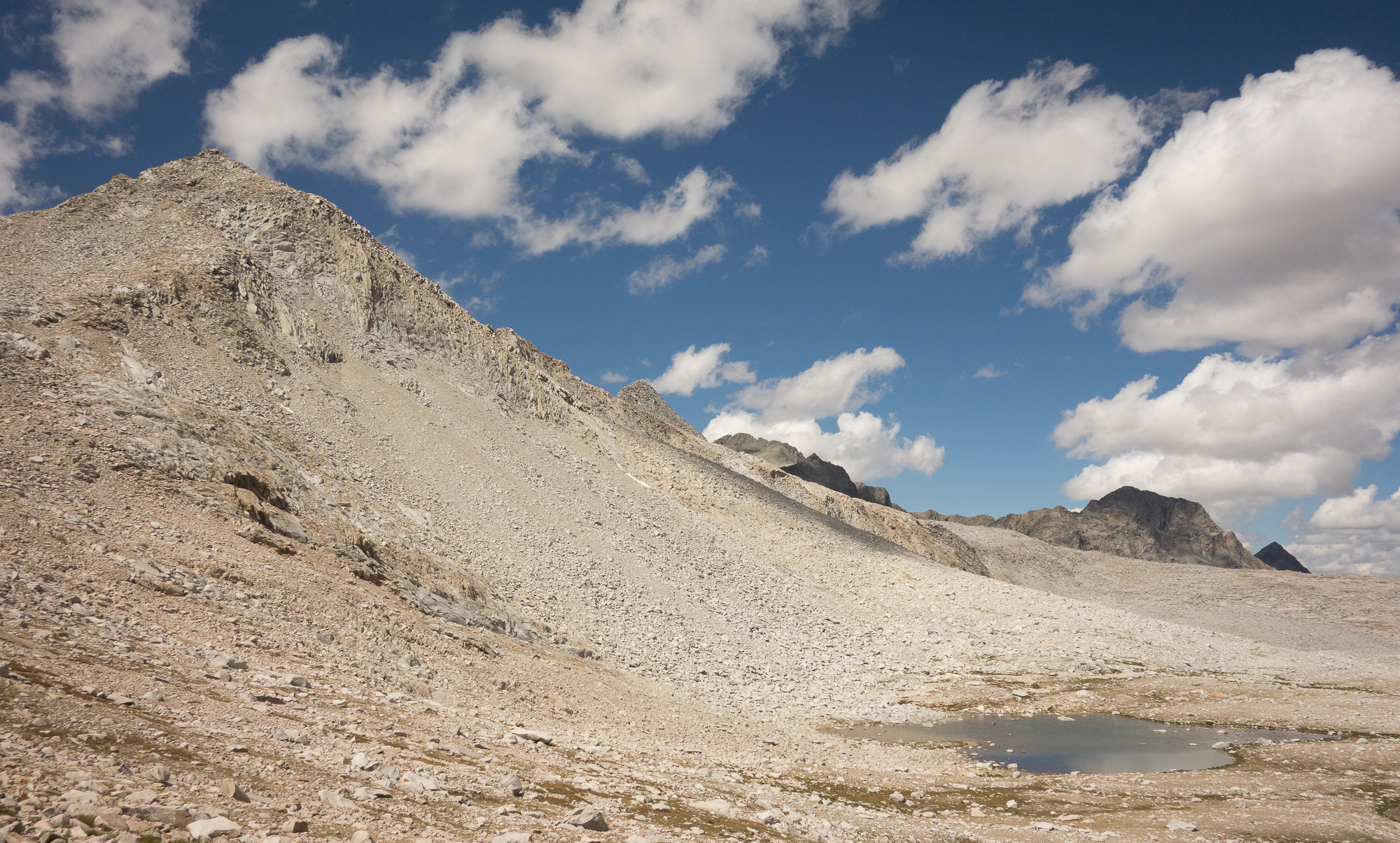
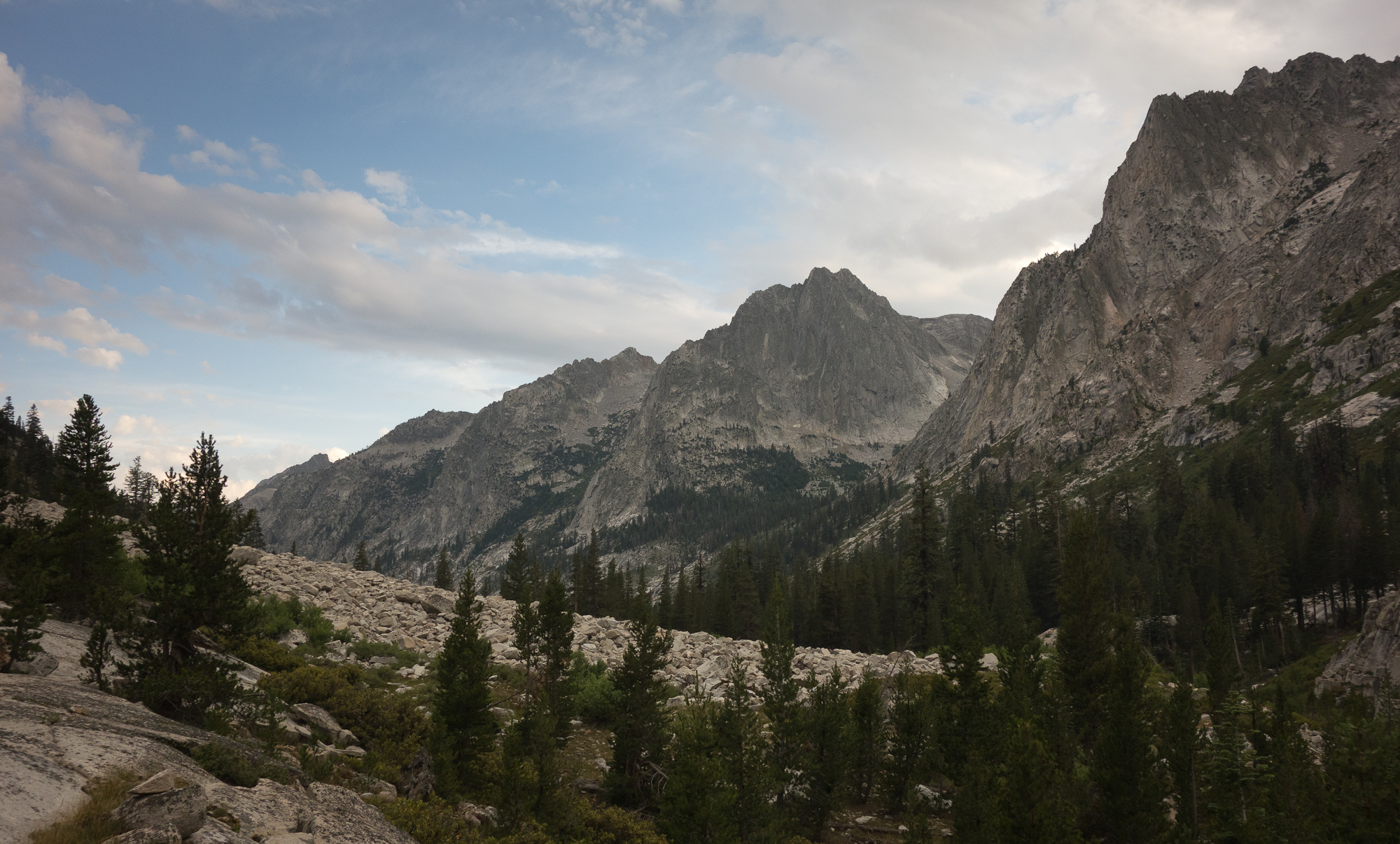
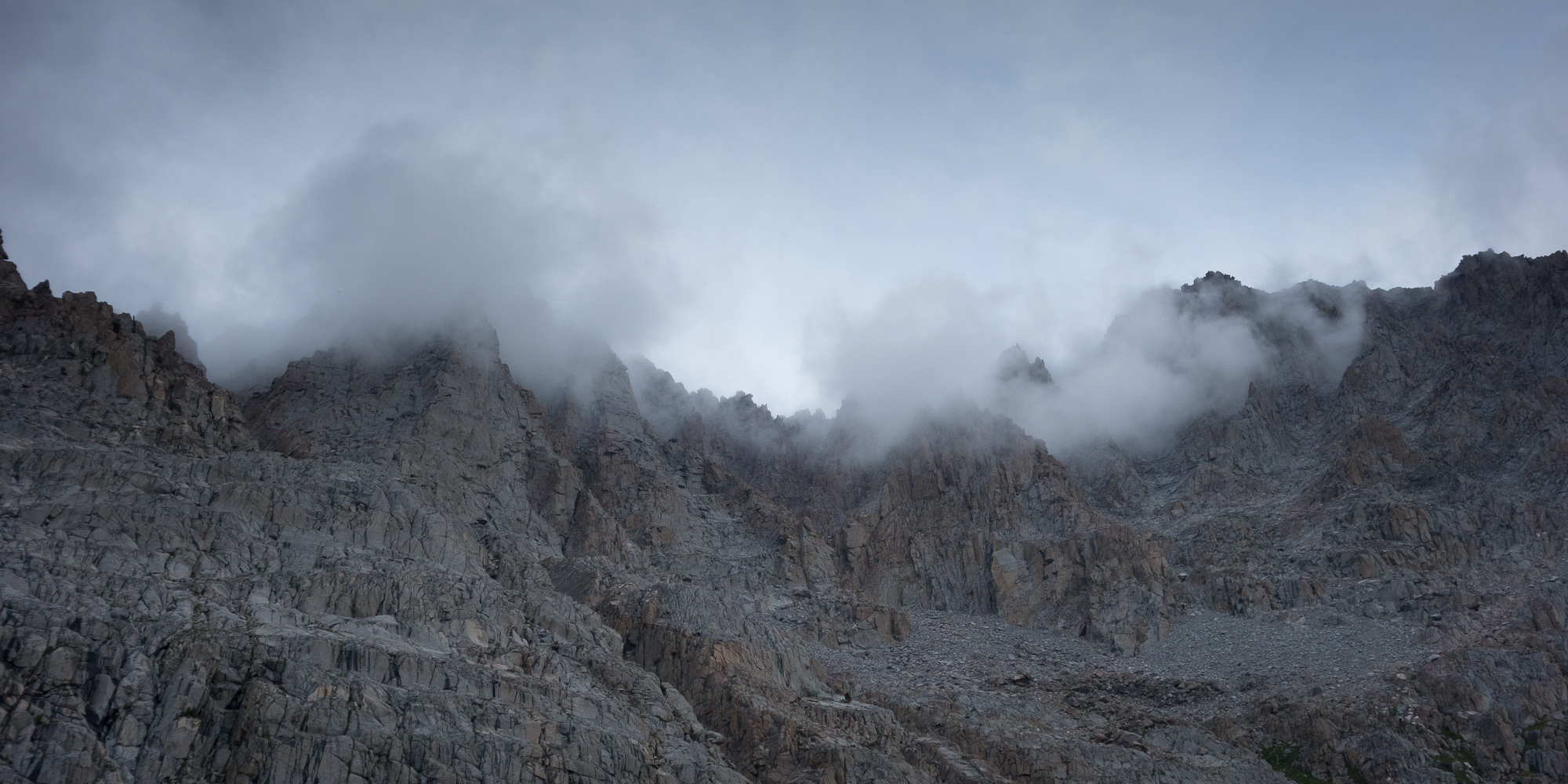
Crest trail skims between these parapets rock formations. Every now and then you get glimpse to the eastern side. I noticed another pair of hikers pausing to the side as one vomited. Altitude sickness is a real thing up here. Thankfully after sleeping above 10,000′ feet we were acclimated. I did get a headache as we started down the other side but soon realized that it was just my coffee addiction acting up.

Pausing on crest trail to look out over the amazing view
Mt. Whitney Crest Trail
Hikers helping each other over the bigger steps.
Mt. Whitney Crest Trail
Mt. Whitney Crest Trail.
Mt. Hitchcock
Mt. Hitchcock.
Looking west off Mt. Whitney
Looking west off Mt. Whitney.
2015_08_08-026
Headed east and down! Wonton’s Throne and Consultation Lake.
Looking back on the summit of Mt. Whitney from the eastern side
Looking back on the summit of Mt. Whitney from the eastern side.
Mt. Whitney
Mt. Whitney. The highest peak is the one furthest to the right. Just an optical illusion.

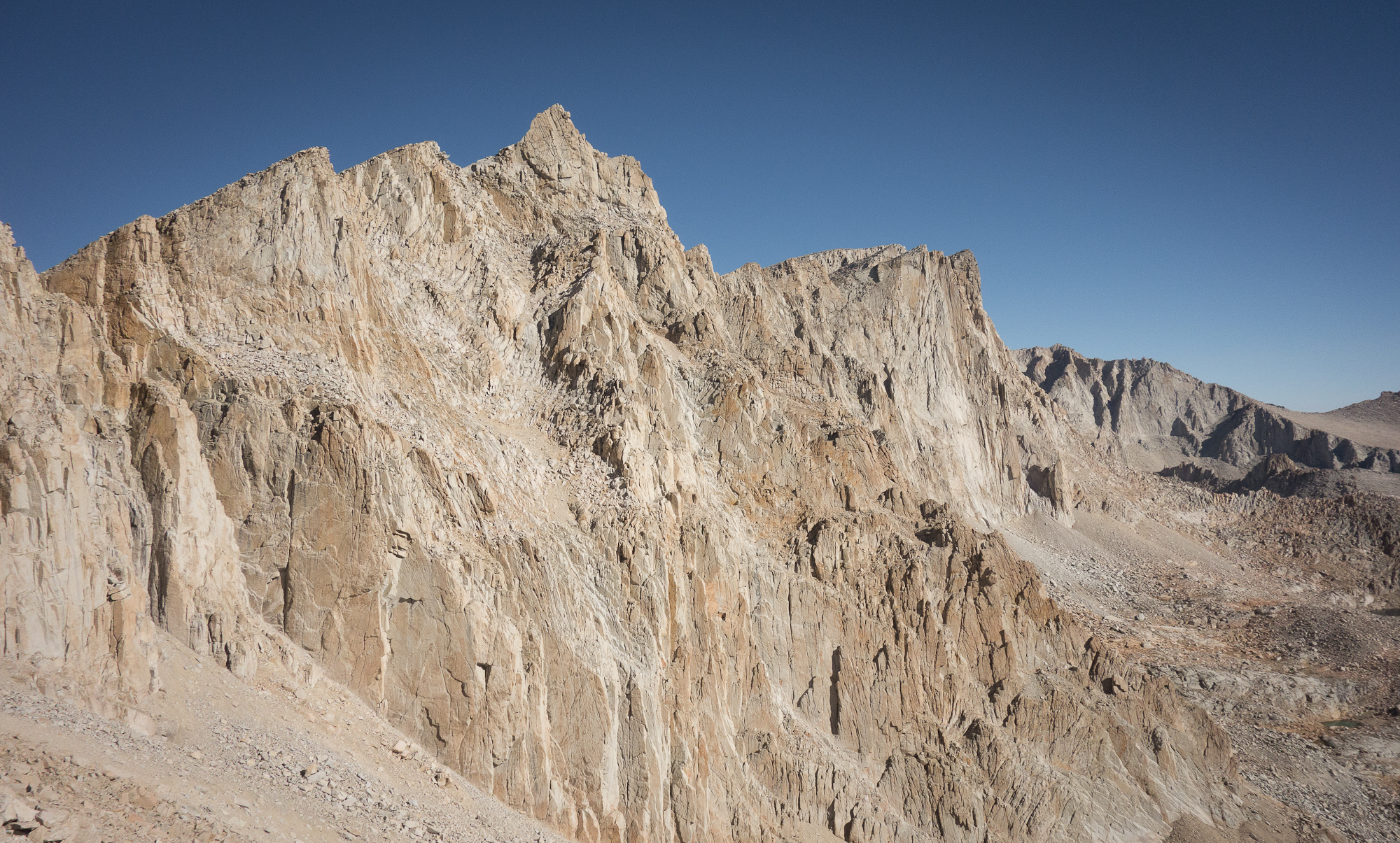
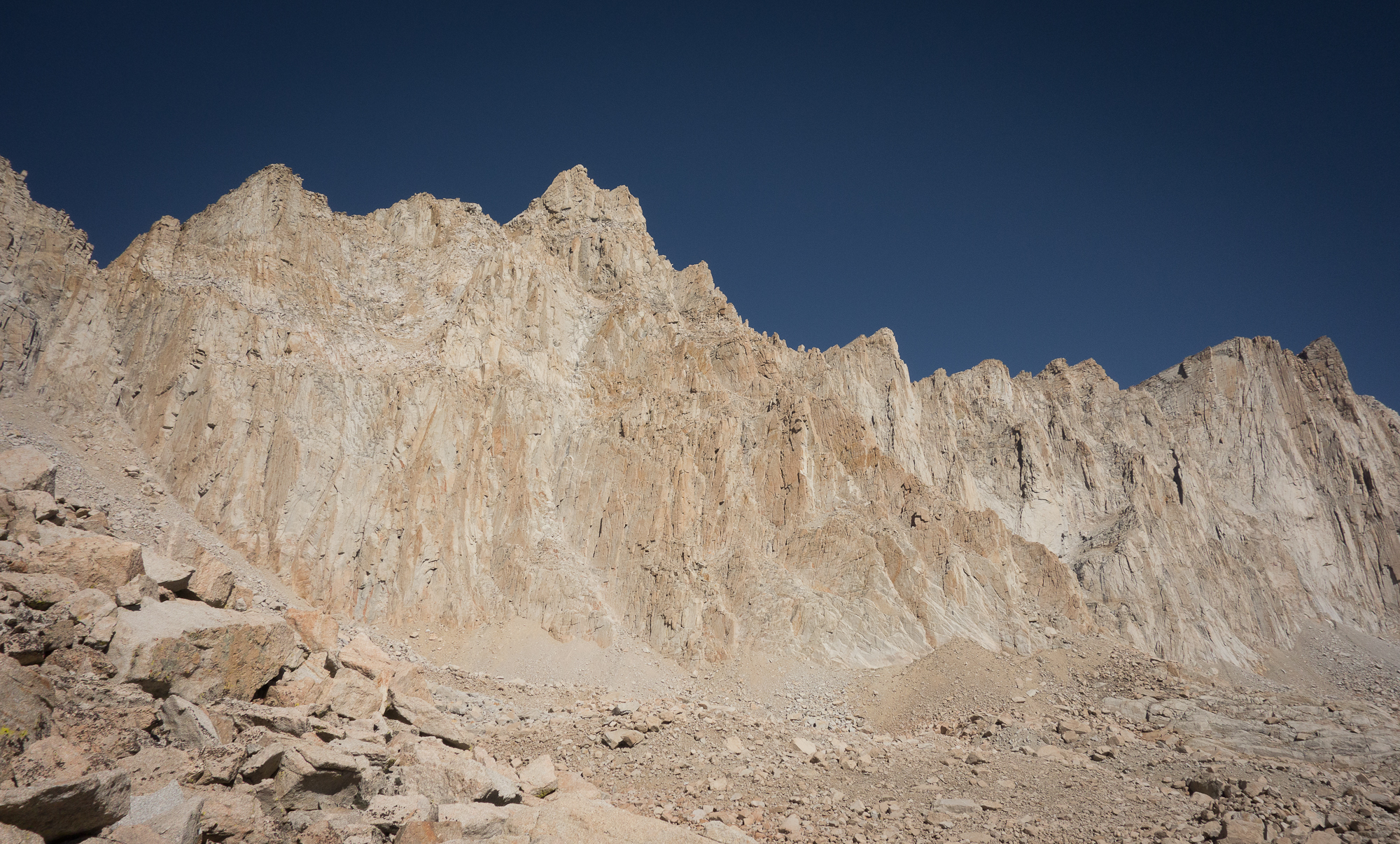
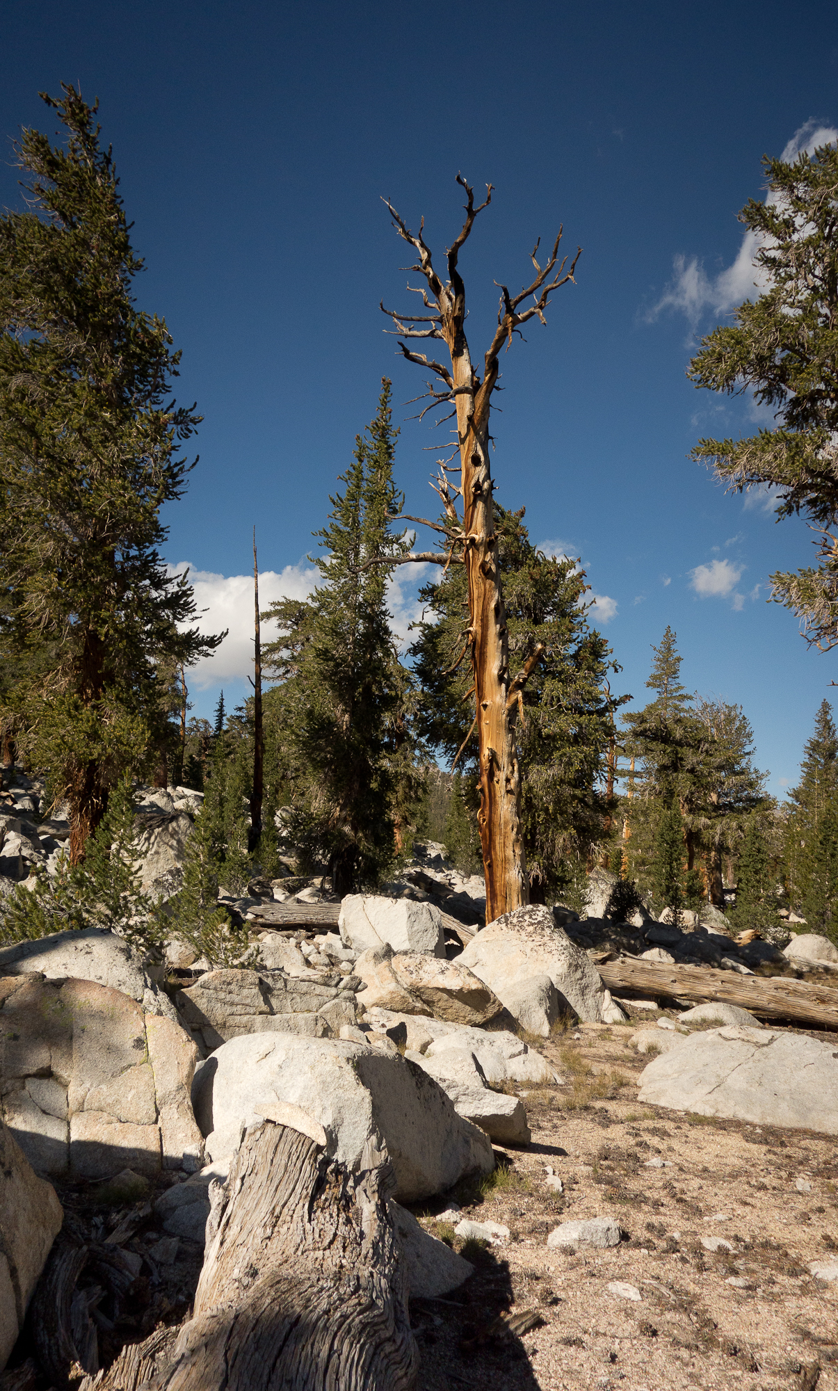
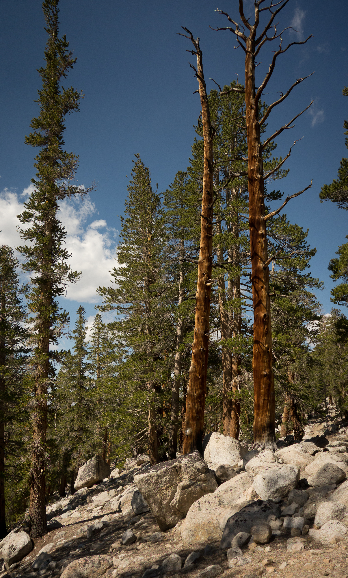
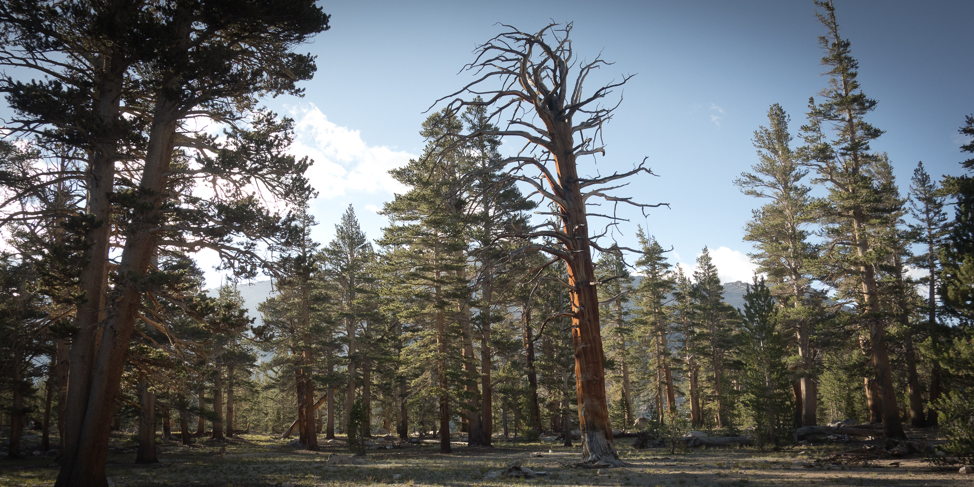
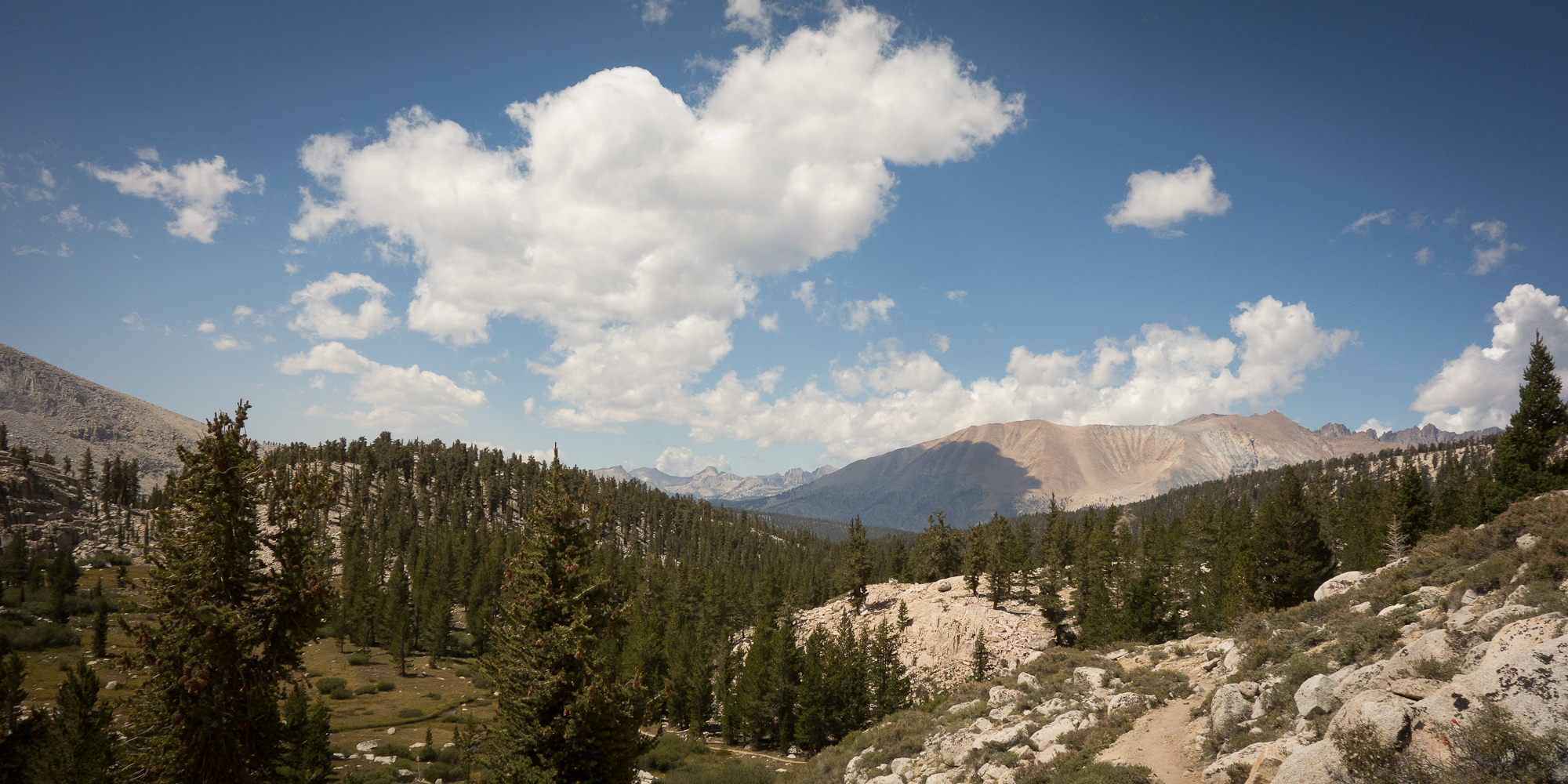
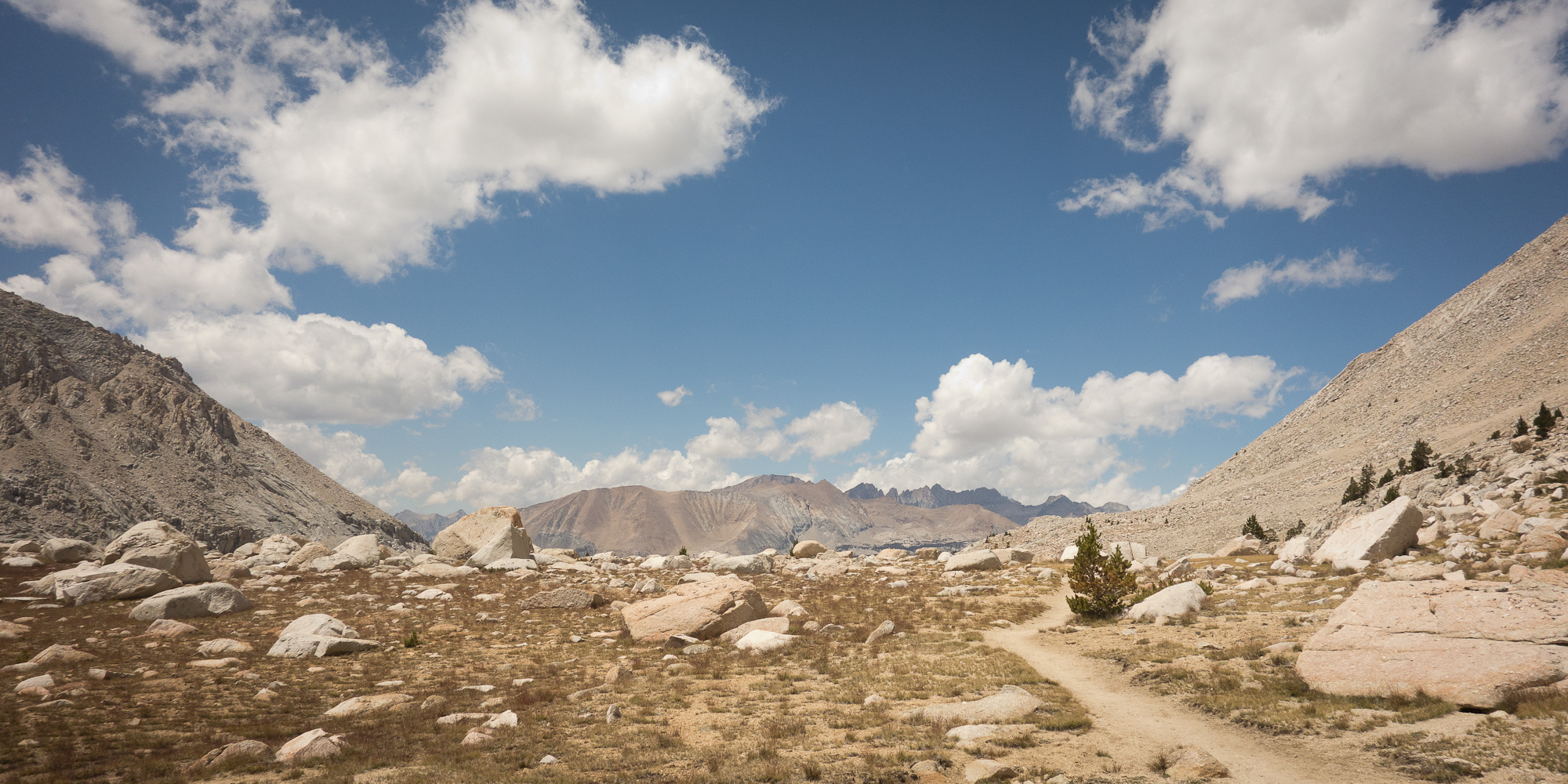
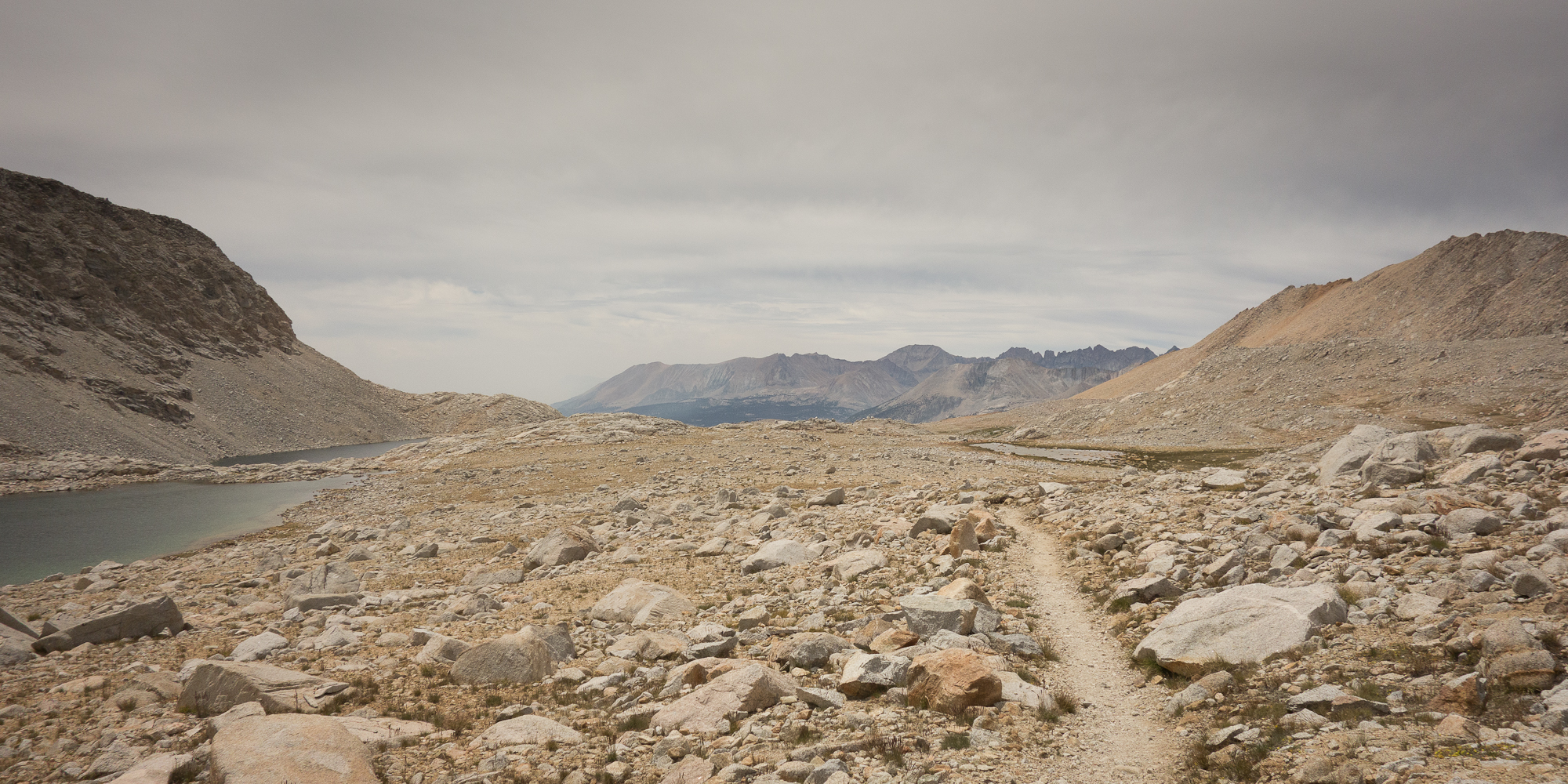
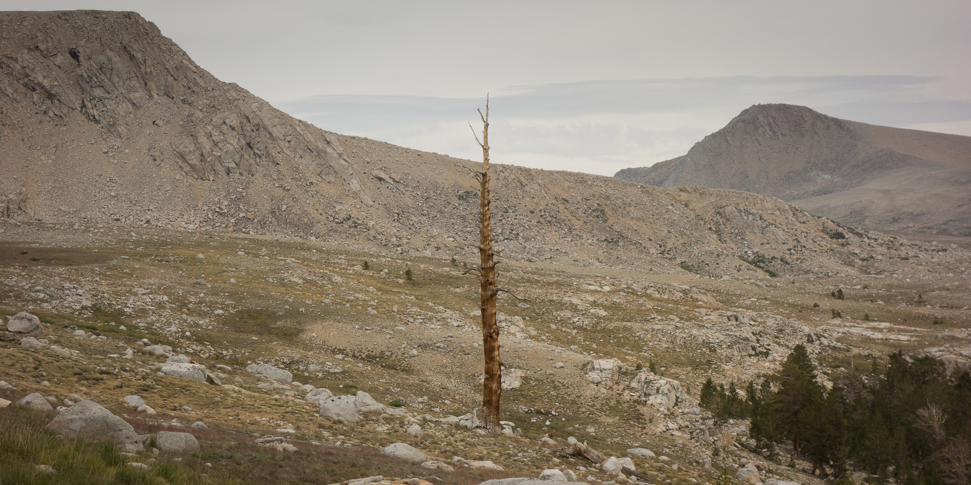
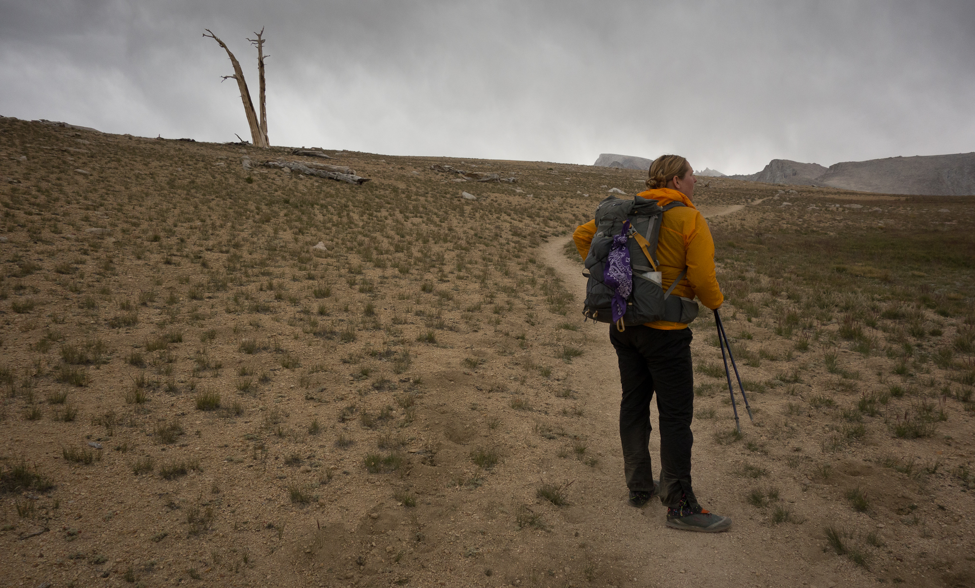
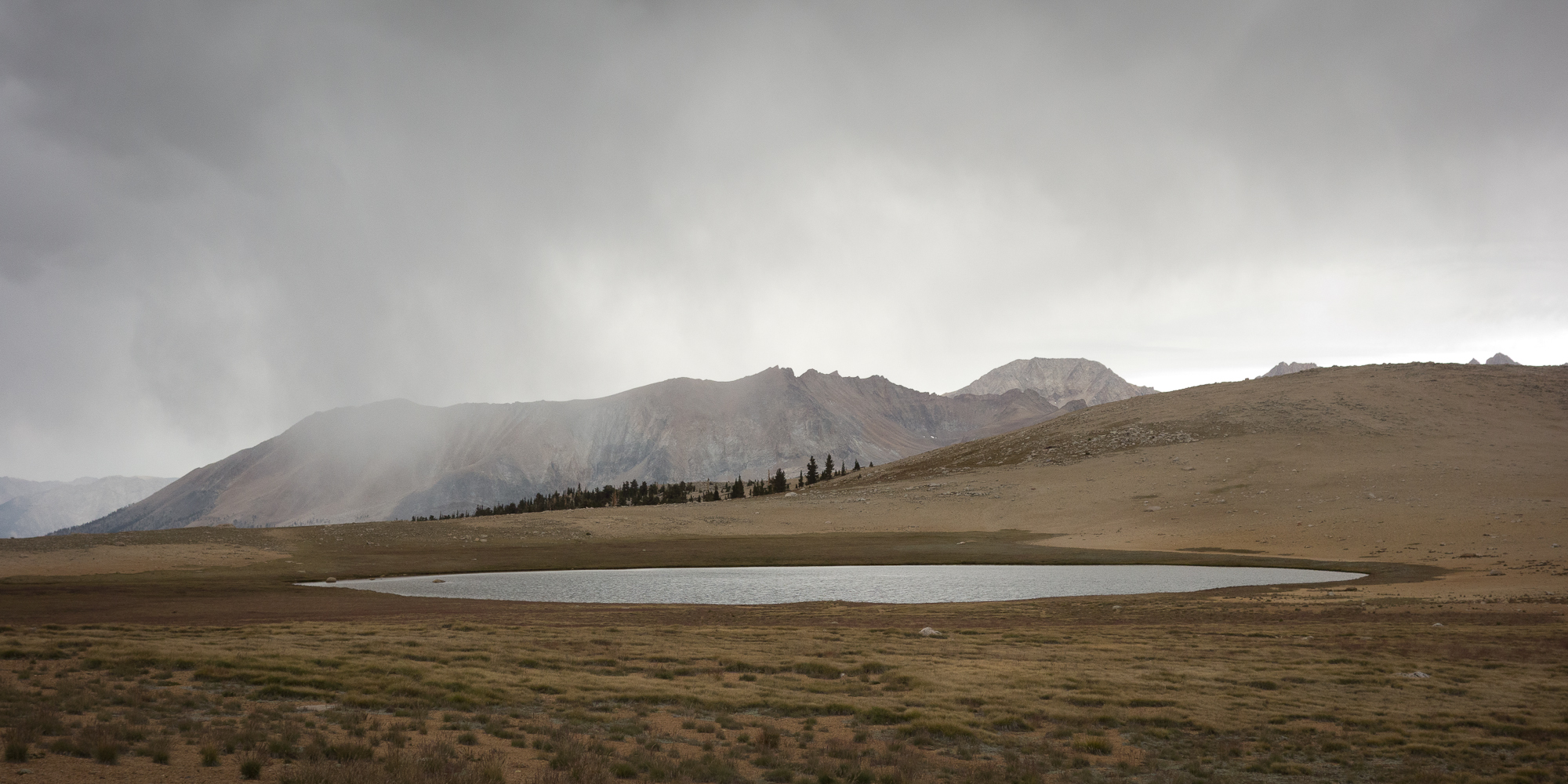
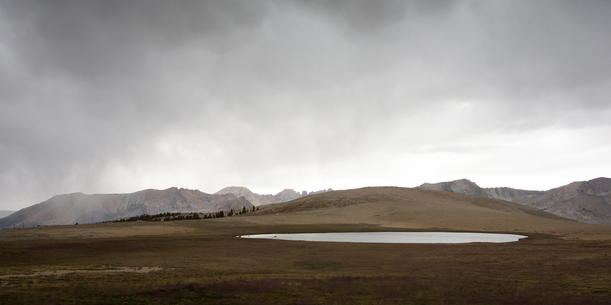
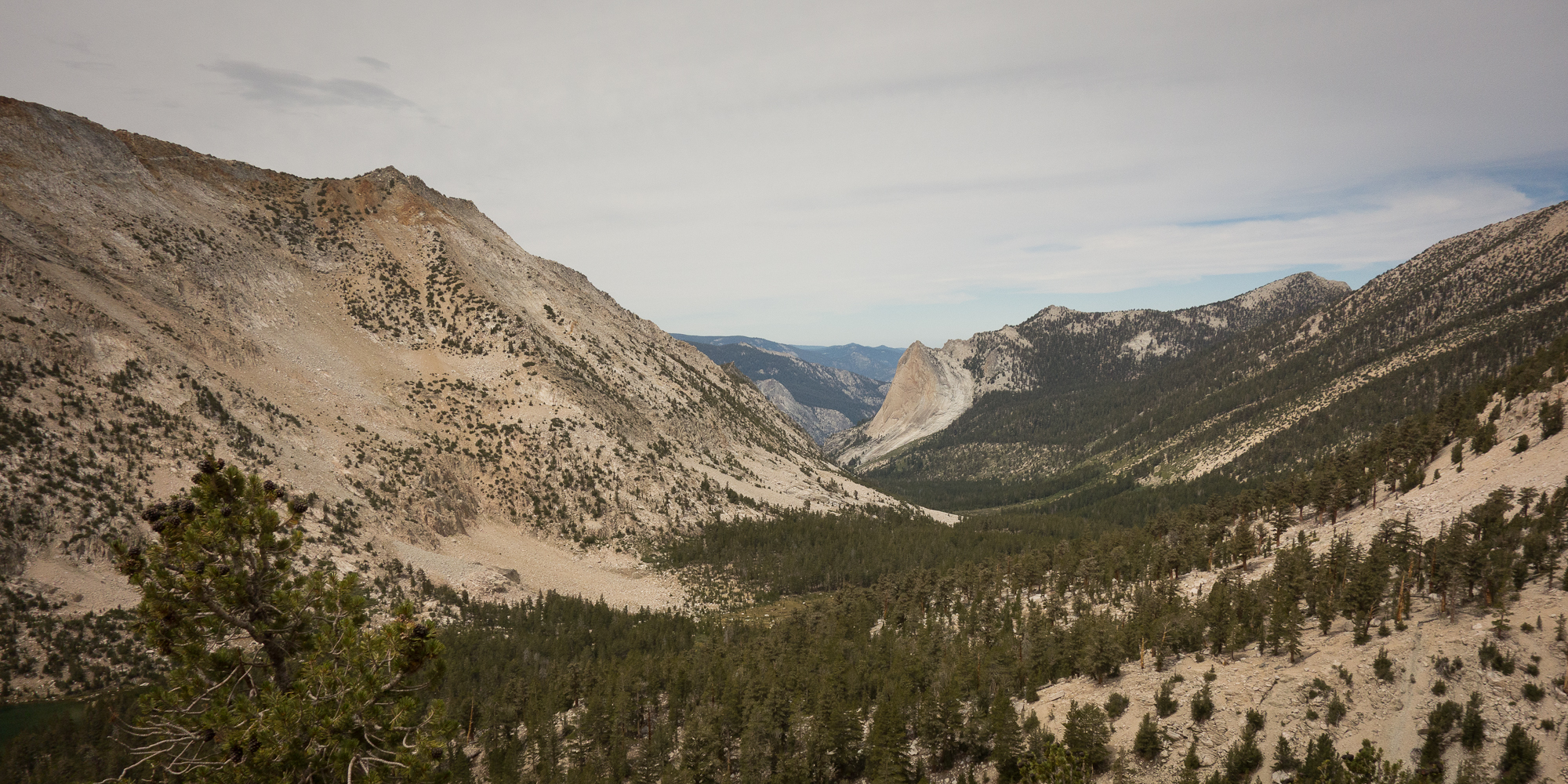
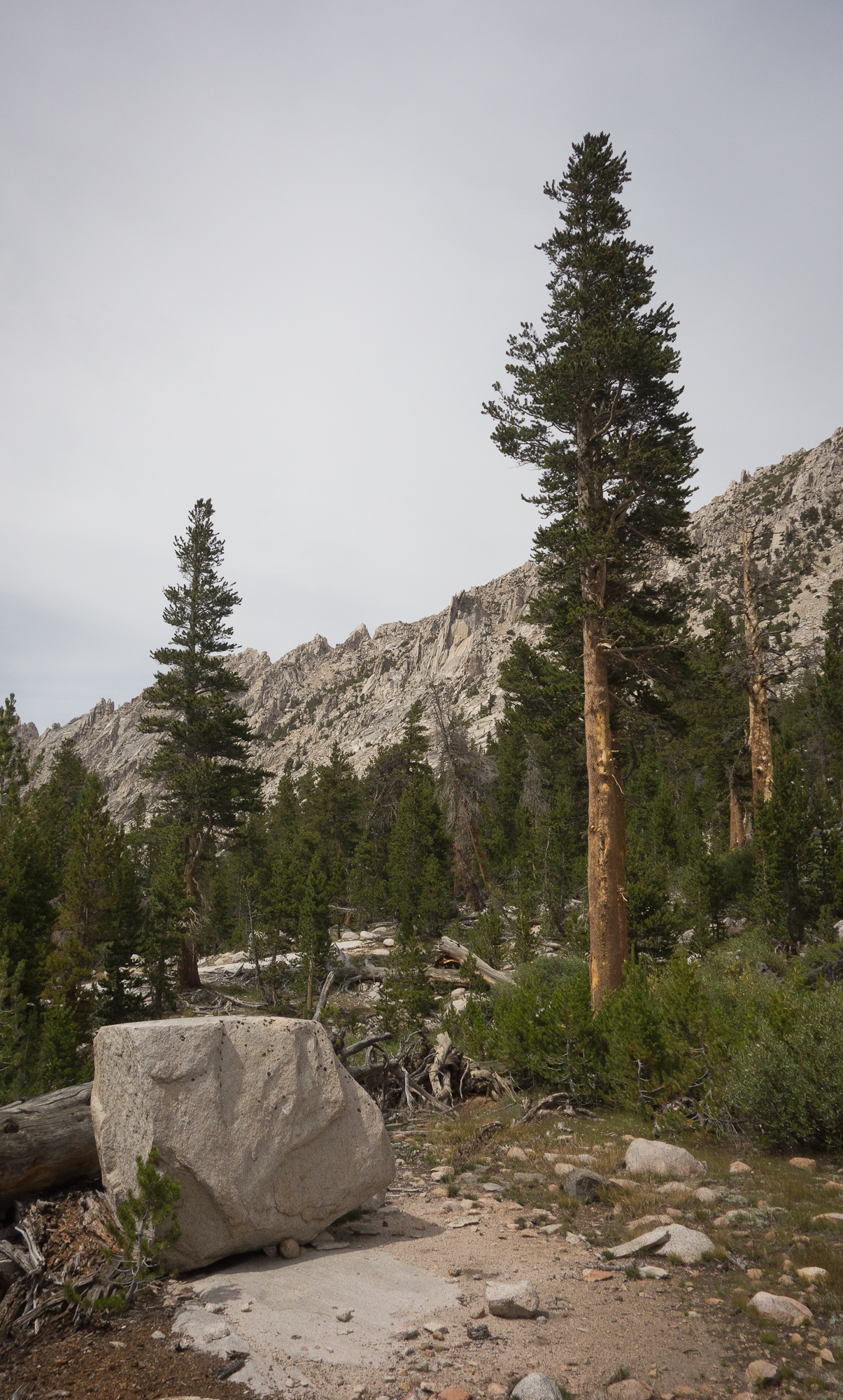
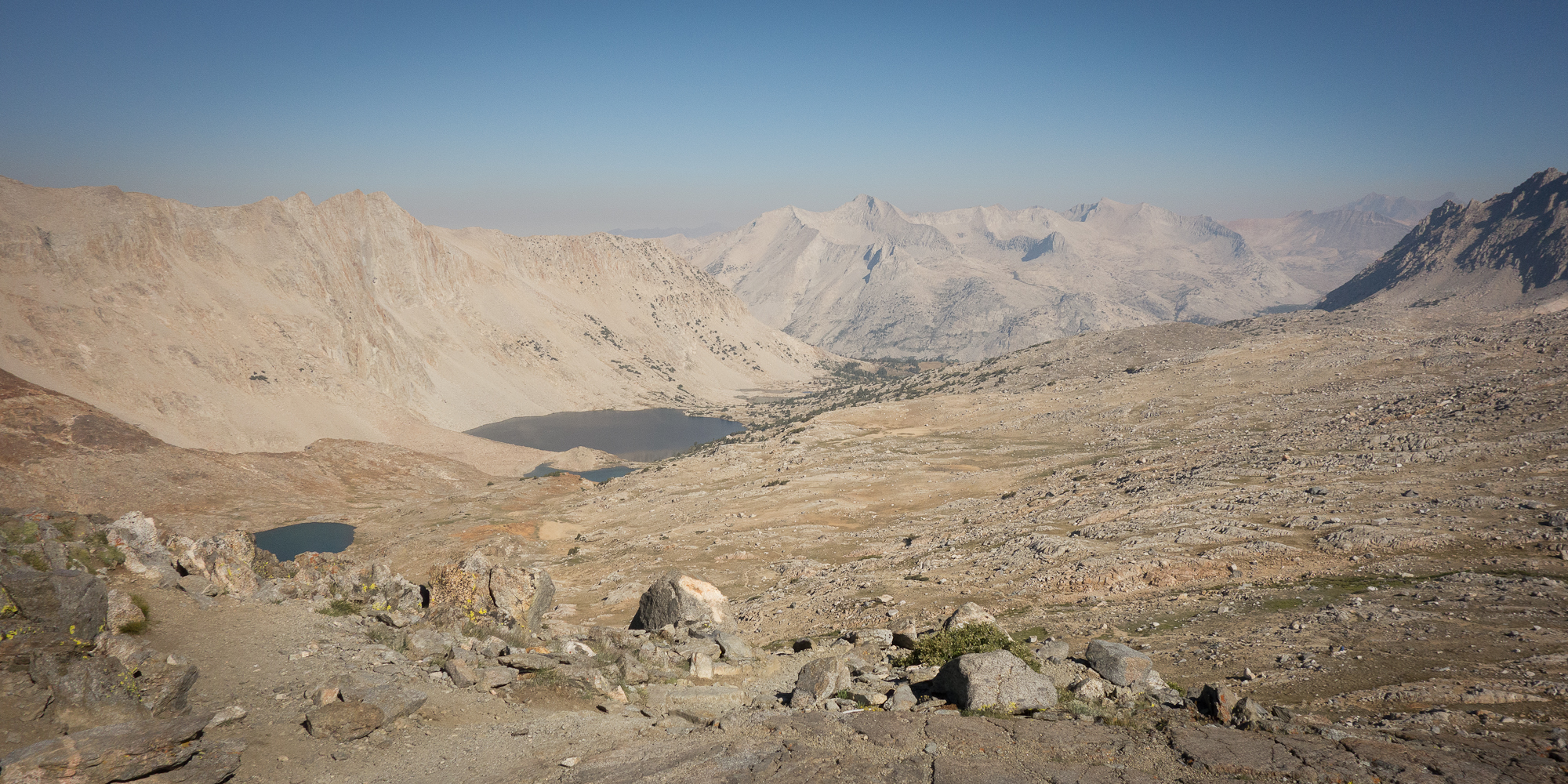
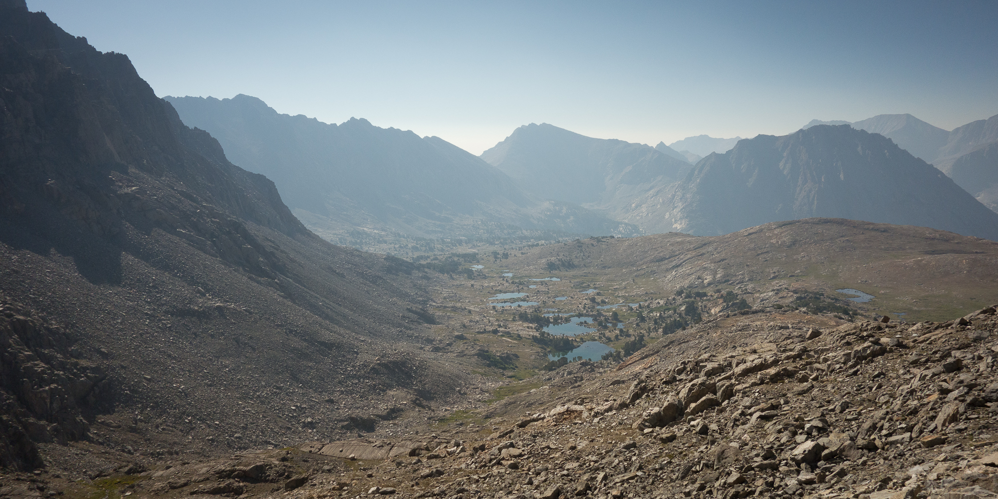
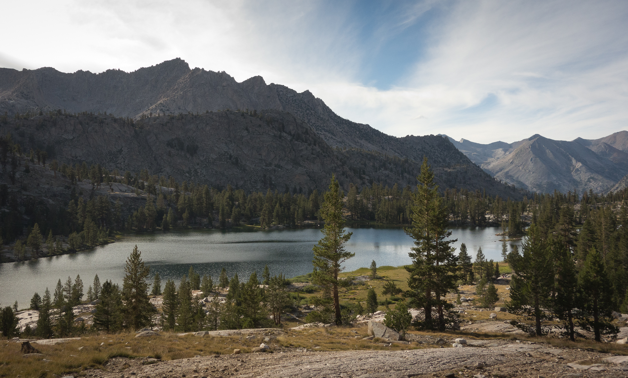
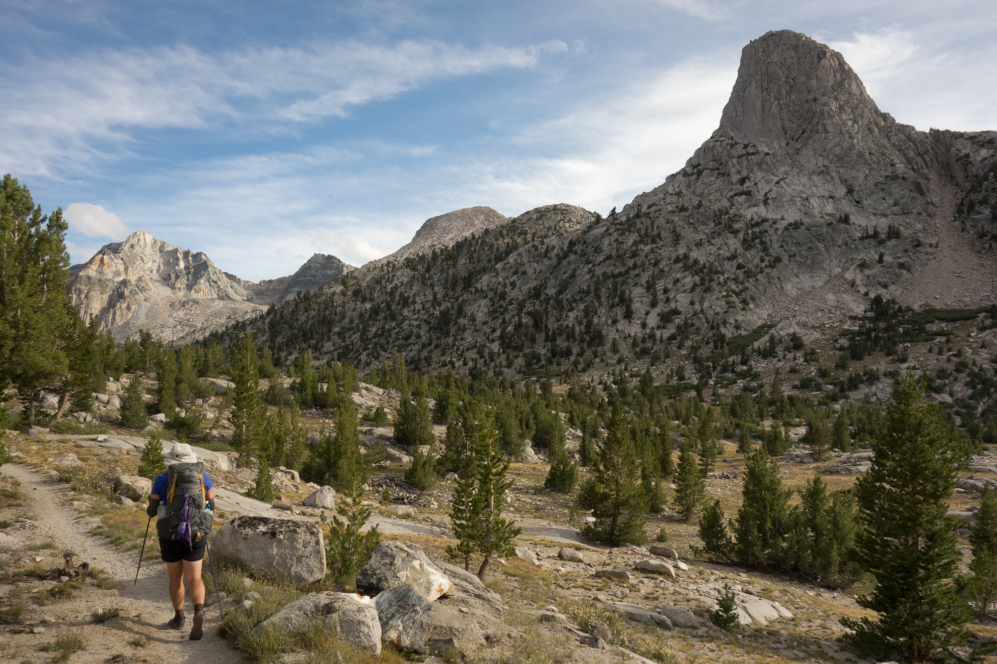
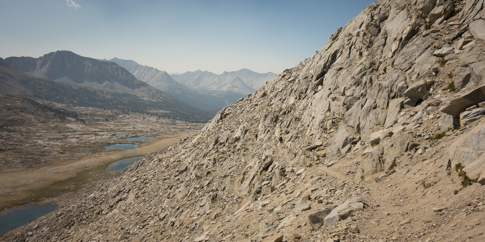
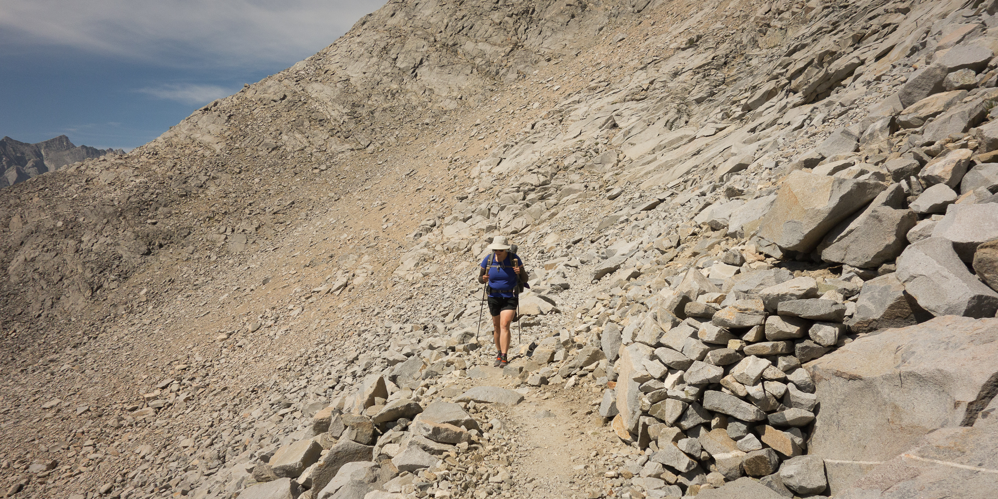
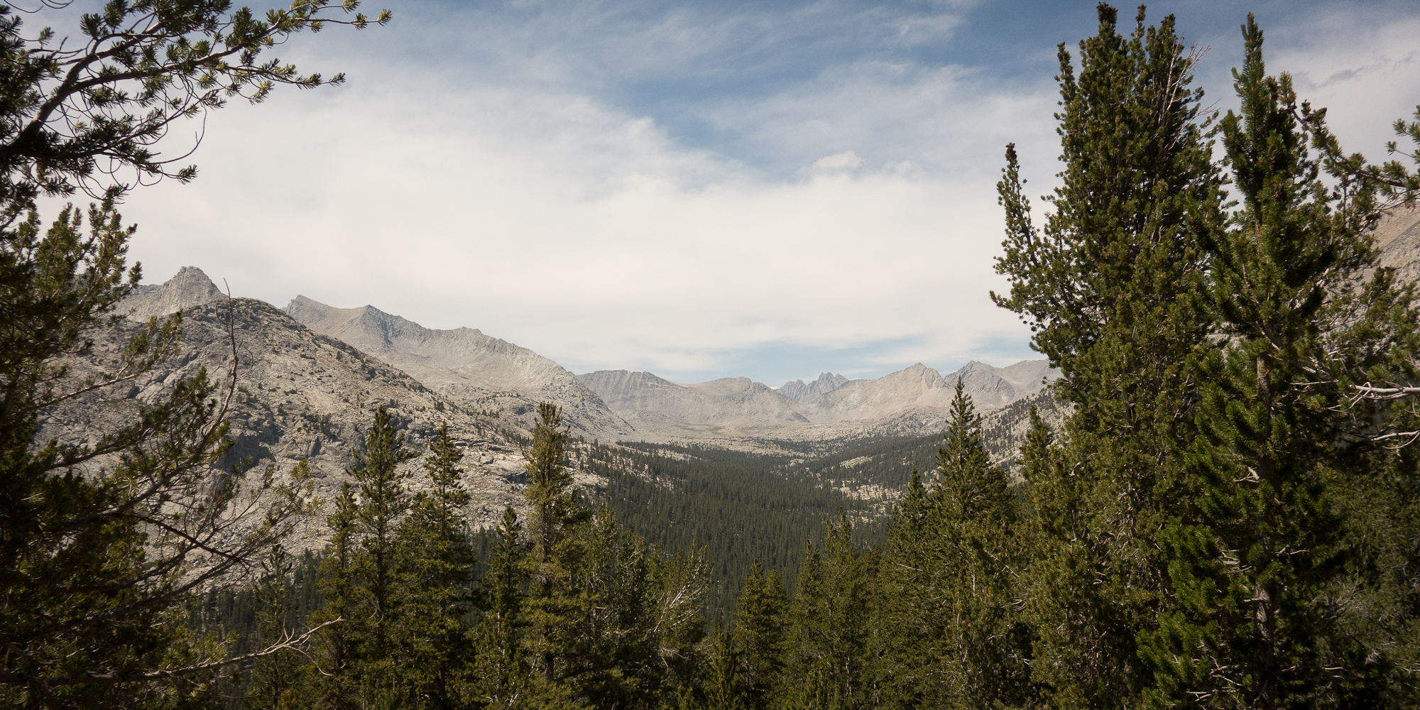
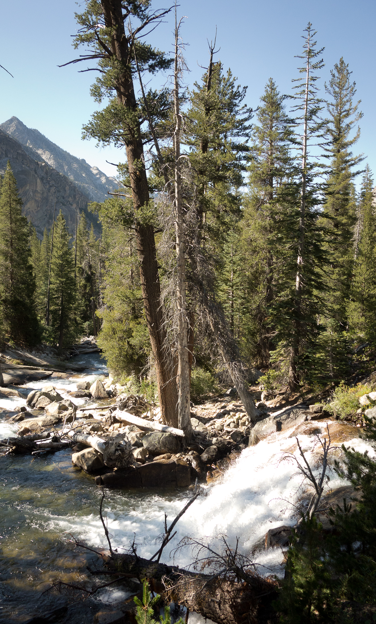
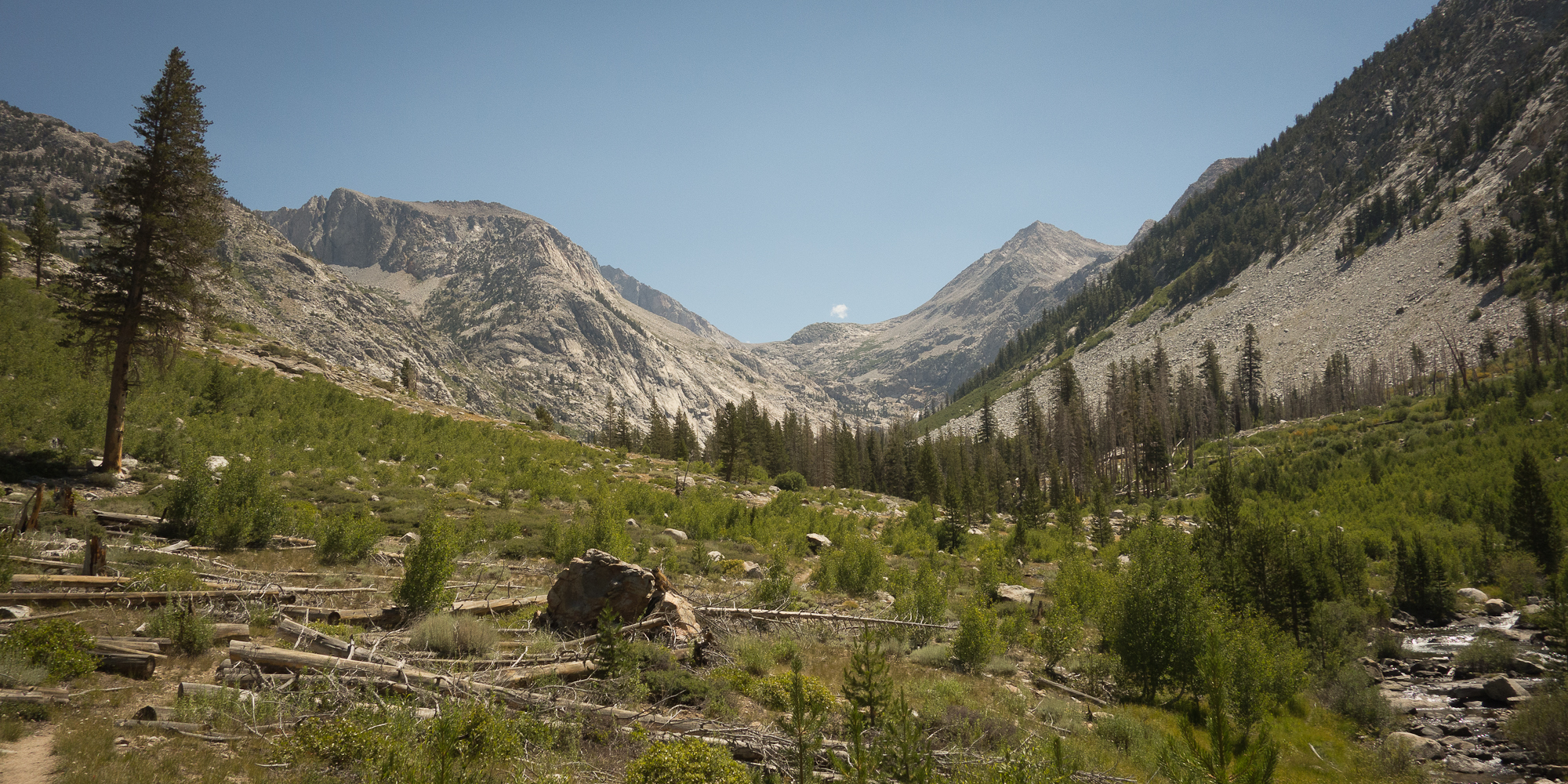
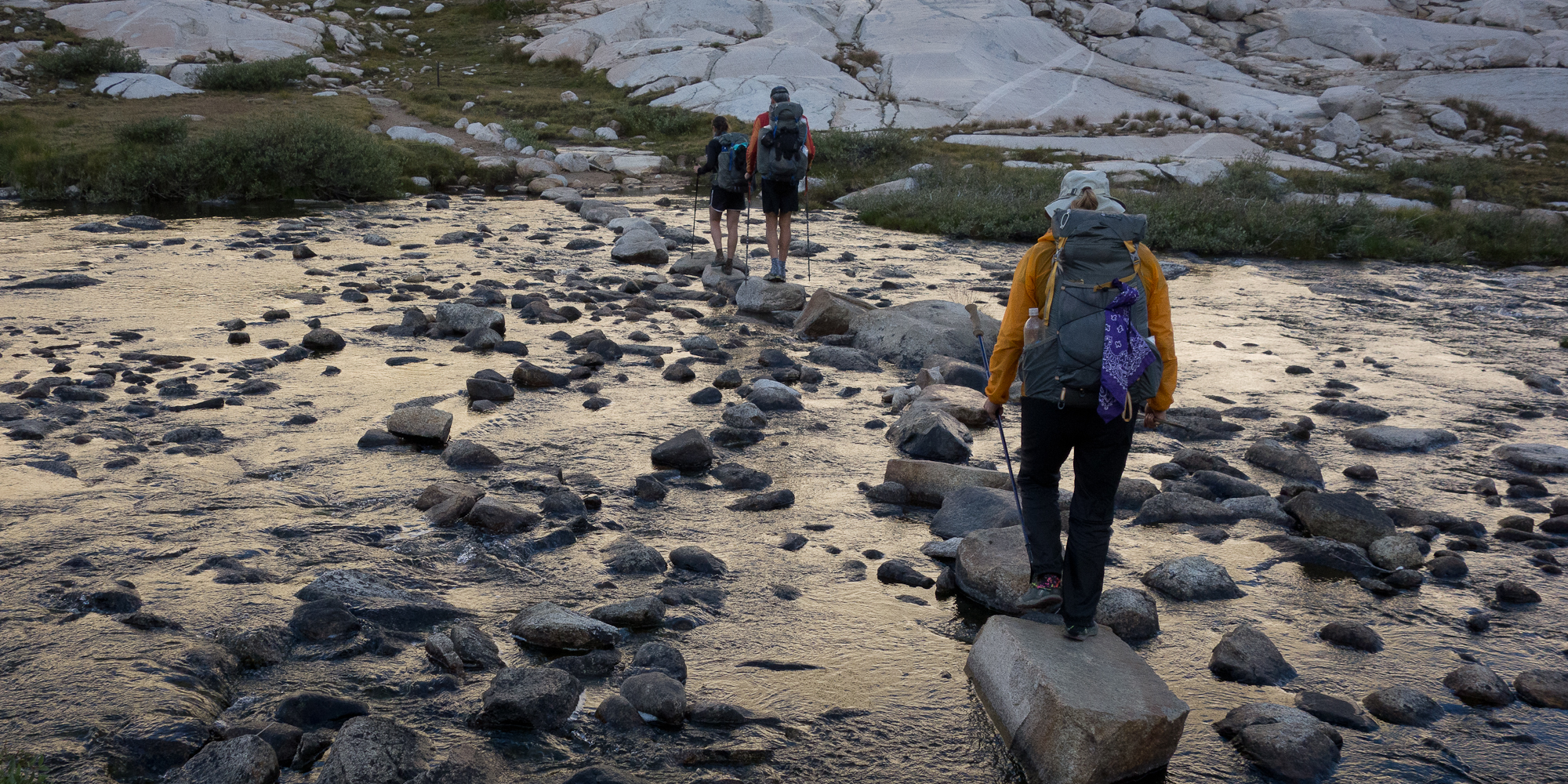
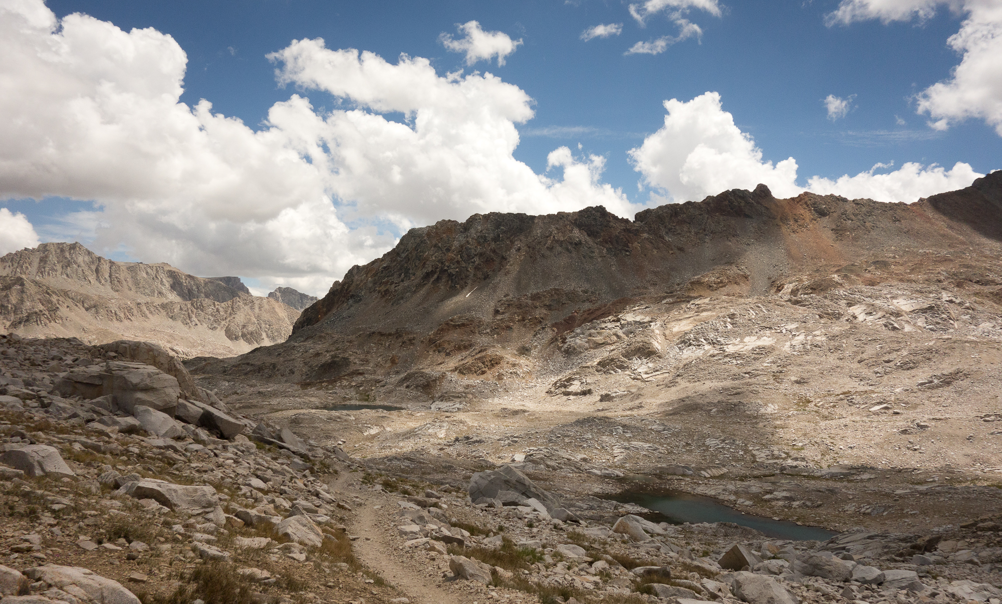
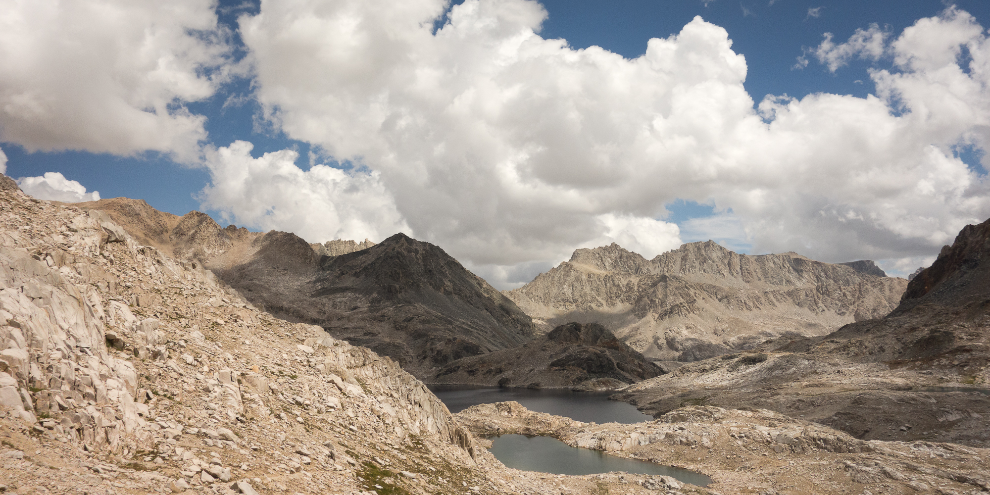
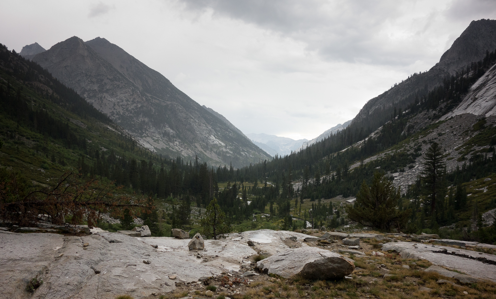
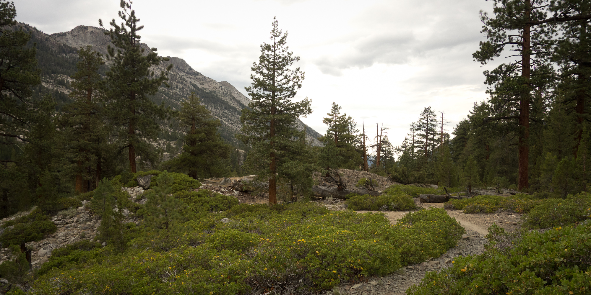
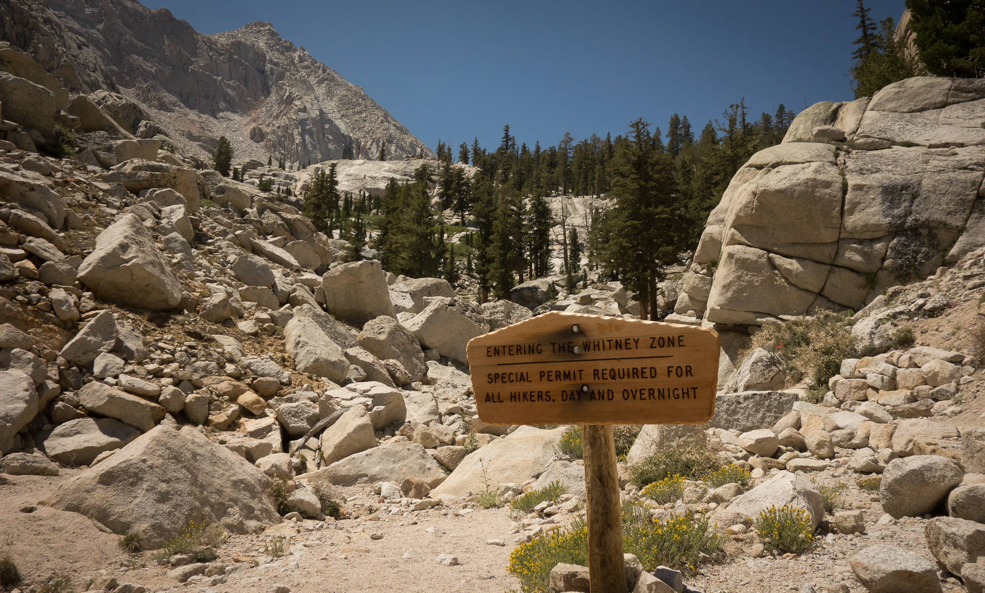
From Trail crest junction the trail starts what are known as the 99 switchbacks down the side of the mountain. Now I’m not sure if there really were 99 switchbacks as I didn’t count, but considering we descended for over 5 hours and 11 miles, it is highly possible. We started encountering hikers coming up from Trail camp around 7 am. They looked so clean. And out of breath. Coming up the eastern side of Whitney looks WAY harder than the western side, granted we had to hike for days just to get to the western side approach :P. We paused around 10 or 11 am to peel all our layers off and return to our normal shirts and shorts uniform.

Mt. Whitney
Kevin managed to snap a picture the one time I pulled out my cell phone to take a picture. Dang my legs are tan!
Selfie with Mt. Whitney.
Wotan's Throne
Wotan’s Throne.
Lone Pine Creek
Back down among the trees. Lone Pine creek.
Entering Mt. Whitney Zone
Entering Mt. Whitney Zone.
The summit is out of sight now. The long trail down to Whitney Portal.
Just keep hiking down.

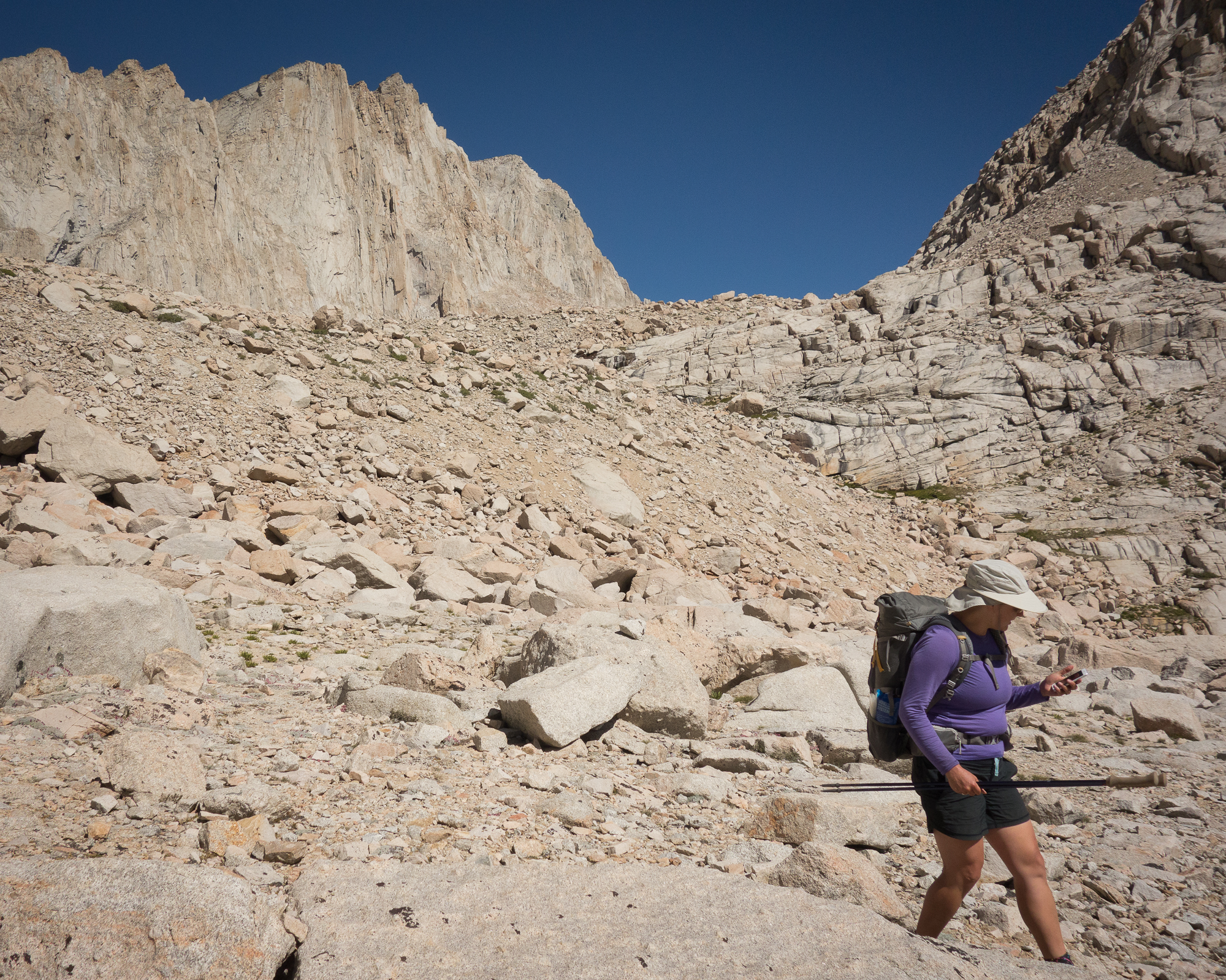
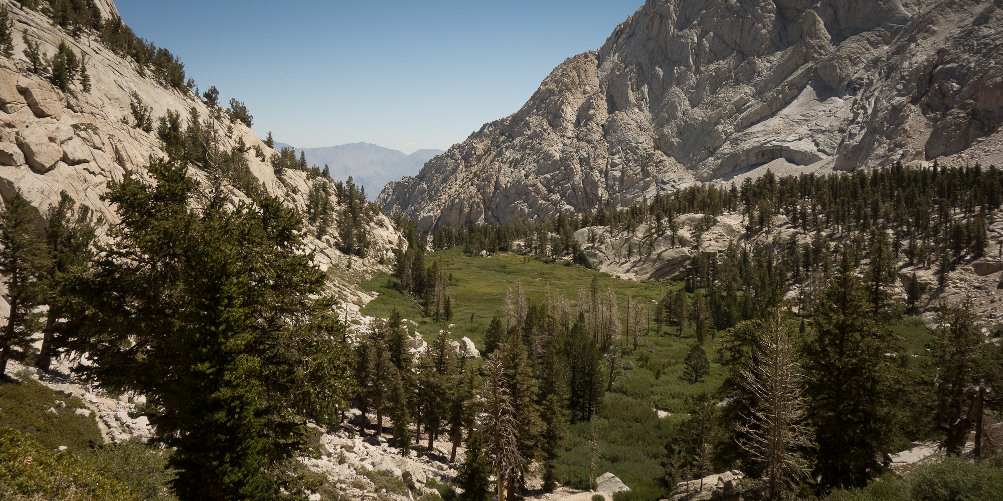
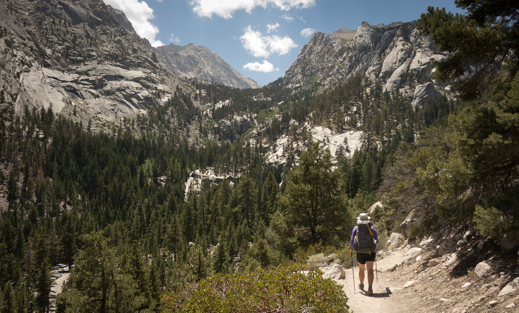
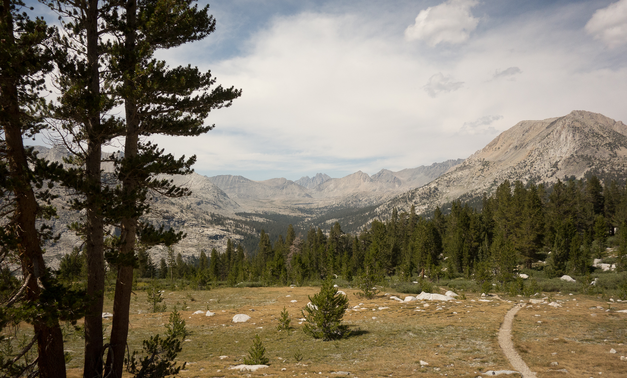
The folks in our group who had climbed Whitney before warned us about the length of the downhill descent and they were right.  It just kept going on and on, 6,300′ feet of down actually. Even when we could spot the road, and a car, and the roof of a building, it was another mile, mile and a half to the bottom. By then we were encountering day hikers.  Folks with no hat, no back pack, not even a water bottle.  Dang we must of looked like dirty hippies to them.

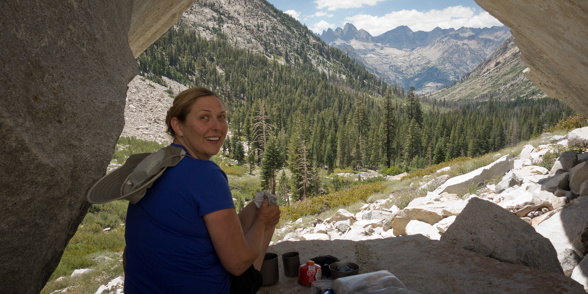
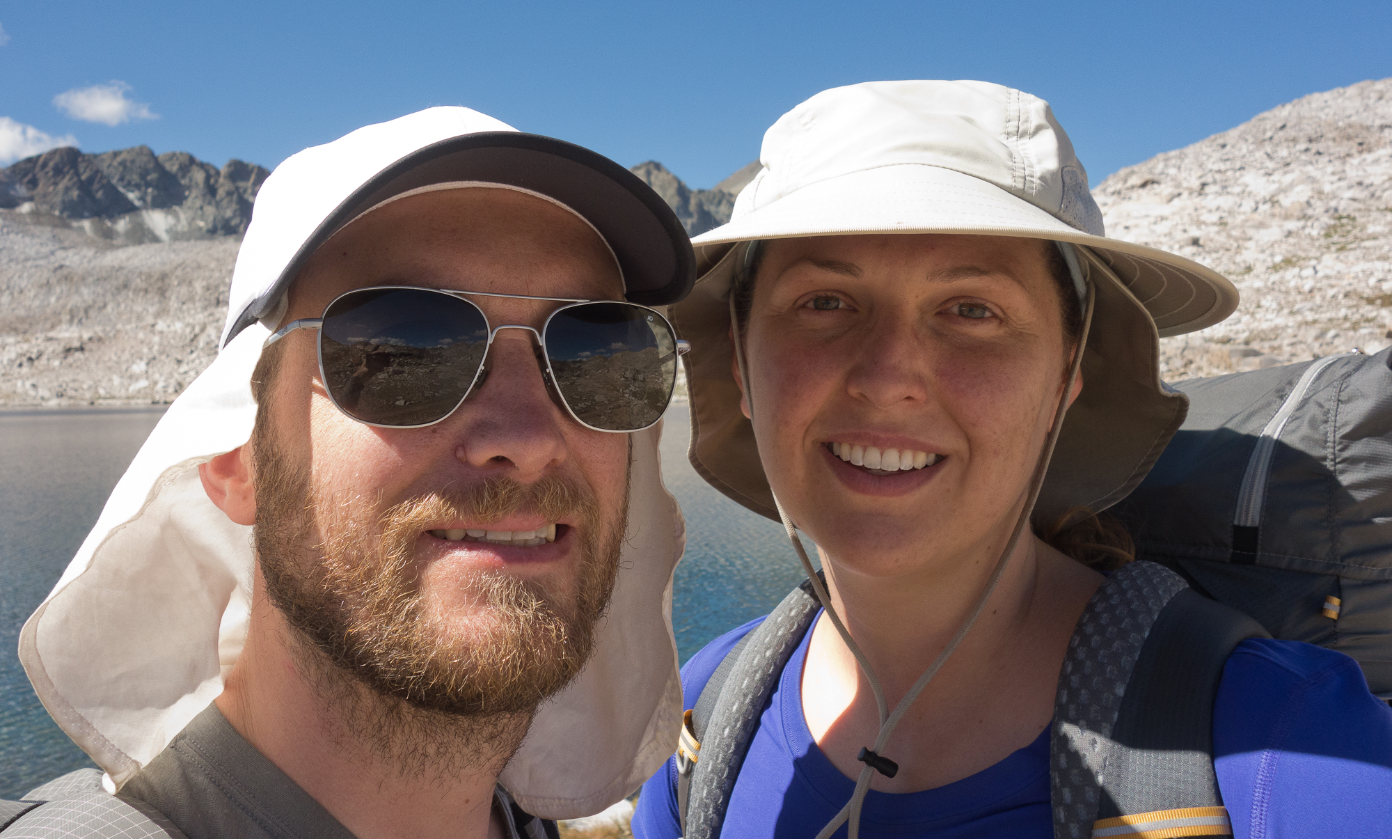
Eventually we made it to the end of the trail. I grabbed Kevin’s hand as we walked off the John Muir Trail and onto the asphalt pavement of the Whitney Portal Parking lot. We quickly found Dave, Steve, and Emma hanging at the picnic tables.

Whitney Portal Store
Whitney Portal Store (borrowed photo)
Random Mt. Whitney stuff for sale in the Whitney Portal store
Random Mt. Whitney stuff for sale in the Whitney Portal store. (Borrowed photo)

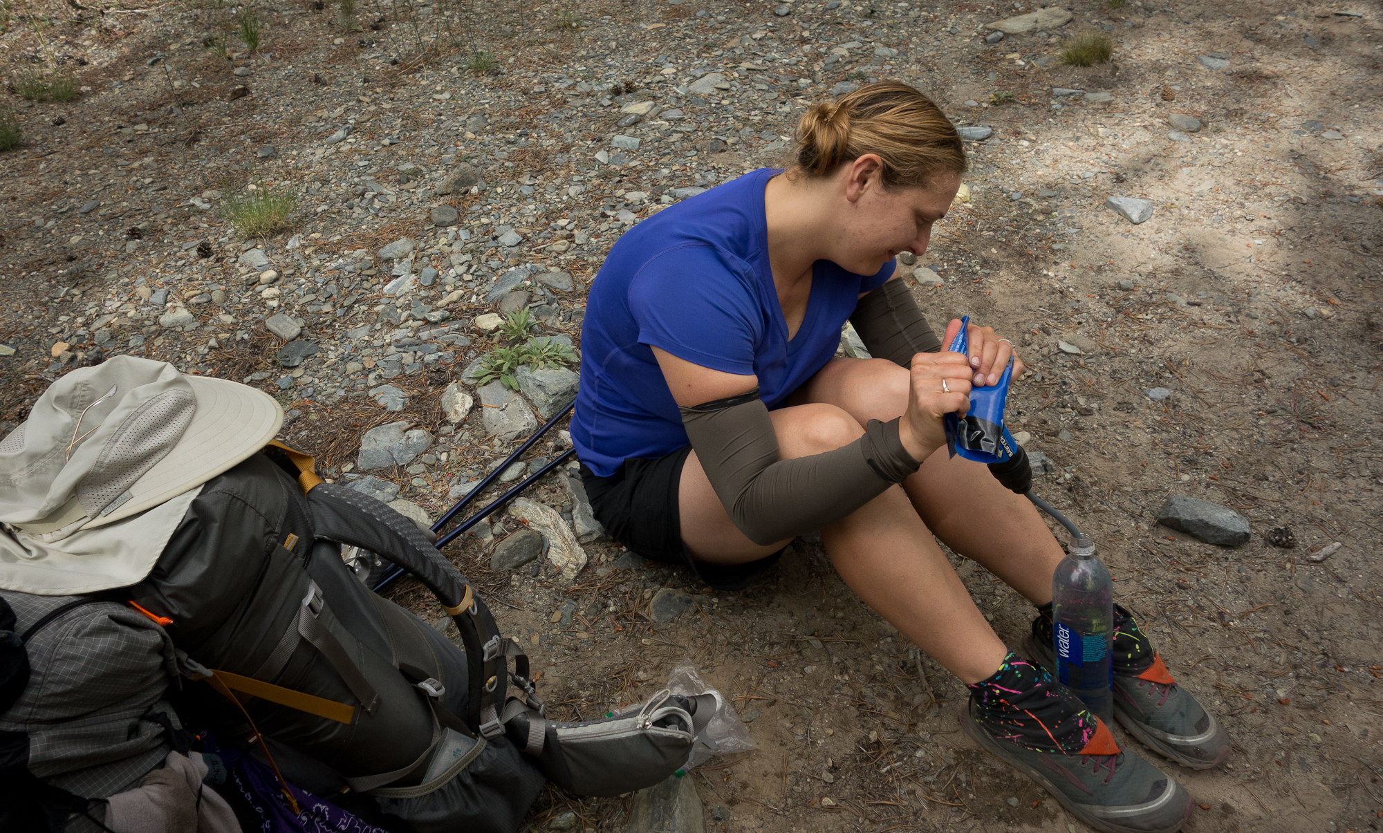
I procured the long discussed cheeseburger and beer from the general store, and a hot coffee, while Kevin filled up on more water. Honestly, it was not the best cheeseburger. The fries were mushy and the bun was soggy god I sound like an annoying foodie hipster. All that was left to do was wait for our ride to Reno. Thanks again George for getting that arranged, otherwise I think we would of hitchhiked out. When the shuttle arrived we realized it only fit 6, and Steve and Emma bowed out. Sad.


Mt. Whitney
Panoramic shot of sunrise on Mt. Whitney
Mt. Whitney
The blue line is the earths shadow. Mt. Whitney
Guitar Lake down below
Mt. Whitney
Stitched together panorama shot from Mt. Whitney

Day 18 – Guitar Lake

Wallace Creek to Guitar Lake
Probably only 7 miles

We had a slow start out of Wallace Creek this morning. With only 7 miles to do before Guitar Lake there wasn’t much of a rush. The trail was rather nice amongst the trees. It rolled over a knoll down the other side, back up another knoll and down again. We stopped on some boulders for our last breakfast on the trail. We technically wont eat breakfast tomorrow when we got to summit Mt. Whitney. A large herd of noisy boy scouts passed us. We can feel our selves getting closer and closer to civilization and it is WEIRD. I made a double dose of Starbucks via coffee and soaked up the views as much as I could.

2015_08_07-003
Pines
2015_08_07-014
Pines
2015_08_07-001
In the trees near Sandy Meadow.
2015_08_07-002
Early morning in the trees. Last full day on the trail.
2015_08_07-005
Sandy Meadow.
2015_08_07-006
Last full day on the trail! Sandy Meadow.

Soon we passed the Crabtree ranger station. There was a big rubbermaid tupperware filled with “wag bags”. Basically doggy bags for humans.  Since Mt. Whitney is a highly frequented spot rangers have a problem with human excrement on the mountain. It is so high up and cold the stuff doesn’t biodegrade so you are not allowed to do number two once you pass the ranger station. There was much discussion in camp about how we wanted to handle this situation.  Again, I had a double dose of coffee at breakfast.  I plan to not do number two till I make it off the mountain as I do not want to carry my own poop in a little baggie.

11.7 to Mt. Whitney!
Wag Bag distribution center.

From Crabtree at 10,600′ the trail climbs to Guitar Lake at 11,500′. While short, my legs were feeling really out of energy and the climb was kinda hard. We paused a lot.


2015_08_07-007
Sandy Meadow.
2015_08_07-013
Mt. Whitney through the trees.
2015_08_07-016
Looking west back at Crabtree meadow.
2015_08_07-017
Crabtree meadow and Mt. Whitney.
2015_08_07-018
Mt. Whitney
2015_08_07-019
Mt. Hitchcock to the south.
2015_08_07-020
Looking West from where we came.
2015_08_07-021
Mt. Muir. The trail leads to the right first and switch backs up Mt. Muir before making a hard cut back to the left.
2015_08_07-022
Mt. Whitney. The highest point is actually out of view to the east. 
Mt. Muir and Guitar Lake.
Guitar lake
Lunch.
2015_08_07-025
Home for the night. Guitar Lake.
2015_08_07-027
Lots of miles on these babies

We made it to Guitar Lake around noon, set up camp, filtered lots of water, made lunch. Now I’m just sitting in camp staring at Mt. Whitney pondering how hard it will be to climb tomorrow morning.  The group has decided to start up for Mt. Whitney at 2 am tomorrow morning, meaning we are going to wake up at 1 am. I’ve never woken up at 1 am for anything! Not even fishing. Fishing starts at 3 am. This all feels really surreal as we are so very close to completing the JMT and now we are just burning hours of daylight. Guitar Lake probably has 30+ people camped around it and more keep filing in. I went behind a boulder to pee and sure enough there was mounds of toilet paper blowing around in the wind. Rather frustrating to see people disregard the rules of their wilderness permit.  Kevin and I have gone to great lengths to pack out all are trash, picking up loads along the way. Just wish others did the same.

The trip is totally coming to an end and I’m bummed.  Dave managed to secure a private shuttle for the 8 of us with help of George on the outside world. Thanks George! He left the trail a couple days back to get back to his wife and kids and Dave and he were still communicate through his satellite texting device. The shuttle is going to be at Whitney Portal at 3 pm which means we need to hit the summit by like 7 am and start the long hike down. I’m relieved to have an actually exit plan as we truly didn’t have one before.

I feel I have been going slower the last couple days. Just feel out of energy honestly. I’m sure I am. Clif bars only go so far and I’ve ran out of gatorade days ago.  If we leave at 2 am that gives us 5 hours to go up the 4.7 miles and 3,000’+ of up. We are camped at 11,200 and summit is 14,505. Totally doable, I’m just getting nervous sitting and staring at the mountain.

Day 17 – Wallace Creek

8/6/2015 Bubbs Creek to Wallace Creek
14 miles and Forester Pass at 13,153′!

We made it over Forester pass today! Biggest pass yet!

It was a long, steady climb to the top of Forester Pass. On the switch backs up a pika came out and sniffed my shoe. Literally ran around my feet and sniffed my shoe. It was the most amazing experience. More amazing than when Magic Trail Bunny told me he believed in me. I nearly touched the pika, but I bet if did the pika would bite me and I’d get rabies.

Took us about three hours to climb the final 4 miles from camp.  This pass felt much easier than Glen Pass. It was a good steady grade going all they way up. None of that crazy rocky steep nonsense like Glen Pass.

Bubb Creek
Looking north on Bubb Creek.


Headwaters of Tyndall Creek
No name lake.
Headed up to Forester Pass
Headed up to Forester Pass.
Find the pika
Find the pika.
Pika
Oh Hi!
I almost got the pika.
Pika
So tiny and cute.
Pika on a rock
Pika on a rock.
Looking north at Bubbs Creek
Looking north at Bubbs Creek and Center Peak
Forester pass up to the right
Mt. Keith to the left and Forester pass up to the right.
Center Mountain
Mt. Keith at 13,983′.


From the top we could see peak after peak of mountains to the north where we hiked through. Then to the south a giant bowl with more mountains. I half expected to be able to see Mt. Whitney from the top of Forester but no such luck. We snapped a bunch of pictures and shared the butter biscuit we have been carrying for the last 100 miles in celebration. Some kid up on the top was searching for cell reception. I had such an urge to toss his phone off the side. There is no cell reception out here and that is the point.

Looking south on Diamond Mesa and Tyndall Creek
From the pass looking south on Diamond Mesa and the start of Tyndall Creek.
Second highest point on the JMT. Highest point for the PCT. Forester pass
Second highest point on the JMT. Highest point for the PCT. Forester pass.
Trail is off to the right
Trail is off to the right.
Looking back on Forester Pass
Looking back on switch backs up to Forester Pass.
That notch is Forester Pass
That notch is Forester Pass. I think there is a pika in the rocks.
Trail leading to Tyndall Creek
Trail leading to Tyndall Creek.
Forester Pass
Forester Pass.
Forester Pass
Forester Pass.
Forester Pass
John Muir Trail headed south.
Tawny Point
I think this is Tawny Point.
Forester Pass
Looking back on Forester pass. How did they even find that in the first place.
Headwaters of Tyndall Creek, which flows into Kern River
Headwaters of Tyndall Creek, which flows into Kern River. Again we are in an new drainage basin.
Loan tree
Loan tree.
2015_08_06-026
Getting closer to being back in the trees.
I think that is Kern Peak looking west
I think that is Kern Peak looking west.

We stopped at Tyndall Creek for lunch.  A group of middle aged guys were stopped there as well to pump water and eat lunch. They were free hiking the peaks around us, or at least I think that’s the phrase they used.  Basically means they weren’t following any demarcated trails. One guy had slipped on the rocks and skinned up his shins pretty badly. We also witnessed a mouse fall in the creek and nearly get swept away but he managed to grab hold of a stick and climb himself out. He sat on the banks panting for awhile. We were very scared for him.

Can you tell we have a thing for personifying the small creatures we see on the trail? Sorry.

I borrowed this YouTube of Tyndall Creek. Our skis were cloudy and overcast compared to this sunny day, but I wanted to show how lovely the creek was.

From lunch we crossed over Tyndall Creek we dropped down a bit more before climbing over Big Horn Plateau. We originally thought this looked like a good campsite between Forester Pass and Guitar lake.  When we got there we laughed at ourselves.  Flat maps tell you so very little about the actual terrain. Big Horn Plateau was exposed, dry, and over run by marmots. Literally the place was teaming with them.  We kinda stopped naming the marmots as they were just so plentiful.

Big Horn Plateau
Big Horn Plateau.
Big horn plateau and our first peak at Mt. Whitney, to the left of my head.
Big horn plateau and our first peak at Mt. Whitney, to the left of my head. It’s raining on us.
Rain over Big Horn Plateau
2015_08_06-031
Amazing and desolate.
Big Horn Plateau
Big Horn Plateau.
2015_08_06-033
Big Horn Plateau. We originally thought this would be a good camp spot. HA
Kern Ridge
Kern Ridge in the distance.
2015_08_06-035
Sweet tree. Little dry out here.
2015_08_06-036
Another shot of the tree.


This day seemed to keep stretching on and on. Since we made Forester Pass so early in the day I was anticipating camp the whole rest of day.  We were leap frogging with Dick and Manuela most of the day and near the end getting pretty anxious to find camp.  We ran out of water after Big Horn Plateau and the marked creeks on our maps were totally dry as we passed them. The group original planned to camp at Wright Creek and we didn’t find them. We knew they had just kept on till they found a flowing creek and sure enough, they were all camped at Wallace Creek. Always such a relief to spot that blue tarp :).

That night we hung out in a circle with our dinners and shared stories. Dylan read a poem from this book he had with him. Steve and Emma were running a bit low on food after a resupply mix up at Woods Creek Bridge. To be more specific their resupply never showed up. With the help of a ranger and the group they managed to scrounge up enough food to make the tail end of the trip. But what a bummer, the resupply to Woods Creek must of cost a pretty penny as it was hiked in on mule train. I gave Emma a couple of my clif bars and a snickers bar. She was so grateful. Kinda amazing what food does out here.  As we sat around in the circle Emma and I traded ideas of food we wanted to eat. I stared longly into my bear can trying to conjure a green apple. Just something crisp and cold.

Then Emma and I brainstormed how we could trap a pika with our bear can and a little bit of peanut butter.

Hey, you never know, peanut butter tricks bears all the time.

Tomorrow is a short day to Guitar Lake, about 7 miles.  Then a giant 17 mile day with the tallest peak in continental United States.

Day 16 – Bubbs Creek

Lower Rae Lakes to Bubbs Creek
10 Miles

This morning we did Glen Pass at 11,978′. While slightly shorter in elevation than Mather or Pinchot Pass that one was REALLY HARD.  We started out around 7:30 in the morning. The trail passes right through the two Rae lakes on land bridges. There are tiny islands in the middle of the lake and Painted Lady above us.

Painted Lady and Upper Rae Lake
Tiny island in the middle of Upper Rae Lake

The climb started in earnest at the edge of Upper Rae Lake and took us basically over a rock pile or moraine. This climb was really a challenge. Some of the steps came to my knee and I had to climb up on hands and feet.  Manuela who is much shorter than I exclaimed the steps came mid thigh for her! It was just all around super steep and I felt I would fall off the side at any point.  We only had 2 miles and 1,800′ but it took us till 9:50 to hit the top. The pass itself was a knife edge, dropping off on both sides. I borrowed this picture from another JMT hiker’s blog to try and demonstrate.

Glen Pass.
Glen Pass.

See how it drops off on both sides! We went down the other side immediately as I wasn’t having it and paused once we were on more stable ground for a snack.

Looking over the edge of Glen Pass
Switch backs leading down from Glen Pass


We paused for another snack right before the cut off to Keasarge Pass and exit to Onion Valley. One boon of the hike down from Glen Pass were all the little Pikas scurrying around the rocks and squeaking out. I swear they think they are way larger than they actually are and squeak to defend their territory.

PIKA
Pika!
Upper Vidette Meadow
Charlotte Lake
Charlotte Lake

When we came to the cut off for Kearsarge Pass Trail we found a sign posted on the trail maker from one of the rangers confirming some of the stories about “Bear Man”.  There is indeed a man running around these parts stealing food and acting odd. So very strange. There was also an old canister food cache with the inscription “Food Cache, Do Not Disturb, Pick up 09/04/12”.  So first off it’s 4 years old, secondly food caching is illegal as it is basically littering in the park and introducing human food to the animals.

Sign about "Bear Man" at the cutoff for Keasarge Pass Trail
Sign about “Bear Man” at the cutoff for Keasarge Pass Trail
Food caching is illegal
Kearsarge Pinnacles
Kearsarge Pinnacles
I think this is University Peak

After the cut of the trail dropped down into Bubbs Creek.  This area is frequented by hikers doing the Rae Lakes Loop, a 5 day loop that Kevin and I did parts of YEARS ago. We can easily spot the Rae Lakes hikers from the JMT hikers; the look so clean, freshly shaven, I can even smell the cologne on them. I have no idea what we must smell or look as we are 8 days no shower at this point. HA!

Here is a joke: “What’s the difference between a backpacker and a homeless person?”

The answer? Goretex.

We climbed along Bubbs Creek for a short ways before spotting the blue tent marking our stopping point around 3pm. Such a nice short day! We had a lot of time to hang out and chill that night. Dylan had a Frisbee in his back and we tossed it around, out in the middle of the woods.  Jason was trying to pawn off some of this unwanted gear, lemonade mix, wet fire starter, even his coffin tent.  Pretty darn funny. He said his pack weighed in at 50 lbs and was really eager to shed some weight.  While we don’t have many creature comforts while in camp like flip flops or camp chairs our backs barely crack 30 lbs.  And at this point in trip with only 5 days of food left I bet my back is less than 20 lbs.

Tomorrow will probably be a 14 mile day with Forester Pass, the tallest pass on the trail, and camping somewhere along Wright Creek.

Along Bubbs Creek
Along Bubbs Creek
Group camp
Group camp for the night. Bubbs Creek


Day 15 – Rae Lakes

8/4/2015 Lake Marjorie to Rae Lakes
15.2 miles with Pinchot Pass at 12,130′

We probably did 3,000′ of up and 3,000′ of down today. It was really exhausting and I had to concentrate hard on pushing forward. Pinchot was only 1,000′ or so vertical feet up from where we camped. We were probably the last ones to leave camp as I had some clean up to do.  Thanks flow if you know what I mean. Ah the joys of camping.

Something amazing happened on our way up to Pinchot Pass. A very large, rather fat, white-tailed Jackrabbit (Lepus townsendii)  bounded into the middle of the trail and just looked at us.  He twitched his nose and bounded up the trail a bit and then looked back at us again.  Kevin claims this was magic trail bunny (MTB) and he was telling us that we could “do it”. Kevin even went so far as to say MTB was my spirit guide. Thanks MTB for believing in me. I sure believe in you.

Mt. Pinchot
Morning light behind Mt. Pinchot
Mt. Pinchot
Mt. Pinchot

I think we summited Pinchot Pass before 10 am.  We had the pass all to ourselves.  We split a snickers bar, took a bunch of pictures and started our way down. The basin to the south looked like a moon scape. Really incredible.  This basin drained to the Woods Creek.

Pinchot Pass
Looking north from Pinchot Pass. Lake Marjorie Down Below.
Pinchot Pass
Looking south from Pinchot Pass.
2015_08_04-012
Basin.
Pinchot Pass
Looking north from Pinchot Pass

2015_08_04-014

Pinchot Pass
Giant Basin
Pinchot Pass
Looking back on Pinchot Pass.
Mount Cedric Wright
Mount Cedric Wright,12,362′

On our way down from Pinchot Pass we encountered a group of guys that hiked this loop every summer. They were from Texas, seemed a long way to come but they just loved the Sierras and said they wouldn’t miss it. At this point we have 60 miles left on our trip and only 4 days left.  I’m starting to feel sad that the adventure is almost over. Though the hardest part is yet to come!

On the way down we met up with Elizabeth who is section hiking the PCT by herself and meeting up with her boyfriend in a couple days.  She asked us if we had heard about “Bear Man” to which we replied “no”.  She then recounted a story for us that a crazy man was hanging out out around the Woods Creek Suspension bridge scaring hikers and stealing food. Apparently he even jumped a mule train, frightening the lead horse to throw the rider and he broke his leg. She was scared to hike alone (rightfully so) and asked if she would hike with us all day. Of course we let her.  The thought of bear man really crept into my head today. I was worried he was around every corner or tree. We had about 3,500 feet of down to hike to the bridge and we did it nearly in silence.  Sadly, Elizabeth slipped on a wet rock and landed hard on her hand.  She was bloodied up. I don’t think she broke anything but she was pretty shaken up. I blame bear man for this incident. I helped her pull her first aid kit our of her pack and clean out the cuts on her hand and bandage her up. We continued our way down the bridge and re-connected with the rest of our group and found a ranger. Yay ranger!  He confirmed that there was indeed a possible schizophrenic man running around the woods stealing food from campers. The ranger had an ace bandage and wrapped up her wrist as I’m sure it was throbbing. Poor thing; she had been out on her own for 35 days without injury and on her last day before meeting up with her boyfriend she hurts her hand. Elizabeth decided to camp at that junction along side some other women who could help her assemble her tent. We headed on to regain the 2,500′ of elevation we lost earlier in the day to hit Rae Lakes for camp.

The whole bear man thing really threw us. I don’t think we stopped for lunch but ate snacks as we hiked to keep moving. We have no pictures of the Woods Creek Suspension bridge or our descent through some pretty amazing scenery. I swear the rocks were green and pink in some locations! Just overall an odd day.

2015_08_04-018
Arrowhead Lake.
Fin dome Painted Lady
Fin dome and Painted Lady in the distance.
Rae Lakes and Painted Lady

We were pretty relieved when we made it to Rae Lakes and could just hang out and enjoy the evening.  Dylan managed to catch some fish in the lake. Though he couldn’t get his stove to light so he couldn’t cook the fish :(.

Dave had a bottle of whiskey that he passed around as we ate dinner and told stories. Karl was leaving the trail the next day through Kearsarge Pass to Onion Valley for rest days in the real world. We joked that he was going to order a pizza and hide under the covers of the hotel bed.

Tomorrow is Glen Pass at 11,926′. We have less than 40 miles left on the trail. Steve, Kevin and Dick pulled out a bunch of maps and we plotted out where we would camp the next three nights. We are going to do one 14/15 mile day and then two 10 mile days. If we pushed really hard we could be out of the trail earlier but we are kinda gated in by these large passes.  We have enough food to last us another 5 days if need be which is a good spot to be in.

Day 14 – Lake Marjorie

8/3/2015 Upper Palisades Lake to Lake Marjorie
12 some miles and Mather Pass at 12,100′

Upper Palisades Lakes, the spot we slept the night before, may be my favorite campsite so far.  We were high up on a bluff (10,800′) looking down over the two lakes and could see small waves on the shore. We kept the sides of the tarp open last night to check out the moon and the stars.  We have a bug net we put up inside the tarp every night to keep the critters out. And I mean more than just bugs. Little mice like to come and sniff our packs and try to find remnants of snickers bars.

We ate our morning meal in camp and headed up towards Mather Pass. I think we had 3 miles and about 1,800′ more up to make the pass.

2015_08_03-001
Pika. They make a squeaking noise.

Pikas are one of the more adorable facets about the John Muir Trail. They only appear above 10,000′ feet in rocky tarns. So they are a bit of a treat for hiking up so high. You hear them before you can see them as they make this little squeaking noise to warn you off of their territory. They are awfully territorial for being a tiny ball of fur. They are more closely related to rabbits than rodents and were the inspiration for Pikachu (gotta catch them all).

Mather Pass
Rocky switchbacks up to Mather pass. Palisades lakes in the distance
Mather Pass
Looking north at Palisades Lakes. Climbing up to Mather Pass
Mather Pass
Made it! Day 7 no shower.
Mather Pass
Mather Pass! Our clothing is starting to look a bit worn
Mather Pass Looking south
Mather Pass looking south. Drainage basin for the South Fork of the Kings River.

One of the wild things about these passes that I didn’t realize until I was in them, is that each pass really separates the drainage basin. Like before Muir Pass all the creeks and rivers flowed into the San Joaquin. Before Mather Pass the creeks flowed into the North Fork of the Kings river. Now after Mather Pass everything is draining into the South Fork of the Kings River.

Little steep
Little steep going down
Upper Basin, Kings River
Head waters for the South Fork of the Kings River
Mather Pass
I’m concentrating on not falling over
Upper Basin
Upper Basin.
Mather Pass
That is Mather Pass from the back side. Pick out the trail.
Upper Basin
It was windy on the south side of the pass. Pack is smaller after eating a couple days of food. 
2015_08_03-016
Headed south.
Getting down back amongst the trees.
John Muir Trail
The trail leads through that valley and then up to the left.

From Mather Pass we descended about 2,000′ to cross over the river, it was no longer a creek at the point where we crossed it.  We ran into Dick, Manuela, and Dave at the crossing as they were just finishing up their lunch break.  We pumped water and chatted for awhile about the pass. Going over the large stones to get across the river I managed to slip on an unsteady rock and it flipped and pinched my foot under the rock. My shoe ripped open and I now have a nice black and blue mark. I guess the injury could of been a lot worse with a broken bone had the rock been bigger.

From the creek we tackled about 1,000′ of up in the afternoon heat to get up and over to Bench Lake cut off.  We ran into two women on a 3 day excursion. They looked SO CLEAN. I swear I could smell the laundry detergent. They had so many questions about our trek, the distance, food, resupplies, gear, planning. They made me feel like a real seasoned hiker.  I asked them questions about the outside world and they informed the that Ben Affleck and Jennifer Garner broke up. Tragic.

From Bench Lake the trail leveled out and we found our group at Lake Marjorie at 11,132′. We set up tent next to Dylan and Anna and Jerry and Jason (father son duo). I full on took a “Dundo” style shower in my clothing trying to get some of the grime out of my hair. I think it worked. Dylan recounted stories of how he biked across the continental United States in his younger years.  Both have hiked Mt. Whitney on a number of occasions and they talked a bunch about the last leg of the climb as being slight treacherous and needing to watch the weather to make sure you don’t get caught in a thunderstorm.

Tomorrow we hit Pinchot Pass, then descend to one of the lowest points on the trail (boo) with Woods Creek Bridge suspension bridge at 8,500′.

Lake Marjorie
Lake Marjorie.
Lake Marjorie
Moon over Lake Marjorie.
Lake Marjorie
Lake Marjorie.
Lake Marjorie
Lake Marjorie. Can you spot the blue tent?
Lake Marjorie
Lake Marjorie.
Lake Majorie
Last one of Lake Marjorie.


Day 13 – Palisades Lakes

8/2/2015 LeConte Canyon to Palisades Lakes
12.5 with lots of up. 8,070 – 10,700.

We broke camp at 7:40 this morning and hiked a couple miles before stopping for breakfast on a sunny rock.  One of the interesting aspects of hiking through canyons that are oriented north to south is we don’t get much light in the morning, or in the evening for that matter.  So mornings can be a bit cold and it feels good to get moving first and then stop for hot oatmeal and coffee.

From LeConte Canyon the trail makes a hard turn east and leaves the Kings River behind and follows Palisade Creek up an amazing canyon. Kings Canyon is just as beautiful as Yosemite, just without the giant crowds and parking lots.  Which I supposed makes it better. We met a woman who had a GPS device that gave her weather read outs. She told us that we had maybe one more day of thunderstorms but then clear weather for the next week. Which is very good news for our climb up Mt. Whitney, the highest peak in the continental US.

Very pungent
Very pungent Aspen Onion.
Morning shadows in the canyon
Kings River
Kings River
Long canyon up to Palisade Lakes

The canyon slowly climbs for about 7 miles alongside Palisade Creek.  We paused for lunch under some giant boulders to escape the heat as we were above the trees at that point.  It was a pretty cute little spot. I’ve been trying to make gatorade at lunch to make sure I get necessary electrolytes to prevent leg cramps. Though the pink powder blows everywhere in the wind and makes my fingers all sticky.  Next time I’m getting easy to use tablets or even just take electrolyte pills.

Lunch spot hiding from the heat
Palisade Canyon
Palisade Canyon
2015_08_02-007
Big Granite Boulders


Another shot of our lunch spot courtesy of Stuart
Another shot of our lunch spot courtesy of Stuart.

After lunch we encountered basically a rock wall and the only way up was beautifully engineered stairs and switchbacks.  Thanks conservation corps! It really was a golden staircase to get up and out of the canyon.  I thought the rocks were a more pink in hue than golden.  We’ve been hiking a lot with Stuart and Lyell from Portland. We paused next to one of the many waterfalls coming down the switchbacks to dunk our heads and shirts in the water and pump water. Lyell (the son of the father son duo) had a nice iPhone app that gave pretty accurate location and altitude read outs, letting us know how much further we had to go till we hit the lakes.

Golden Staircase
Close to the top of the Golden Staircase
Golden Staircase
Thats steep! Golden Staircase
2015_08_02-010
We started the day at the bottom of that canyon
Palisade Crest
Still more up to do to get to the lakes. Palisade Crest in the distance.

One of the funny tricks about this hike is even after you do a butt load of climbing up, say 2,000′ of elevation, there is typically a tiny bit more to get up and over a ridge. The staircase was good hard work and it tapered out. I thought we would hit the lake “any minute now” but it was a good half hour more of hiking before we saw the lake. But my word, what a relief when that lake came into view.

Lower Palisade Lake
Made it Lower Palisade Lake. Can you spot the blue tent?

Steve and Emma were camped at Lower Palisade lake. I think Emma had gone for a swim and they were chilling reading their books. So idyllic.  We all hung out for a bit chatting about the day, the trail, life in general. I dangled my feet in the lake and pumped more water. Kevin and I opted to hike on a bit to the Upper Palisade lake.  The camp site we found was spectacular. Up on a bluff looking over both lakes.  It is a shame I don’t have a picture of it. We are now at the 145 mile marker which leaves us with only 75 or so miles left to go.  Makes me feel very invigorated to know I can actually accomplish this trail.  We’ve passed a lot of PCT hikers, you don’t even have to ask you an just tell as they carry less, smell worse, and keep moving now matter what.

Palisade Lakes
Mather pass up and to the right. Upper Palisade Lake
Marmot
Why hello Marmot!

Day 12 – Muir Pass

8/1/2015 Muir Pass and LeConte Canyon
13.5 miles

We made it over Muir Pass today at 11,955′!  The climb honestly started all the way back at Muir Trail Ranch two days prior. One could even claim it is 18 miles of “up”.

I think we broke camp at 7:17 am, the earliest ever! Yet Steve and Emma were still out on the trail before us. They are so quick! I think they get to camp by 3 or 4 pm while we come rolling in closer to 6. Oh well!

Kings Canyon may be more beautiful than Yosemite. It is certainly more remote and hard to get to than Yosemite. There are no shuttles, ice rinks, lodges with 3 star dining, gift shops to buy fridge magnets . . .

We climbed the last 1,000′ over about 6 miles to Muir pass and passed Sapphire Lake and Wanda lake (named for Muir’s daughter). Both were just jewels of icy blue water in a sea of giant granite cliffs.  Dylan claimed that there was still frozen glaciers at the bottom of the lake. Everyone had told us that the later half of the John Muir Trail was more spectacularly beautiful than the first half.  This is a big statement as the first half of the trail is Yosemite National Park, but they are right.  The second half is filled with 14,000′ peaks, glaciers, alpine lakes and inspiring vistas.  Just check out these pictures of our 6 miles climb up to Muir Pass.

Evolution Lake
Morning Moon in Evolution Lake
Sapphire Lake
Sapphire Lake.
Sapphire Lake
Sapphire Lake
Sapphire Lake
Stepping stones over the lake outlet. Steve and Emma in the lead.
Muir Pass
Muir Pass in the distance
Muir Pass. John Muir Trail.
Muir Pass
Wanda Lake.
Wanda Lake.
Wanda Lake.
Wanda Lake.
Lake Wanda
Wanda Lake.
Lake Wanda
Wanda Lake.
Muir Pass
Happy climbing up Muir Pass
Lake Wanda
Wanda Lake.
Lake Wanda
Wanda Lake.
The long climb up to Muir Pass
Muir Pass
Muir Pass up to the right
Pika
Hi Pika.
Pika
Oh Hi little guy. Pika.
Muir Pass lakes
Looking back on the jewel colored lakes
John Muir Trail
Amazing
Muir Hut
Checking out the trail ahead. Muir Hut.
Muir Hut
Muir Hut. Pretty sure that is Karl in the red.
Muir Pass
The trail headed down and south from Muir Pass
Muir Hut.
Muir Hut. Funded by Sierra Club. Of which we are members.
John Muir Trail
Looking North on the John Muir Trail
Muir Hut
Made it! Muir Hut.
Muir Hut
Tibetan prayer flags. Really?
Muir Pass
Hanging out on Muir Pass. Big clouds forming.
Looking south from Muir Pass
South from Muir Pass.
Looking south. Notice all the clouds puffing up?
John Muir Trail
So Good!

The Muir Hut was built by the Sierra Club (of which we are members) in honor of John Muir. It is pretty sweet.  Basically a stone igloo.  Manuela and Dick weren’t too far behind us and we shared the summit with them. We took their picture in front of the hut and they took our picture.  Their kids had hiked portions of PCT and they wanted the JMT experience.  We probably spent a total of 20 minutes up on top of Muir Pass, checking our maps, drinking up on water, and eating a snickers bar before headed down over 7 miles to LeConte canyon.  We went down for hours and it felt much more treacherous than the up. It was rocky with large steps and switch backs. At times it was hard to discern the trail from just straight up rock fields.

Then of course a thunderstorm started up. Clouds had been forming all morning. Kevin and I got into a fight as I was so desperate to wash my hair (we are six days no shower at this point) I walked out into an open meadow to get water. Kevin was right to stop me and insist we get to lower ground and amongst the trees.  Everyone was hustling to get down off the exposed granite out cropping and into the trees.  We were nearly running at certain points. ANNND we ran right past whale rock. Didn’t even stop to take a picture. Sad face.

The whole methodology of the later half of the John Muir Trail is to get over the pass in the morning, descend, find camp, and set up to summit the next pass again in the morning before thunderstorms have a chance to get you.  There are 5 pass in in increasing height leading towards Mt. Whitney: Muir 11,955′, Mather 12,080′, Pinchot 12,100′, Glen 11,978 and lastly the highest Forester 13,153′.  One does not want to be going over a pass late in the afternoon as thunderstorms typically roll through after building up in the afternoon heat and moisture in the San Joaquin valley.

Helen lake
Helen Lake. Named for John Muir’s daughter.
Muir Pass
Looking back on Muir Pass
Helen Lake
Helen Lake
John Muir Trail
Pick out the trail from the rocks if you can.
John Muir Trail
Hiking down in the rain

Some folks set up temporary shelters along side the trail to wait out the rain. We just kept heading down the trail. The trail descended through LeConte Canyon, through Big Pete Meadow, into Little Pete Meadow, and then on to Grouse Meadow.  Honestly we really trucked it getting down off of Muir pass and didn’t stop for much sight seeing.

Big Pete Meadow
Big Pete Meadow


That night at camp I dunked myself in the Middle Fork of the Kings River and had Kevin pour soup on my head to try and get clean. It worked a bit. We did a bunch of laundry and hung up a line between trees to let it dry.  A deer came sneaking into our camp and wouldn’t leave. We scared it off three times and it just kept hovering around. Very funny.

The Citadel
The Citadel
The Citadel
View from camp. The Citadel

Tomorrow we climb up Palisade Creek, up the Golden Staircase to Palisade Lakes setting ourselves up for Mather Pass.

Day 11 – Evolution Lake

7/31/15 Piute Creek to Evolution Lake
12.5 miles

Today felt relatively easy.  We slept a bit longer as a storm was rolling through. We broke camp around 8:10 (later than nearly everyone else we were camped next to) and headed out along side the San Joaquin river.  The trail crossed a bridge over the San Joaquin, up some rocky switch backs, and into Goddard Canyon.

King's Canyon
Kings Canyon National Park


Kings Canyon
Kings Canyon with morning storm rolling through
Sequoia tree in Kings Canyon
Hiking alongside the San Joaquin Rivera
Hiking alongside the San Joaquin River. That is the fullest my pack would be on the trip. Not bad, right?


San Joaquin River rushing by
Sequoia Tree
Sequoia Tree
San Joaquin river, Kings Canyon
They don’t call it Kings Canyon for no reason.
San Joaquin River, Kings Canyon
The sound of the river on the canyon walls was amazing
Pumping Water
Pump water or DIE

After hiking up and over some rocky switchbacks and along side a rushing waterfall, we met up with Evolution Creek, who would be our buddy all day long. I think this may have been my favorite day so far. In my prep reading, a lot of folks wrote about the treacherous Evolution Creek crossing with hikers knocked over by the rushing water. Since this was a super dry year in California, the water barely came up to my calves. We took our shoes off at the bank, waded in, and quickly made it to the other side. One poor guy dropped his shoes in the creek. Not good.

At this point in our journey we have found ourselves in the same group of people all day long.  It is as if our pace of hiking finally settled in after 10 days. Dave and George, buddies from Pennsylvania. Manuela and her husband Dick from Oregon. Dylan and Anna from Los Angeles. Karl from St. Louis hiking the PCT.  Steve and his daughter Emma from Mass. Todd, the white wolf who told me to put olive oil on my feet.  The older married couple with the 50 year old younger brother that heads off on side hikes to summit the 14,000′ peaks around us whose names elude me. We are all on the same pace through these lakes and passes and it is just darn cute.

I was searching all day long for Whale Rock, a large boulder that split laterally and honestly looks like the giant whale Monstro from Pinnochio. Didn’t find it. It was the next day.

Evolution Creek
Evolution Creek
Colby Meadow
Colby Meadow and the Hermit (dome)

By the time we hit Colby Meadow, afternoon clouds were building up again and threatening a thunderstorm.  The climb from Colby Meadow to Evolution Lake is about 1,000′ over less than a mile, so decent amount of up.  As we were climbing lightening started striking the peaks in the distance and rain was coming down. So we were basically doing the opposite of what one is supposed to do in a thunderstorm. We couldn’t find a single campsite amongst the trees on our climb up and we kept hemming and hawing over whether to go back down and lose the elevation, or plow forward and camp near Evolution Lake.

In short thunderstorms are really stressful. We pushed on to Evolution Lake to find the rest of our group set up and weathering out the storm.  They are easy to spot as Steve and Emma have this blue tarp tent. The storm was one ridge over and the lightening seemed to be striking about a mile away at it’s nearest. We were timing the strikes with our stop watch.

Thankfully our tarp is pretty easy to erect so we set it up without the foot print and climbed under for protection as the rain came down.

Climbing up towards Evolution Lake


Karl
hey Karl! Hiding under our tarp.
Evolution lake
Evolution Lake. Lightening was striking that peak.
Evolution lake
Kevin checking out the clouds

When the rain broke, we climbed out from our tents and visited with Dylan and Anna.  Dylan cooked up some nice mint tea and we found out why they were on the trail.  Anna had planned on hiking the JMT with a friend, but he passed suddenly earlier in the summer.  Dylan jumped in and decided to go on the trip with her rather than let her hike alone.  They were planning a ceremony of remembrance on top of Mt. Whitney. Everyone has an amazing story of why they are on the trail.

Evolution Lake
Home for the night
Mt. Darwin
These clouds were way scarier in person. Mt. Darwin.
Evolution Lake
Evolution Lake


Evolution Lake
Evolution Lake
Alpine glow at Evolution Lake


Karl from St. Louis set up tent next to ours.  He was section hiking the Pacific Crest Trail.  He had already completed Southern California to Kennedy Meadows and all of Oregon. He was south bound hiking the Sierra section of PCT then going to take a bus north to complete Washington. He recounted many stories of crossing the desert on the PCT, something that I just do not want to do. Apparently he awoke one night to a deer licking the salt off his face.  Better a deer than a bear, right?!  He had given up on filtering his water, claiming it was far better than some of the stuff he drank in the desert.  Made me question our fastidious methodology of pumping water.

Soon the conversation turned to all the food we missed, as it always seemed to on the trail.  Cheeseburgers, cheese, beer, crisp vegetables, oreos, gin and tonics (that one is me), pizza, etc. Karl also recounted that one of his friends works for Kraft foods in the Mac and Cheese division and gifted Karl with a giant bag of just the cheese powder mix.  I was jealous. We purchased multiple boxes of Annie’s mac and cheese just to get those cheese packages.  They are great for building camping meals.

2015_07_31-024

That night the storm picked up again and knocked our tent over around say, 3 am.

Tomorrow we have another 8 miles to go before we summit Muir Pass. Then we will sleep somewhere in LeConte Canyon.  We should try for a 14 mile day to make up for our 2 slower days. Honestly though, I feel a lot better than previous days. My feet don’t hurt as bad and blisters on my pinky toes are healing. And by healing I mean the entire blister pealed off and now I just take to taping up my pinkies to keep them from rubbing too much. Amazingly Kevin has zero blisters.

Day 10 – Piute Creek Bridge

7/30 Heart Lake to Piute Creek Bridge
9 Miles

We slept in this morning after our crazy night going over Selden Pass at 6pm.  I am pretty sure I heard Steve and Emma pass us around 7 am.

Breaking camp at 9 am this morning, Kevin told me he wanted to quit. He told me he feels he is dragging me on the trip.  I told him I didn’t want to quit plus even if we tried to exit it was three days hike just to get out.  So we hugged and resolved to finish the damn trail.

After Heart Lake came Sallie Keys lake, a pair of twin lakes.  The trail ran right through the lakes across little land bridges. We ran into Cordelia and Holly who we hadn’t seen in a long, long time. They were munching on pop corn and chocolate covered espresso beans as they had just resupplied at Vermillion Valley Resort. They graciously offered me some of their chocolate covered espresso beans. Amazing.

2015_07_30-002
Head towards Sallie Keys Lake
Sallie Keys Lake
Sallie Keys Lake

From the lakes the trail winds through a pine forest and then opens up on top of a big old ridge with switch backs that lead down to Muir Trail Ranch. About 2,600′ of down. I got blisters on the front of my toes from all that down.  One of the guys we’ve been hiking along side, Dave, calls downhill such as today’s “toe jammin”.

Looking west into Blayney Meadows and Muir Trail Ranch
Blayney Meadows and Muir Trail Ranch
Blayney Meadows and Muir Trail Ranch at the bottom
Ward Mountain
Ward Mountain

We made it to Muir Trail Ranch just before 1 pm and began the process of organizing our re supply food and gear.

And now for a slight side story about how we got our resupply bucket to Muir Trail Ranch.

We made the decision to de-hydrate and make our own camping meals rather than purchasing store bought. This seemed like a great idea until we tabulated out how many hours of de-hydrating were needed to produce the food we planned to consume. Basically we were already late in getting our meals assembled to make the cut off date to mail the resupply bucket to Muir Trail Ranch in order for it to make it to us in time. MTR is no where near a road. The buckets are mailed to a post office, then driven to Florence Lake, ferried across said lake, then loaded on a mule team and hiked the last 5 miles to MTR.  Since we missed the mail by date, we had to drive to Florence Lake directly.  Which is a mere 5 hour – 220 mile drive south. The last 20 miles of which was a single lane, hardly maintained road. It was an adventure to say the least. While a long drive, Florence Lake was gorgeous.

Florence Lake
Florence Lake, taken 2 weeks prior

So back to the process of doing our re-supply.  Upon reaching MTR we rang a bell, filled out a form, gave up I think $40 bucks, and the MTR help fished our bucket out amongst many others from the shelter.

Then we began the process of pulling everything out of the Home Depot bucket, our two bear cans, and re assembling everything for the next 10 days back in. We also rummaged through the bountiful hiker bins and found SO MANY GOODIES. More Dr. Bronners Soap, gatorade mix, lotion to rub on my feet, and many other amazing and weird things. We ditched a couple salami, 1 bag of oatmeal, tortillas, and wedge of parmesan cheese as we just aren’t eating those. Since Kevin picked up the kevlar bag way back in Mammoth Lakes we are going to pack extra food for our final stretch and hang the food in the bag at night.  The bear cans are rated to hold 8 days of food and with the sack we have enough for 10. I doubt we will need 10 and can probably finish the trail in the next 8 days but we really don’t want to risk it.  After Muir Trail Ranch the trail gets very remote. To even leave the trail and head out the eastern side takes three days hike.

Just like Red’s Meadow, I re-assembled our food in our bear cans as I seem to have the magic touch to cram all the food in. My pack weighed in at 28 lbs, Kevin’s at 31 lbs.  There were many folks who had 50-60 lbs packs hiking with us. Granted we didn’t have camp shoes, camp chair, solar charger, but . . . my back didn’t weigh 50 lbs.

Supply buckets at Muir Trail Ranch
Muir Trail Ranch
Resupplied! Muir Trail Ranch

Fully loaded, we marched on towards Piute Creek Bridge and Kings Canyon. The packs felt so very heavy and with every step I had to remind myself that with eating dinner and breakfast the pack would feel lighter tomorrow. Just keep walking, just keep walking, just keep walking . . .

Piute Creek Bridge
Piute Creek Bridge and a fully loaded pack
Piute Creek. Tributary to San Joaquin
Piute Creek. Tributary to San Joaquin.
Now entering Kings Canyon National Park
All smiles as we enter Kings Canyon National Park.

After crossing the creek we came across our group, Steve, Emma, Dick, Manuela, Dave, among others.  It seemed as good a campsite as any other so we set up for the night.

John Muir Trail
We camped to the right.